
Various weather models and runs have been showing the potential for winter mischief in parts of Texas late next week. Various media outlets have picked up on this possibility and the snow-lovers are getting ready. Long-time Texans know that forecasting winter weather in Texas is like trying to pin the tail on a really angry donkey, running around as fast as it can. It simply can’t be done easily or in most cases accurately. Small parameters can dramatically change a winter weather forecast even the day of an event, so it is no surprise that forecasting specific winter weather parameters a week away is next to impossible. It may be easier in the northern United States where cold air is in place more often, but that certainly does not apply here. With that disclaimer/rant out of the way lets dive into some data for next week.
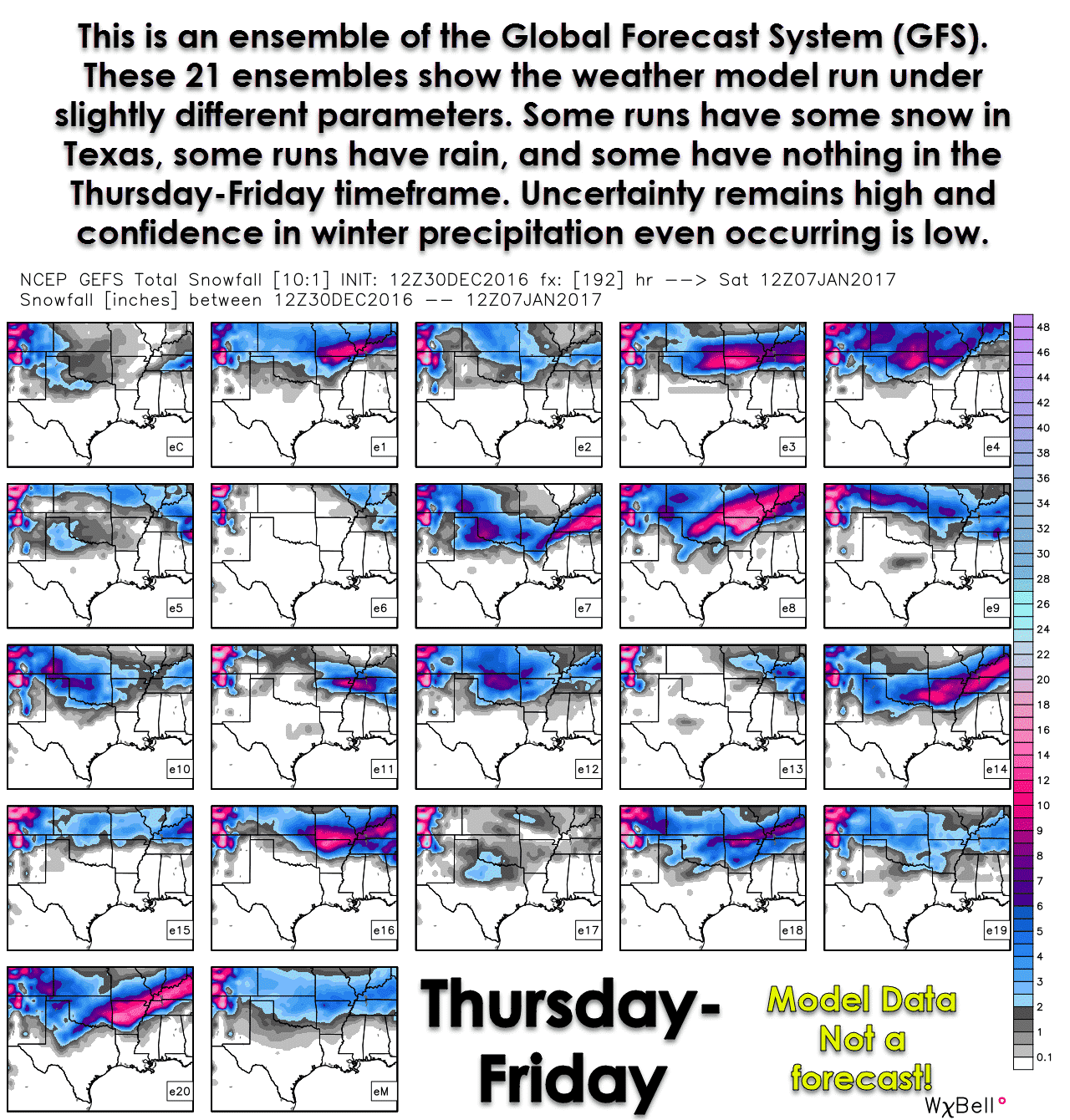
I’m not going to show you one specific weather model from this morning’s run because it’ll probably look drastically different by this evening. What I am going to show you is an model ensemble. A weather model ensemble is a number of simultaneous runs with slightly different parameters. That allows forecasters to build confidence in a forecast. If a majority of the ensembles show a similar solution you can have higher confidence in a particular forecast or outcome. If the ensembles are look different than your confidence in one particular scenario is lower.
The ensemble graphic above comes from the 12Z run of the GEFS (Global Ensemble Forecast System). Like one particular weather model these are certainly not meant to convey a forecast. They can look drastically different in a later run and often times do change. The European weather model has its own set of ensembles. I can’t show them here for licensing reasons (around $50,000 reasons actually), but they may not look like this set. A number of the ensembles do have some sort of winter precipitation falling in parts of Texas next week. A number of the ensembles have rain falling, and some have nothing at all. Winter weather is far from a guaranteed next week, but we may have the potential for light winter weather. Remember – the storm system responsible for next week’s mischief potential is still many thousands of miles away!
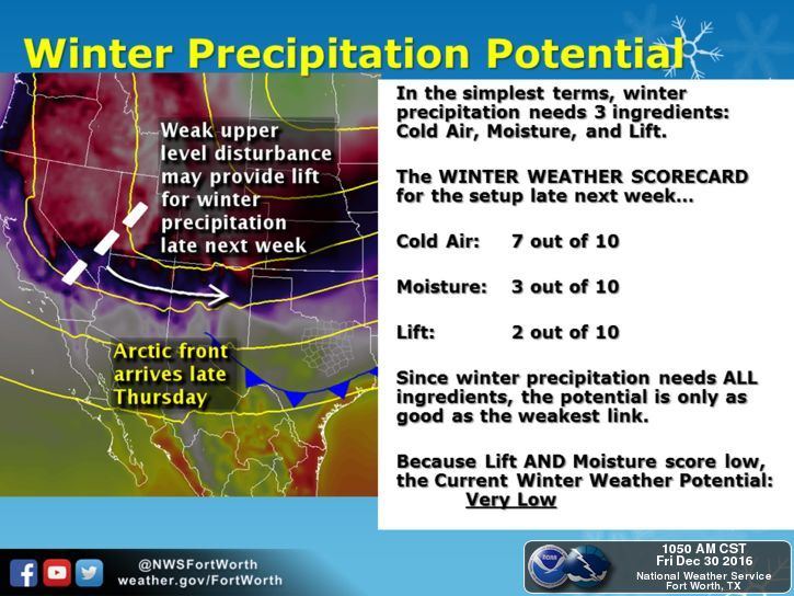
The National Weather Service in Fort Worth has put together a very helpful graphic explaining next week’s forecast and current thoughts. We have fairly high confidence cold air will be in place as an arctic cold front arrives Tuesday Night into Wednesday. Regardless of any precipitation late next week it’ll be on the cold side. The amount of moisture available for precipitation and the actual path of an upper level storm system remain in question. If moisture values are low, like some models project, the only precipitation that occurs will be near the Gulf Coast where temperatures should be above freezing. Back in the cold air we wouldn’t see any precipitation at all, or it would evaporate before reaching the ground. Likewise if the storm system passes well to our north there will not be any lift available to produce winter weather. If it passes to far to the south than we would have the issue of too little lift combined with low moisture values. Everything has to come together just right to give Texas a winter weather event. We’ve seen plenty of instances where one ingredient is a tad off and the chance of winter weather goes down the toilet. As of now there is a slight chance of rain/sleet/snow in Texas next week. I – nor anyone else – can accurately tell you how much could fall, where it would fall, or if this will be a true winter storm. We can say that any sort of mischief would likely be a late Thursday into Friday timeframe – if it happens at all.


0 Comments