
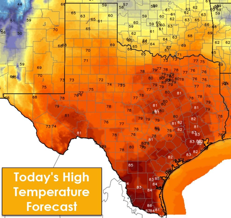
The temperature roller coaster will peak today with high temperatures approaching or exceeding record highs. Temperatures this afternoon will peak in the lower 80s across North Texas, Central Texas, South-Central Texas, into the Brazos Valley, and Southeast Texas. Middle to upper 80s are expected in South Texas and Deep South Texas. 60s to 70s are expected in the Texas Panhandle, West Texas, Northwest Texas, the Big Country, Permian Basin, into the Borderland.
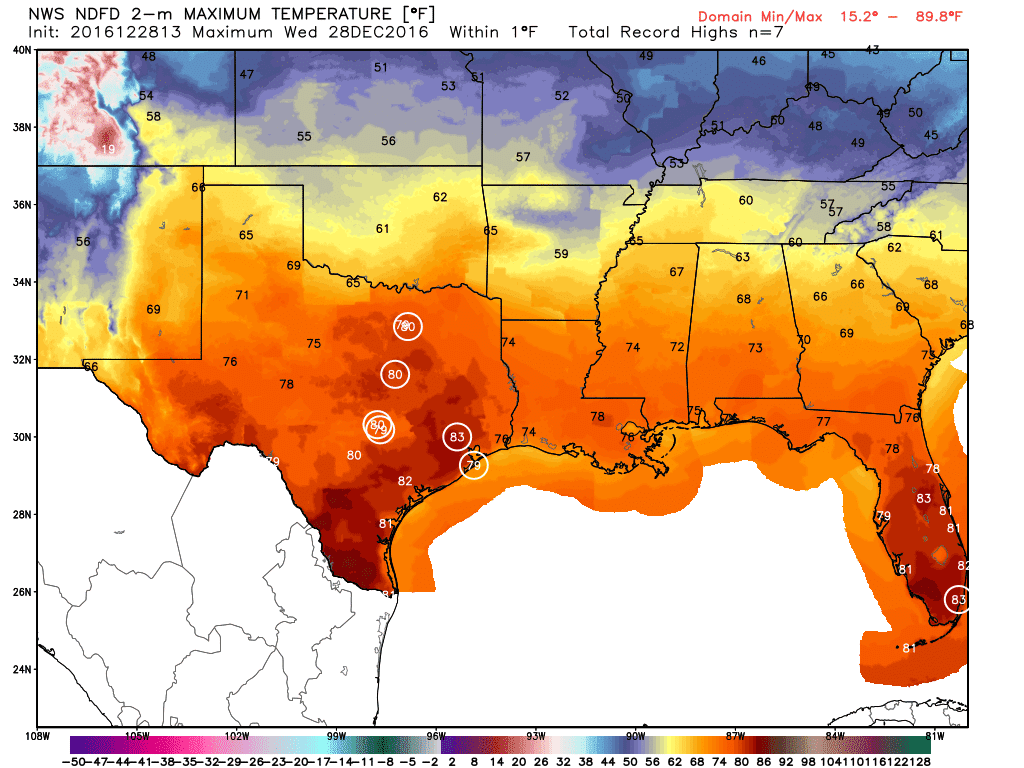
The current forecast has D/FW, Austin, Houston, and Galveston at or exceeding record high temperatures this afternoon. Regardless it’ll feel like a late spring day, just without the chance of severe storms.
A cool front will move south tonight through Texas. Compared to today temperatures will be considerably cooler on Thursday, but they’ll be near seasonal averages. The same can be said for Friday before we warm back up, for the most part, on Saturday. The exception will be the Texas Panhandle who will be colder with cool air advection. Otherwise, our next major arctic outbreak looks to arrive around Wednesday-Thursday of next week. Until then temperatures will remain near or above average to end 2016.
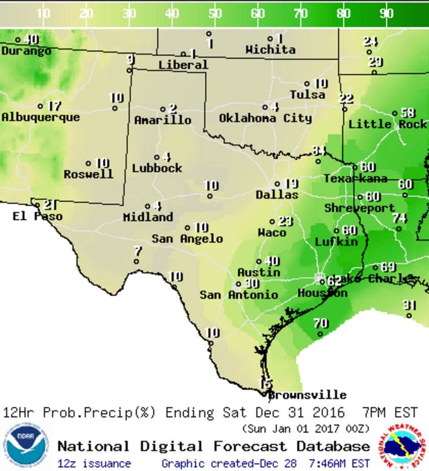
Saturday’s Rain Chances
Showers will be possible on Thursday in the Borderland and into the western sections of the Permian Basin. A separate area of rain is expected in Deep South Texas and the Rio Grande Valley. Isolated showers will be possible on Friday in the Borderland, Permian Basin, Big Country, and Concho Valley. Rain chances increase Friday Night into Saturday near and east of Interstate 35 as a storm system takes shape. Depending on the timing/location of the low’s formation the forecast could require changes.


0 Comments