
Today will be the final day with near record high temperatures in the seven day forecast. A strong cold front will push south quickly tonight and on Friday. Before that point we have a couple hazards to deal with. The first is critical to extreme wildfire danger in the Texas Panhandle, West Texas, and to a lesser extent in the Permian Basin and Borderland. Very strong winds out of the west/southwest in the 35 to 60 MPH range. The highest winds – up to 60 MPH – will be in the northwest Texas Panhandle where the fire danger is extremely critical this afternoon. East of the dryline, and across all of Texas, winds will be out of the south at 15 to 30 MPH today. These strong winds are due to an intensifying area of low pressure moving into the Central Plains tonight.
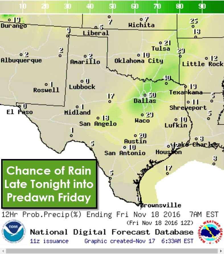
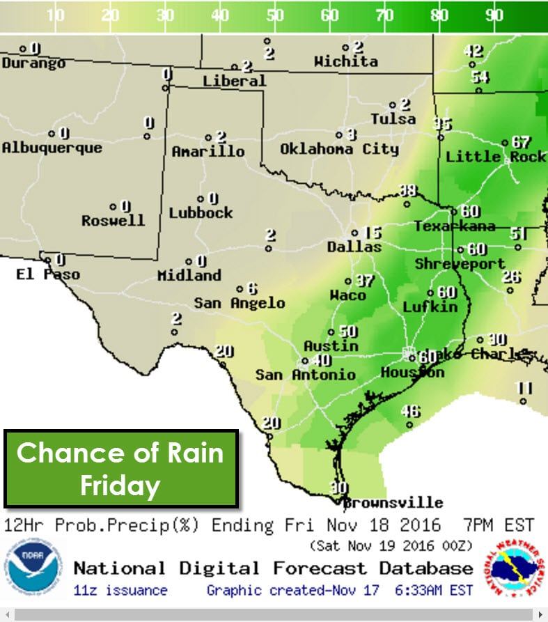
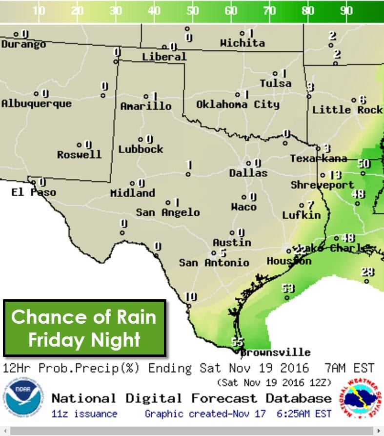
The cold front will move south/southeast this evening through the Texas Panhandle. By midnight tonight the front should be near a Wichita Falls – Snyder – Andrews line. The front will not have any precipitation develop along it today due to capped airmass. After midnight the cold front will be moving into North Texas and a more moisture-rich enviornment. Isolated to scattered thunderstorms are forecast to develop along the front in North Texas and Northeast Texas. A few storms may produce strong wind gusts. Scattered thunderstorms are expected to continue near the cold front as it moves south through the remainder of Texas on Friday. That means rain chances will include East Texas, Southeast Texas, Central Texas, and the Middle Coast. Not everyone will get rained on – in fact a majority won’t see rain at all. Some of the luckier folks may receive up to three quarters of an inch of rain. The severe weather threat late tonight and tomorrow will be low, but not zero. A few wind gusts of 50 to 60 MPH are possible. Rain chances will continue in the Rio Grande Valley Friday night until the cold front moves through. Everyone north of the front will enjoy a much drier airmass.
The coldest air of the season thus far will arrive for Friday and through the weekend. Temperatures will not get out of the mid/upper 40s on Friday in the Texas Panhandle. High temperatures on Saturday will range from the mid 50s to mid 60s. The Texas Panhandle will be very cold by Saturday morning with low temperatures in the lower 20s. Lows will make it into the 30s as far south as the Hill Country, Central Texas, and East Texas. Sunday morning will be the coolest for most of Texas with 30s into South-Central Texas and Southeast Texas. Even the Rio Grande Valley will bottom out in the 40s. After that point temperatures will start to moderate as a southerly flow returns. Moisture will start to increase Monday Night.


0 Comments