
For most of the state it is a fairly cloudy and warm morning. You might even be dealing with patchy fog. At the time of this writing fog hasn’t become too much of an issue, but I can’t rule out dense fog in localized locations through 8-9 AM. Personally, I’d rather be in the Texas Panhandle or West Texas this morning. Lower dewpoint values and clear skies have allowed temperatures to fall into the upper 30s to middle 40s. Canadian, Texas is down to 36 degrees at 6 AM. Sure beats the 60s and 70s from Interstate 20 and points south. Over the next several days we’ll be dealing with an active weather pattern consisting of a couple separate storm systems rolling in from the western United States.
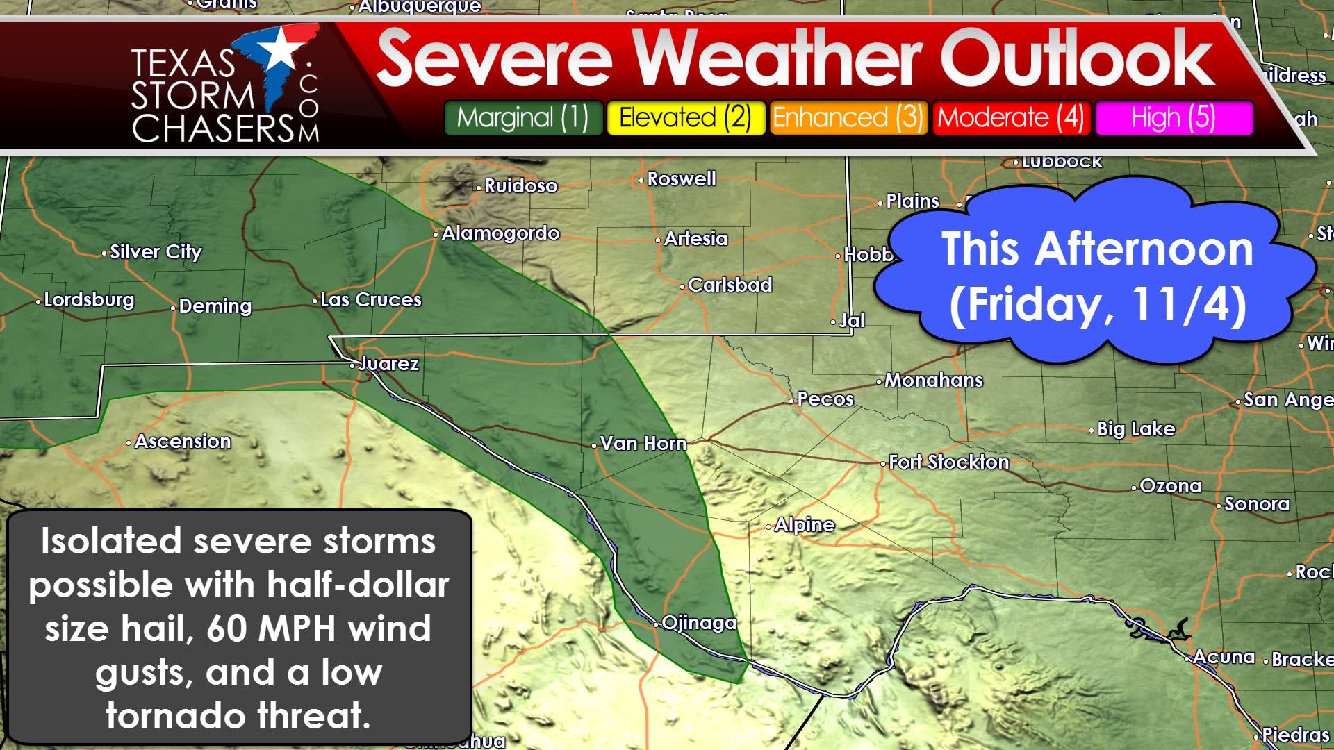
For today we’ll be in-between weather systems. An upper level low is located over southern Arizona with a weak ridge located over most of Texas. The Borderland and far western Permian Basin will be the only locations that will come under the influence of that upper low today. Decent mid to low level wind shear will be in place across the Borderland into adjacent sections of New Mexico this afternoon. There are questions on how unstable the airmass will become which is why the severe weather threat is marginal. It is not out of the question that a couple storms organize this afternoon. Should that occur in the Borderland they may be capable of producing large hail and damaging wind gusts. Low level wind shear is present and cloud bases should remain fairly low. A brief tornado can’t be ruled out. Again, all of those threats are conditional on the atmosphere actually being able to destabilize. The overall severe weather threat is on the low-end.
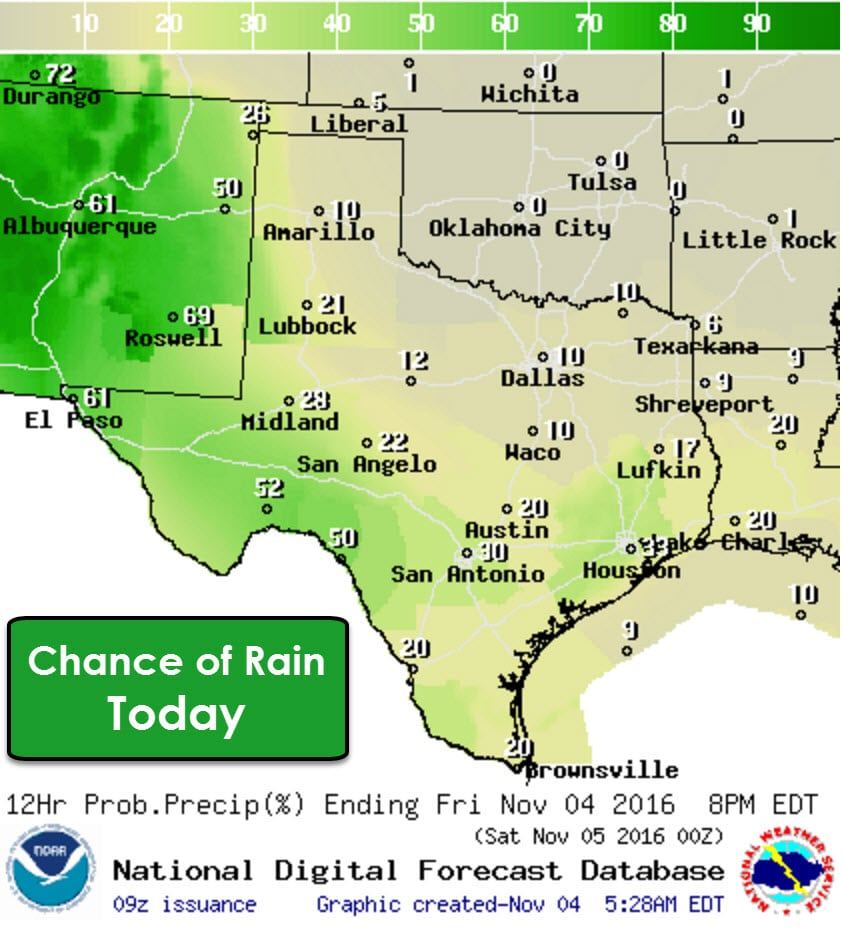
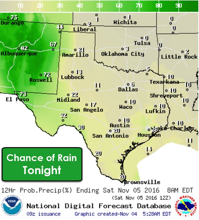
Rain chances today and tonight will be highest in the Borderland and far western Permian Basin in conjunction with the upper level low. The remainder of Texas will be under an isolated to widely scattered threat of showers/storms today just because the atmosphere has plenty of moisture to work with. Widespread rain isn’t anticipated today outside of the Borderland.
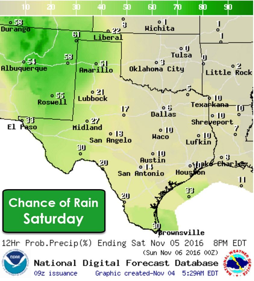
The upper low will degenerate into an open wave on Saturday as it pushes into New Mexico. This will result in scattered shower/storm chances in the Texas Panhandle, West Texas, Permian Basin, and the Borderland. Isolated showers will be possible in the Rio Grande Valley northwest through the Concho Valley. Otherwise most folks should stay dry on Saturday.
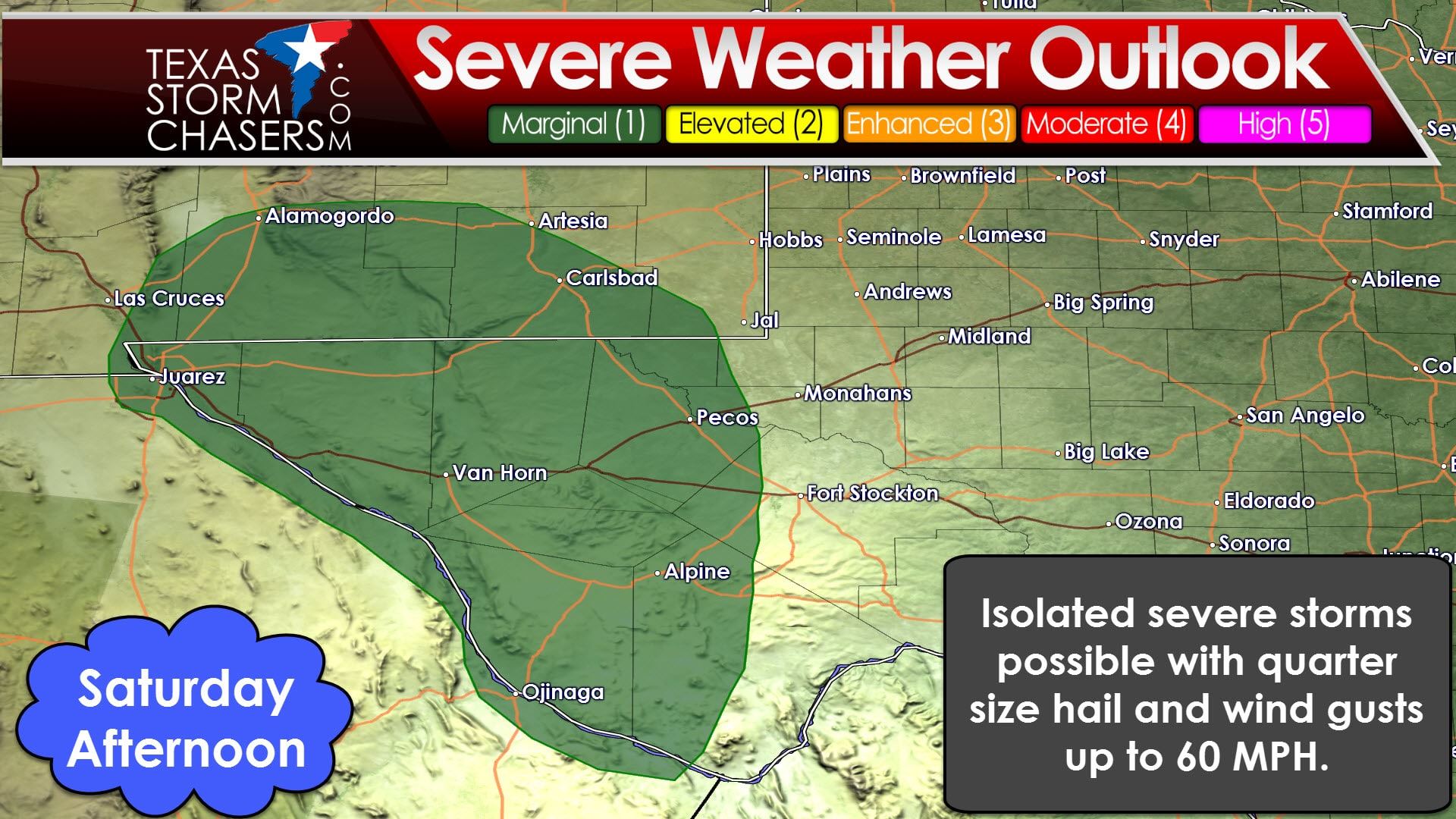
Widespread severe weather is not anticipated on Saturday, although a few marginally severe storms may occur in the Borderland and Permian Basin. The atmosphere will be more unstable tomorrow afternoon, but wind shear values will be much lower than today. The threat level looks to remain marginal.
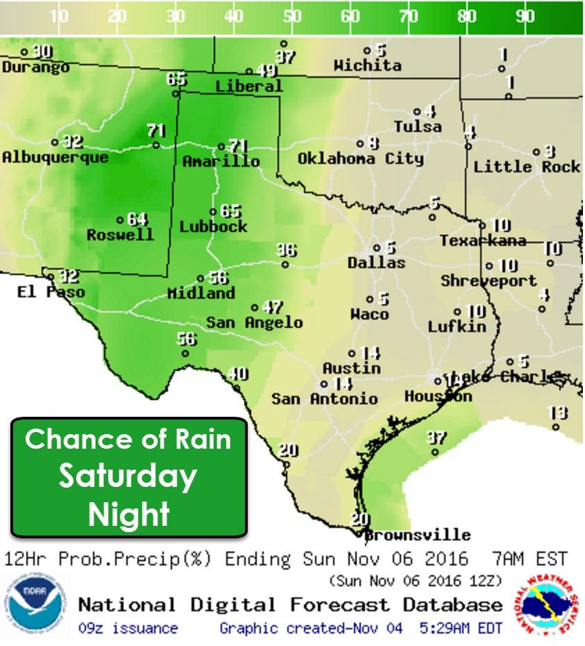
Numerous showers and thunderstorms are expected Saturday Night in the Texas Panhandle, West Texas, the Permian Basin, with scattered showers/storms in Northwest Texas, the Big Country, and the Concho Valley. Some storms may produce locally heavy rains. Severe thunderstorms are not expected tomorrow night.
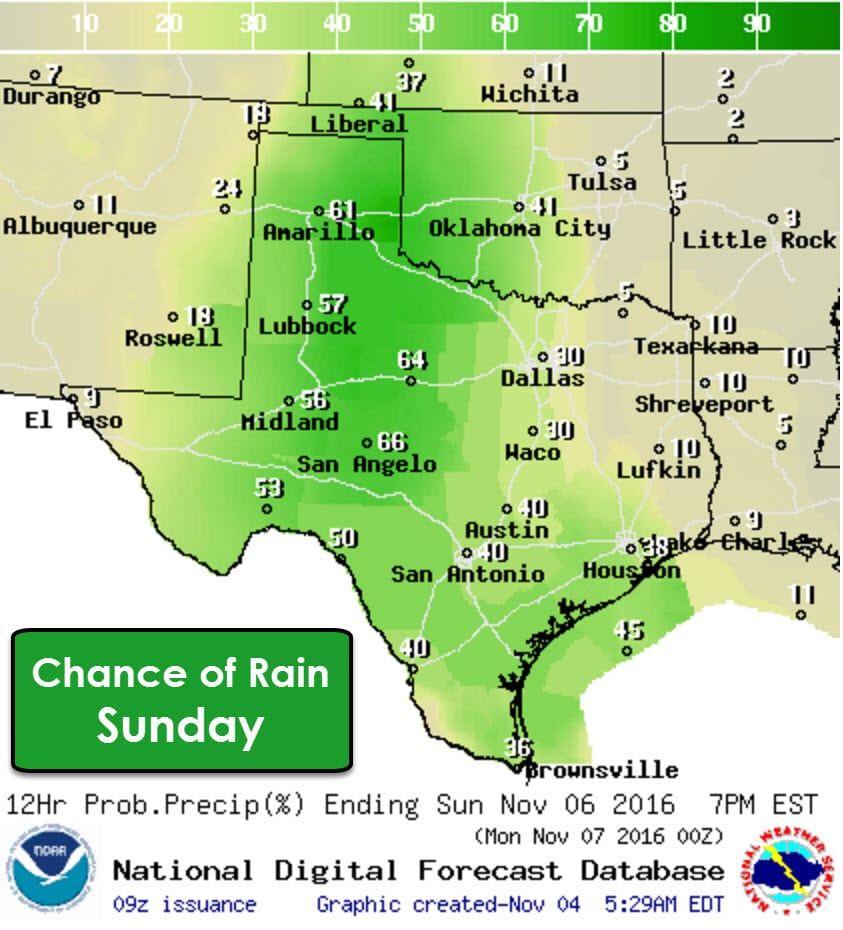
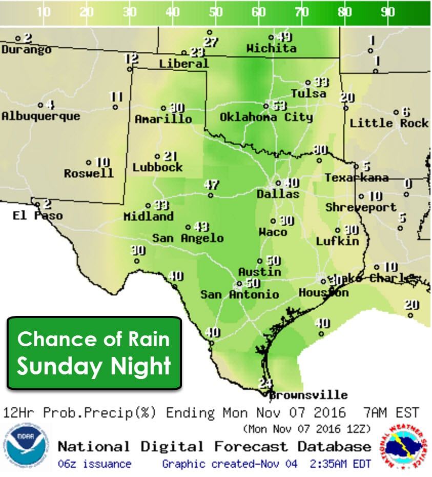
Rain chances continue Sunday and will also increase with eastward extent. Scattered to numerous showers/storms are again expected in the Texas Panhandle, West Texas, the Permian Basin, Northwest Texas, the Big Country, Concho Valley, into the Hill Country. Scattered showers/storms will be possible in North Texas, Central Texas, the Brazos Valley, Southeast Texas, the Middle Texas Coast, South Texas, and the Rio Grande Valley. Severe weather is not anticipated at this time. Some storms may produce locally heavy rain.
A complex and uncertain forecast is shaping up for next week. The American and European long-range weather models disagree on the evolution of next week’s weather pattern. At this point we’ll slightly favor a solution that the European weather model is showing. It redevelops the upper level low by early next week and has it sitting stationary in between New Mexico and West Texas. This solution would favor off and on rain chances and seasonal temperatures through all of next week. We’ll have to see how the forecast evolves over the weekend, but most of next week looks unsettled at this point. It certainly beats the record highs we dealt with in October.
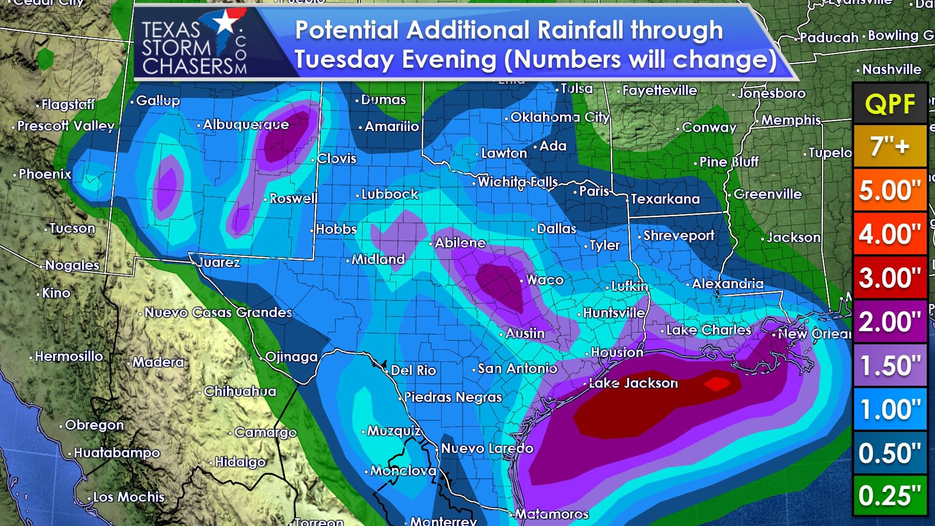
Over the next five days it looks like a large majority of Texas should receive at least some rainfall. The above projected rainfall amounts will change as the forecast from Monday onwards becomes more clear. At this point it looks like a widespread one half inch to two and a half inches of rain looks possible. Far Southwest Texas and the northeastern Texas Panhandle will be on the drier end with up to a quarter inch of rain possible. Again, these amounts are based on a regional scale. Some folks will get less and some will get more. These projected rainfall amounts are not high enough to cause flooding concerns. A few spots may deal with minor flooding, especially urban areas.
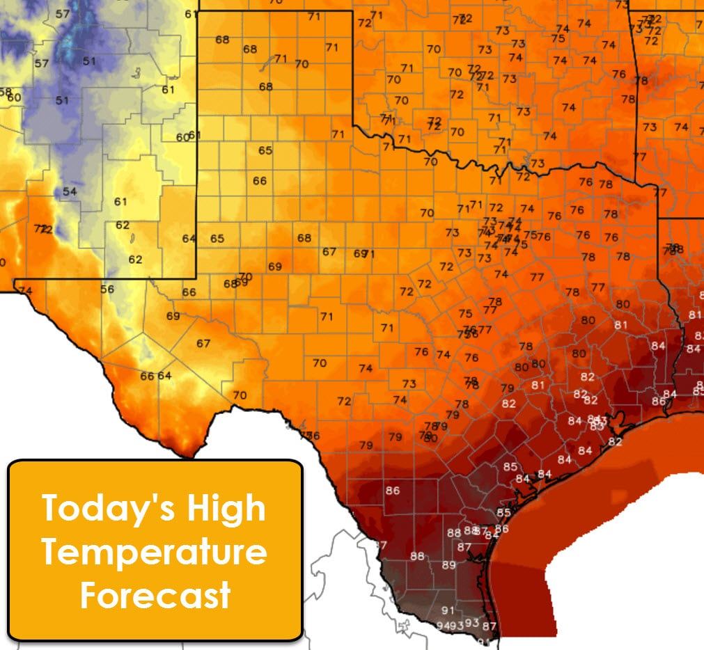
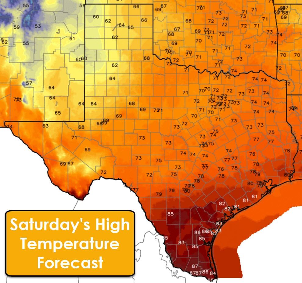
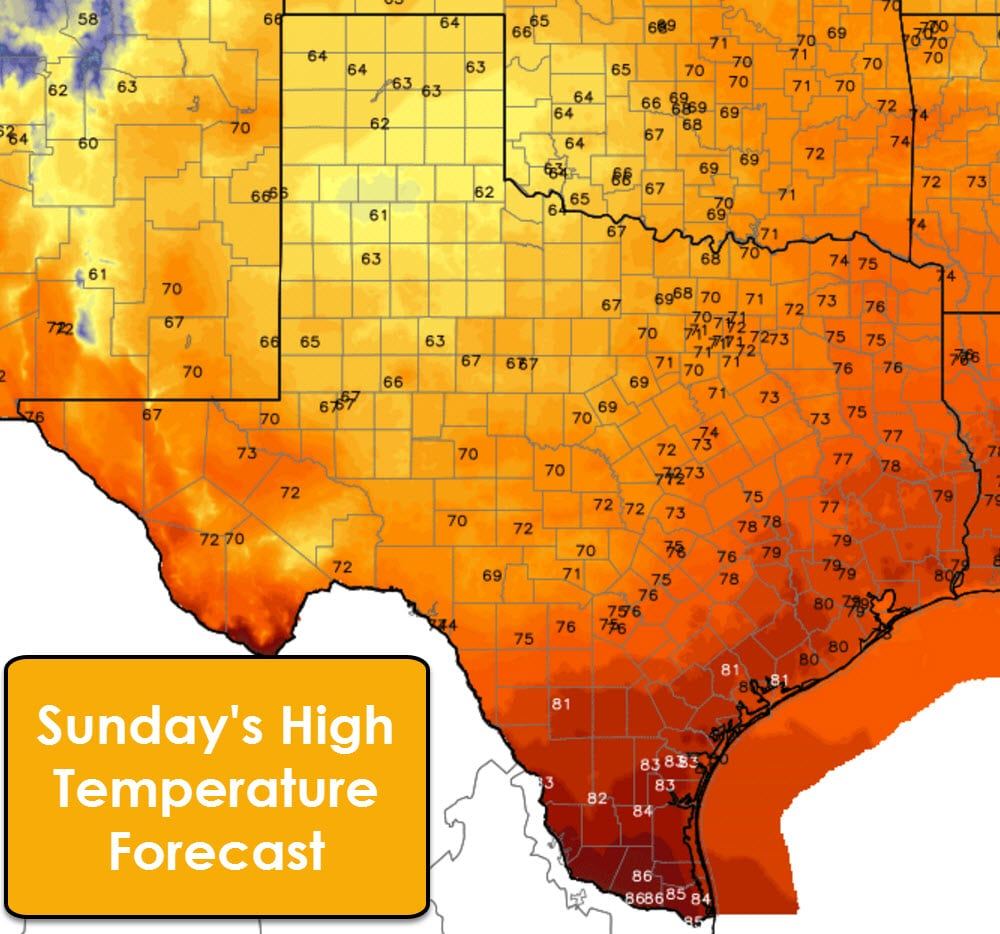
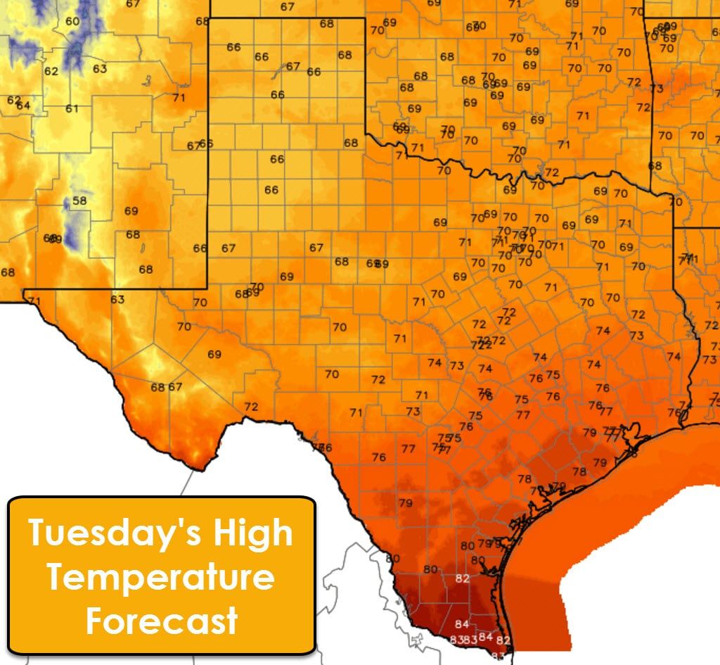
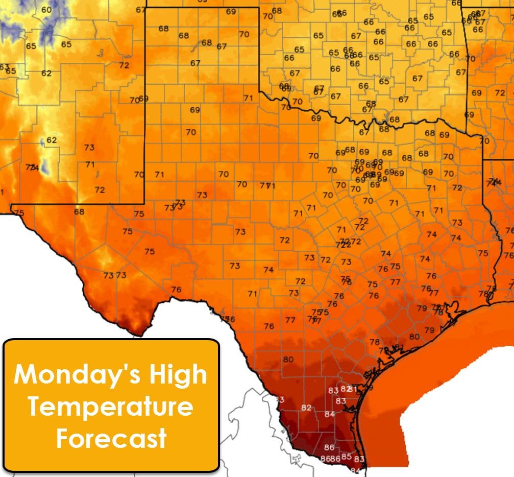
With the upcoming rain chances along with the recent cool front high temperatures should be toward seasonal averages. That means we’ll see highs range from the 60s in the Texas Panhandle and West Texas up into the lower to middle 80s in the Rio Grande Valley. They’ll be temperature variations from day to day depending on rain chances and cloud cover.


0 Comments