
After a week of summer-like weather we’re finally about to head into fall for a few days. We do have a couple things to talk about as the much-anticipated cold front arrives starting tonight.
There will be a low-end risk for a few severe storms this evening across Northwest Texas, the Big Country, North Texas, into Northeast Texas. While we are anticipated a fairly high coverage of showers/storms with the cold front tonight and Thursday the severe weather threat is limited to this evening. Rain chances push south on Thursday into the remainder of Texas as the cold front does the same. By early Friday the front should be pushing out into the Gulf of Mexico and south into Mexico. The result will be fall weather for all of Texas on Friday with high temperatures in the 70s to low 80s. Those temperatures will be accompanied by north winds and drastically lower humidity values. Let’s get into the details!
Severe Thunderstorm Potential
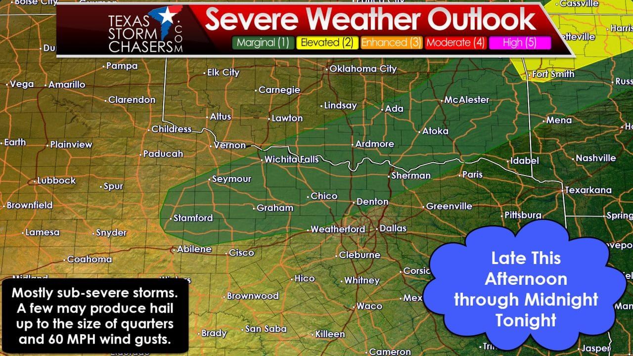
The primary focus for thunderstorm develop by late afternoon to early evening will be in Northwest Texas into South-Central Oklahoma. A cold front will likely be located in those two regions by 6-7 PM. The atmosphere will be marginally supportive of organized convection. Individual storms will move off to the east. With time – perhaps fairly quickly – a broken line of thunderstorms should organize in proximity of the cold front. The line of storms will move south in conjunction with the cold front. At this time the threat of severe thunderstorms is low, but not zero. We could see a few storms briefly become severe this evening with hail up to the size of quarters and gusty winds. Tornadoes are not anticipated. The threat of severe weather will diminish by mid-evening as the atmosphere becomes more stable. However, thunderstorms will continue into the night as the front moves south through Northwest Texas, North Texas, Northeast Texas, and the Big Country. Some of the storms may produce small hail and winds up to 40 MPH. For reference a severe thunderstorm is defined as having hail larger than 1″ in diameter (quarters) and winds over 58 MPH. Obviously tornadoes also fall under the definition of a severe storm, but we won’t be dealing with those tonight.
Precipitation Chances & Timing
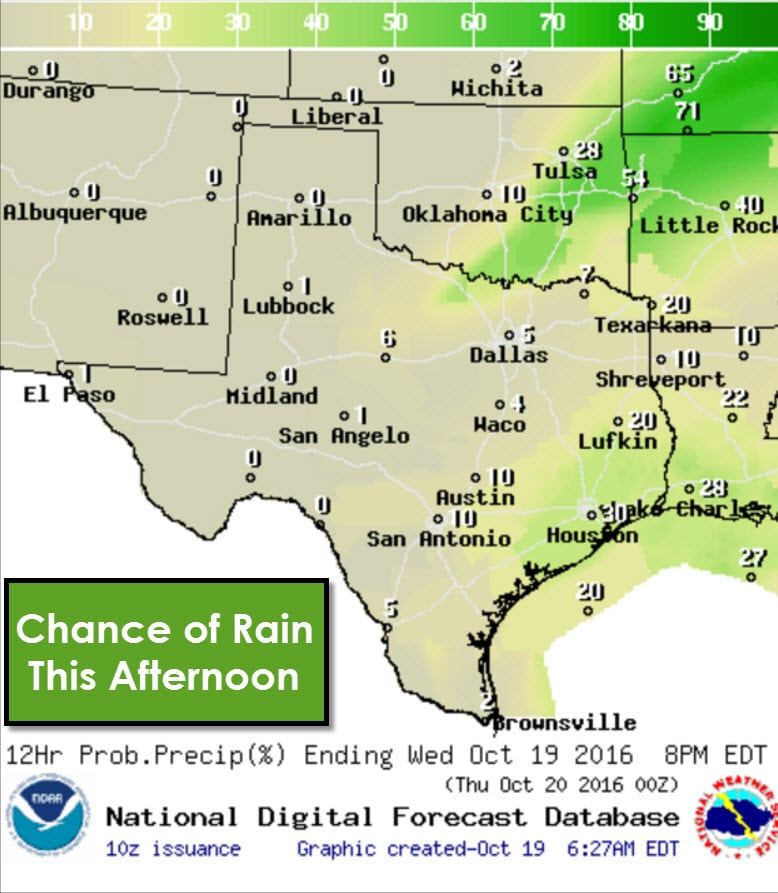
Isolated to widely scattered showers and storms are expected in Southeast Texas, the Middle Texas Coast, and in the Brazos Valley late this morning into the afternoon hours. This activity will be diurnally driven. Known as popcorn storms today’s activity will only last 30-45 minutes before weakening. Outflow from those weakening cells will help spark off new showers/storms nearby. That process will continue through the late afternoon before tapering off by early evening. Isolated thunderstorms will be possible after 4 PM in Northwest Texas and Texoma. The better rain chances arrive this evening.
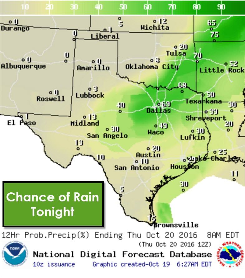
As a cold front moves south across the Red River this evening and overnight we should see a broken to nearly solid line of showers and thunderstorms. Some of those storms may be loud, but as stated in the severe weather discussion we’re not expecting too many hail/wind issues. The heaviest activity with the cold front will be near the Red River and south to Interstate 20 from the Big Country through North Texas and East Texas. A few folks could receive up to an inch of rain, but most amounts will be lower. As the cold front continues its trek south late tonight thunderstorms should be weakening as they move south of Interstate 20. A broken line of showers/storms will remain, but less intense as upper level forcing will be moving away.
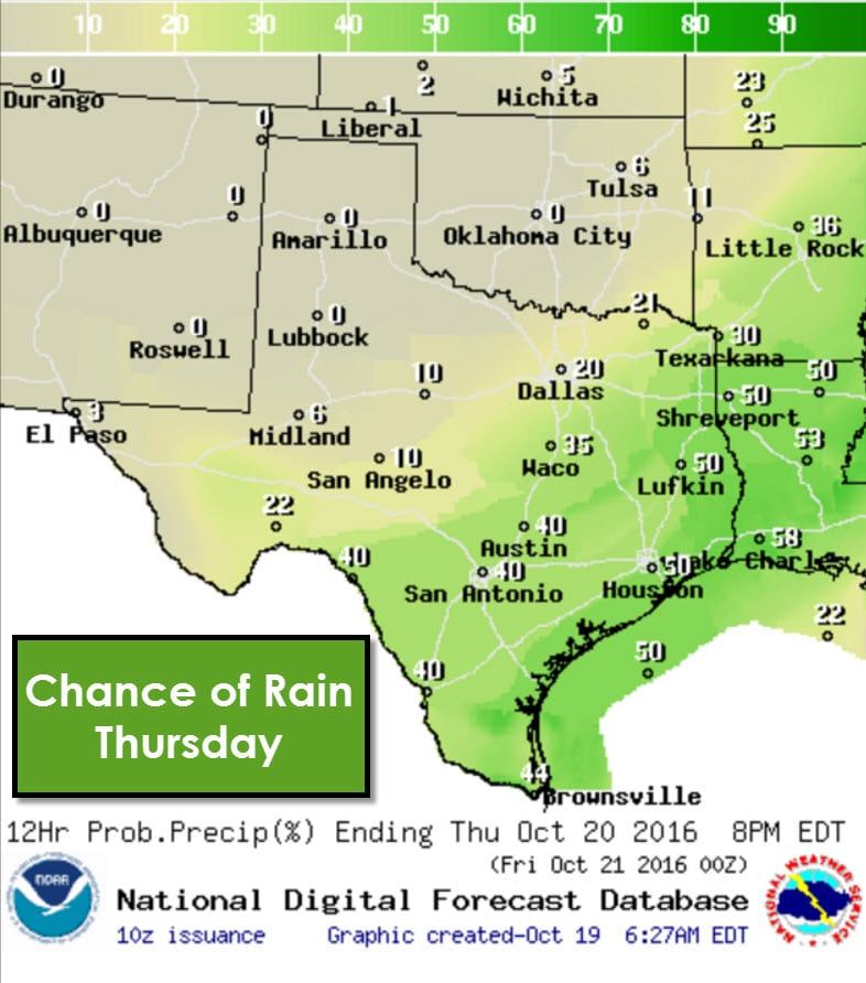
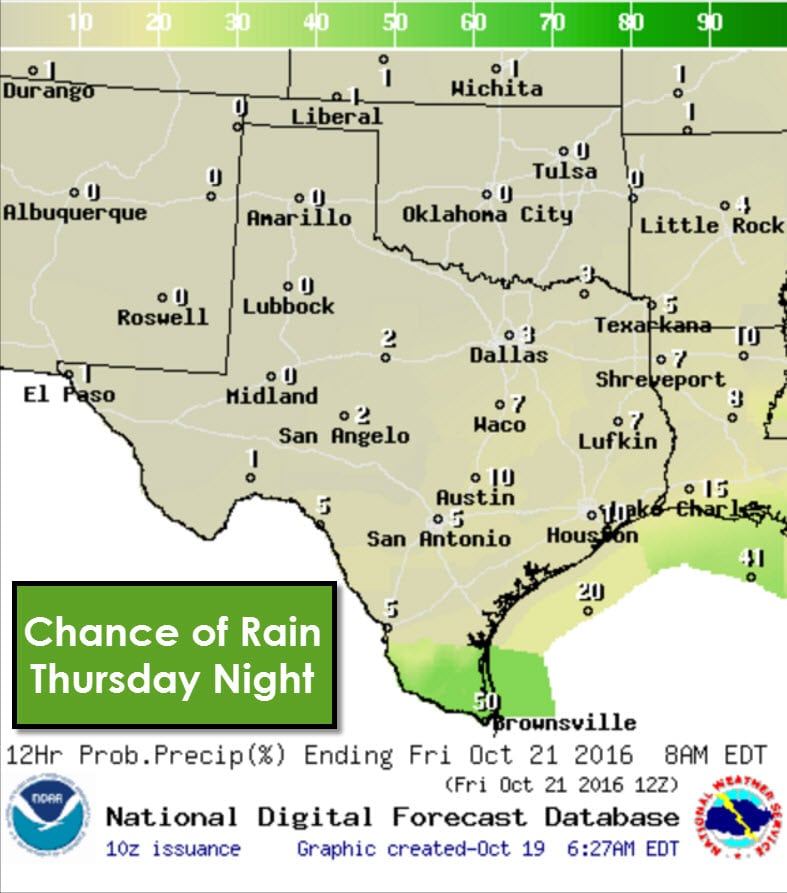
Scattered showers and a few storms are expected on Thursday across the southeastern half of Texas. These will be caused by the southward movement of the cold front along with the abundant moisture in place. While rain chances may be decent the overall rain amounts will be low. Most of the shower activity tomorrow will be light. Rain amounts should remain light tomorrow as the front moves south. By Thursday Night rain chances will be confined to the Rio Grande Valley. Everyone else will be north of the cold front with north winds, cooler temperatures, and a much drier air mass moving in from the north.
Temperature Forecast through the Weekend
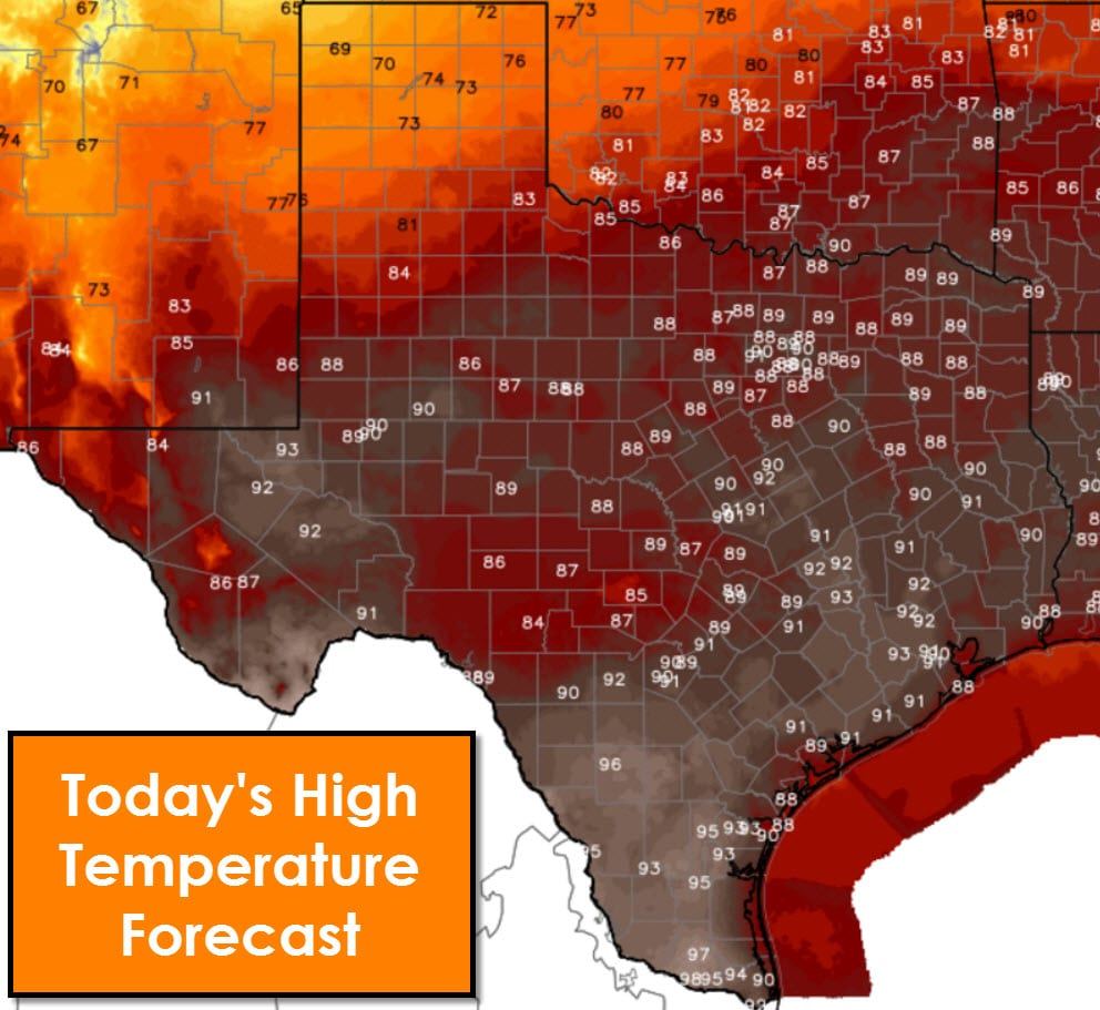
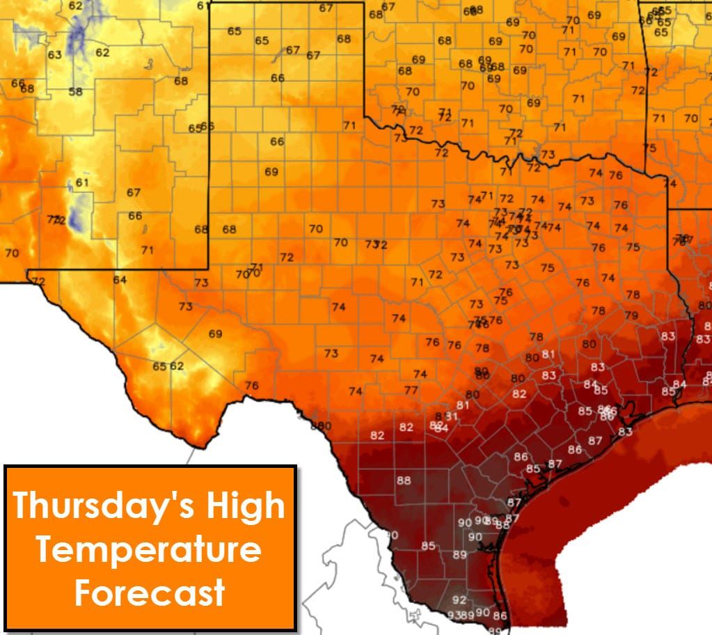
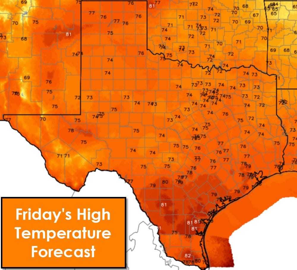
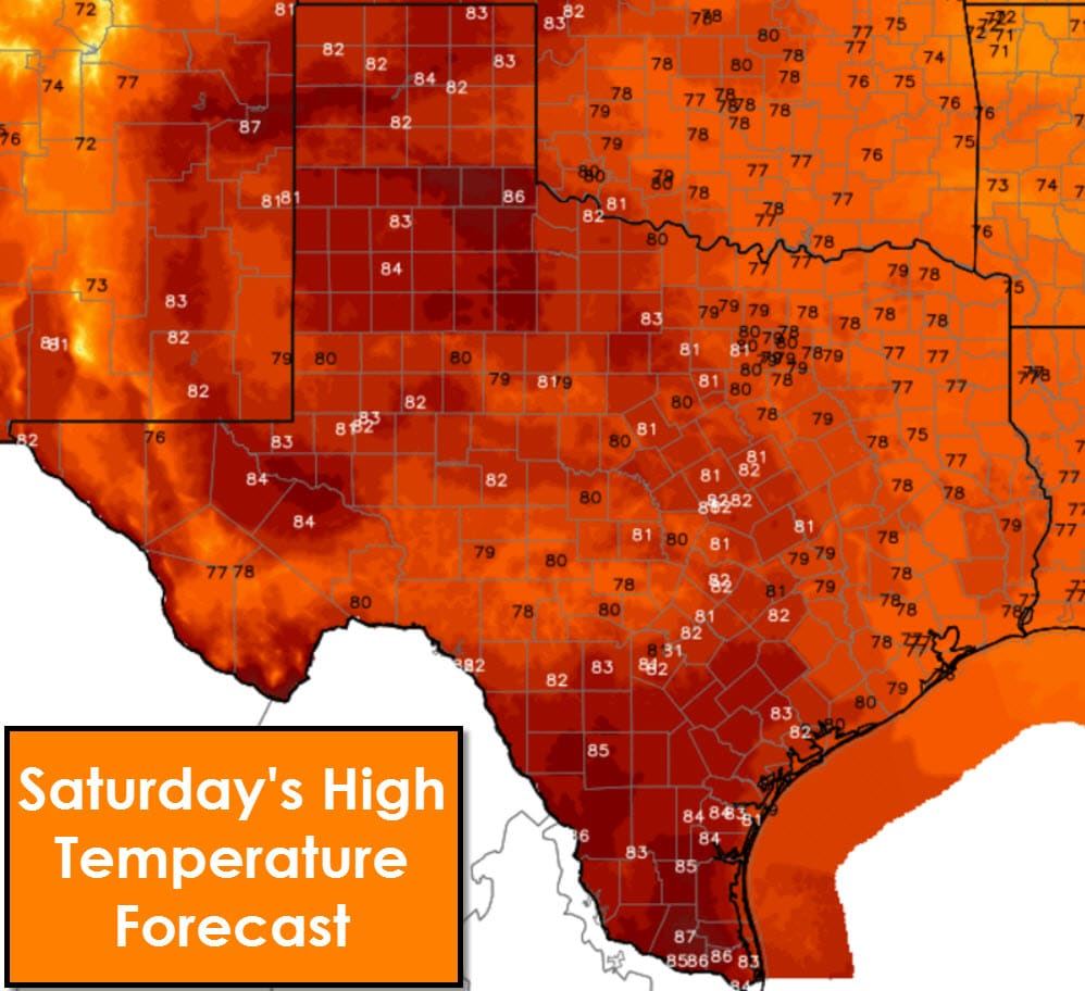
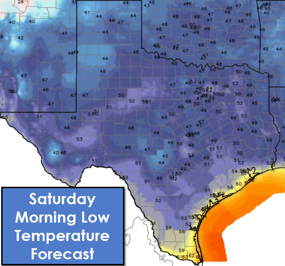
We have one last day of unseasonably hot weather to deal with before a few days of fall weather arrive. The cold front this morning remains stalled out over the Texas Panhandle. Compared to yesterday it has progressed a bit further north overnight. A stronger cold front arrives and pushes south starting later today. That front will push south through all of Texas by Thursday Night. North of the front temperatures will definitely be much more comfortable. The biggest change will be the drier air mass moving in from the north. Dewpoints will go from the upper 60s and 70s into the 30s, 40s, to middle 50s. You’ll be able to tell the difference at night since temperatures can never go below the dewpoint value. Lower dewpoints and clear skies mean great radiational cooling and a nice cool off after sunset. The coolest day will be Friday with high temperatures in the 70s to right around 80 degrees for all of Texas. Yes, even Deep South Texas and the Rio Grande Valley will get in on the cooler weather. A dry airmass will be in place, so it will feel much nicer compared to upper 70s with a humid airmass. Low temperatures by Saturday morning will fall off into the 40s and 50s across much of the state.


0 Comments