
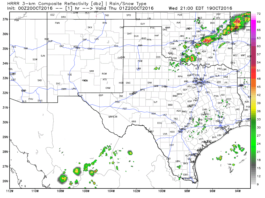
A strong cold front will push through north Texas overnight and into central Texas by early tomorrow morning. A line of strong storms has formed along the leading edge of the frontal boundary this evening across parts of western north Texas on up into Oklahoma. This line will continue to progress south overnight with the threat of scattered strong storms impacting the Red River counties around midnight and moving into the Dallas/Ft. Worth metroplex area before dawn tomorrow morning. Widespread severe weather overnight is not anticipated; however, a few of the cells within the line could reach severe limits with 60mph winds and 1 inch hail. The main impacts expected from a majority of the overnight storms will be heavy downpours, gusty winds and frequent lightning. The animated image below will provide a look at what the radar may look like between now and 1pm tomorrow.
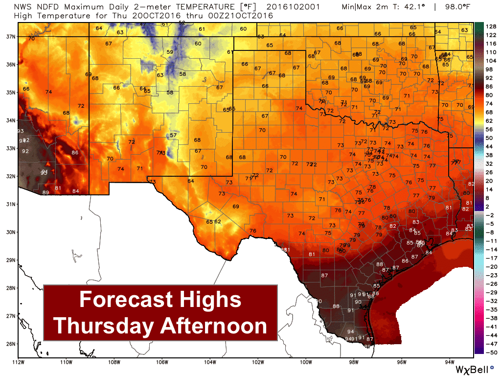
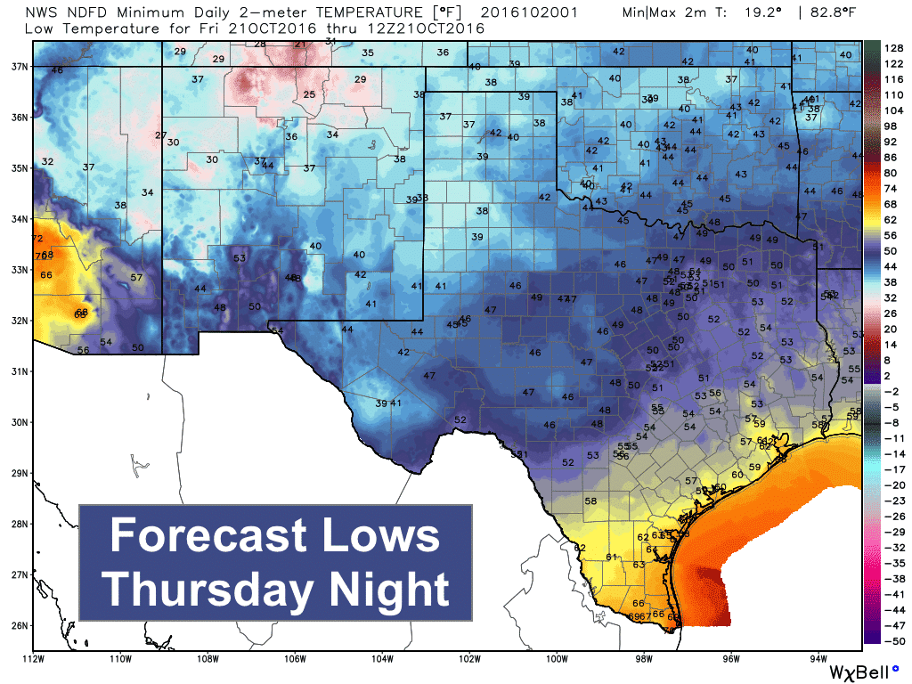
The front is expected to make good progress tonight and tomorrow. The front is expected to reach the Dallas & Ft. Worth metro area around 1am, Waco by 5 to 6am tomorrow, clear the coastline of southeast and south central Texas by mid-afternoon tomorrow and deep south Texas by tomorrow evening. Highs tomorrow behind the front will be quite pleasant and in the upper 60s across much of the panhandle, low 70s across north Texas and mid 70s across central Texas. Southeast and south central Texas will reach their highs by early afternoon and begin to cool gradually once the front arrives. Winds will pick up considerably behind the front with north winds gusting between 20 and 25mph at times. We’ll also see much drier air filter in behind the front kicking most of the humidity back into the gulf for the remainder of the week and into the weekend.


0 Comments