
Warm air advection showers and storms have developed over the past few hours across Northwest Texas, West-Central Texas, the Big Country, and western North Texas. This activity is not severe and is moving east/northeast around 30 MPH. The stronger storms may produce small hail, gusty winds, brief heavy rain, and cloud to ground lightning. They’re moving pretty good so we’re not concerned about any sort of heavy rain/flash flood scenario. This activity as a whole should weaken after sunrise as the warm air advection dynamics become less impressive. We’ll be left with a warm, humid, and windy day.
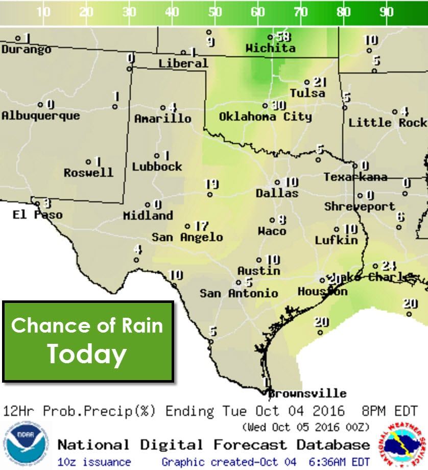
By this afternoon a surface dryline will move east into Northwest Texas, western North Texas, south into the COncho Valley. West of the dryline humidity values will be very low this afternoon along with high temperatures in the upper 80s to lower 90s. Winds will be out of the west/southwest. We do note that with gusty west/southwest winds, warm temperatures, and low humidity values that the grass fire danger will be elevated today. East of the dryline humidity values will be much higher and temperatures will top out in the 80s to lower 90s. Winds will be gusty out of the south/southeast. It’ll feel more like an April afternoon versus October.
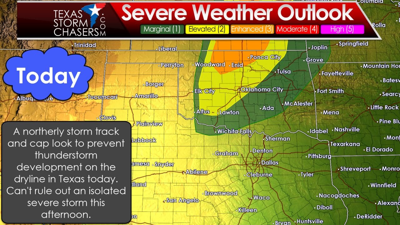
Normally a strong dryline combined with other conditions coming together today would support a afternoon severe weather risk. However, we have factors working against thunderstorm development in the state today. The upper level storm system will be passing well north of the state today. As a result there won’t be much in the way of lift along the dryline. Surface winds will tend to remain out of the south ahead of the dryline – keeping surface convergence lower. A cap will also be in place today. With weak to little lift along hte dryline the cap, even though it’ll weaken by late afternoon, should hold. The same can’t be said for northern Oklahoma and Kansas where several severe storms are expected by late afternoon. We’ll be up there chasing today. It is not out of the question that a isolated storm could develop ahead of the dryline in Texas this afternoon. If a storm were to develop it could be severe – but chances are quite low that this occurs as of now. If data later this morning suggests a better chance of storm development we’ll post an update.
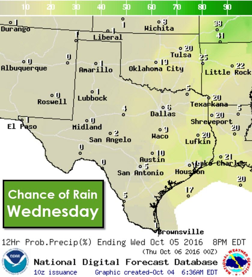
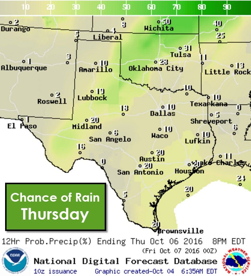
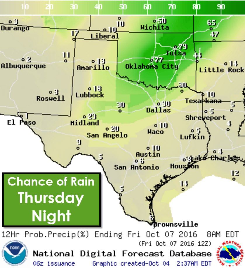
Wednesday and Thursday will remain mostly dry and warm with a strong cap in place. Changes quickly arrive Thursday night as a strong cold front pushes south out of the Central Plains. A line of storms may be underway as the front moves into the Red River Valley and North Texas – and this would be our next chance of more widespread storms. These details will be refined as we get closer in time. Folks coming out of Oklahoma on Thursday south into Texas – or visa versa – can expect thunderstorms in Oklahoma.
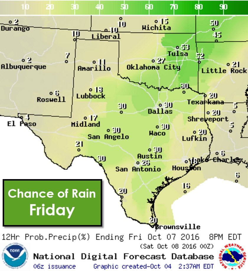
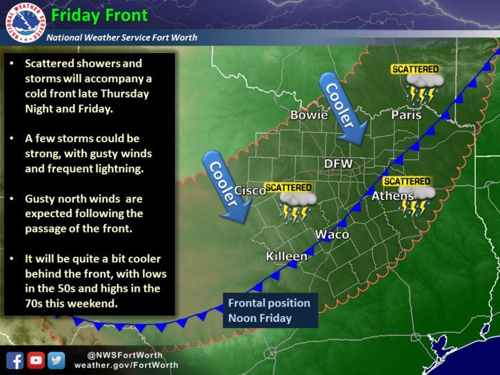
By Friday isolated to scattered storms will be possible from West Texas and the Concho Valley east into Northeast Texas, Central Texas, into the Middle Texas Coast. A cold front should be pushing south during the day Friday. Conditions north of the front will be much drier. This weekend is looking fairly nice weather-wise.
Major Hurricane Matthew is making landfall in southwest Haiti this morning as a category 4 hurricane. Catastrophic damage and a humanitarian disaster is in the making for Haiti. By Thursday, Friday, and Saturday this dangerous hurricane will pose a direct threat to Florida and the southeastern United States. We posted in detail earlier this morning about Matthew.


0 Comments