

The weather forecast for today and through the weekend can be described in one word – awesome! We will see temperatures gradually increase this weekend with mostly sunny skies. High temperatures this afternoon will top out in the 70s to lower 80s north of Interstate 10. South of Interstate 10 temperatures will be a tad warmer with upper 80s to lower 90s. A cool front will help bring slightly lower temperatures to those regions for Friday. Skies this afternoon will be mostly sunny across most of the state. A few clouds are expected in the Borderland in the Rio Grande Valley with a low chance of showers. Winds will be out of the north at 5 to 10 MPH.
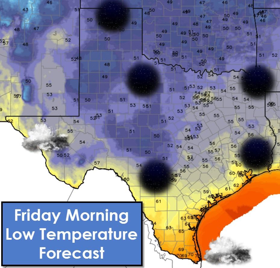
Tonight will be fall-like for all areas except the Rio Grande Valley. Mostly clear skies and light northerly winds will allow temperatures to fall back into the upper 40s to upper 50s north of Interstate 10. Even in South-Central and Southeast Texas temperatures will fall back into the 50s to right around 60 tonight. South Texas, Coastal regions, and the Rio Grande Valley will drop off into the 60s. Skies may become overcast in the RGV and in the Borderland by sunrise Friday.
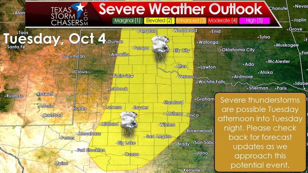
Weather this weekend won’t change much with mostly sunny skies and dew points remaining in the 40s and 50s. Temperatures will get warmer during the afternoons with 80s and 50s/60s at night. Overall it’ll be a great first weekend of October weather-wise. We do expect changes beginning on Monday. A strong upper level storm system, the strongest we’ve seen so far south in a couple months, will start pumping moisture northward on Monday. A rapid increase in dewpoint values is expected with 50s and 60s. South winds will become noticeably as well. By Tuesday a surface dryline will likely set up somewhere in the Texas Panhandle south into West Texas and the Permian Basin. East of the dryline the atmosphere could become supportive of organized thunderstorms. The Storm Prediction Center has already placed those regions in a severe weather risk for Tuesday and Tuesday Night. There is plenty of time to refine the details and we’ll do that as we get closer in time. Just know now that Tuesday has the potential, not guarantee, of being active. Storm chances could shift east to include much more of Texas on Wednesday and Thursday.


0 Comments