
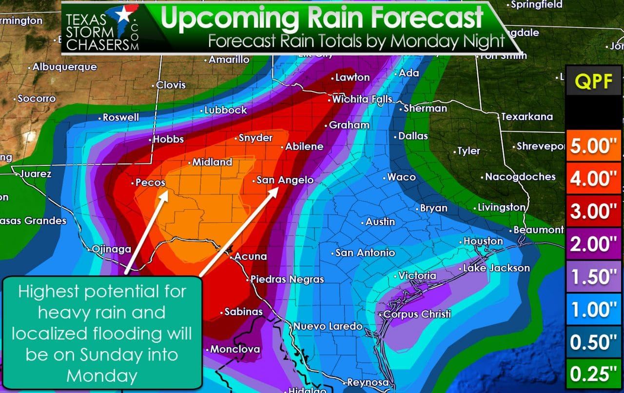
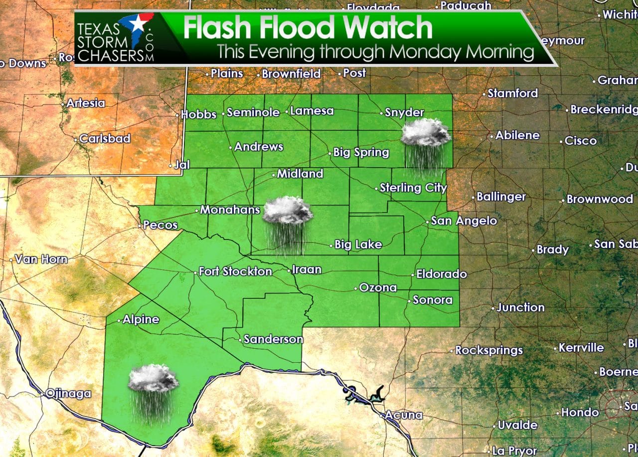
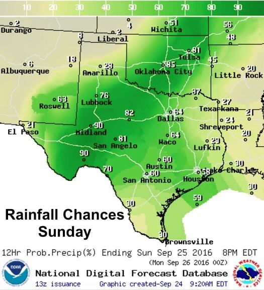
Our first strong cold front of the fall season arrives later this weekend bringing several days of rainfall ahead of it. The front itself will not really begin to push through the state until Sunday, but starting this afternoon, we will see several days of widespread heavy rainfall potential. The front itself will be slow to move which means will be dealing with a training complex of storms repeatedly developing over the same areas later today, tonight and through Sunday and Monday as well. These training bands of storms, wherever they set up, will have the potential to create localized flash flooding issues. As depicted in the graphic below, we’ll be seeing the best chances for heavy rainfall from this event across west Texas with lesser amounts the further east/southeast you go. Much of this region has been placed under a Flash Flood Watch beginning this evening and continuing through Monday night.
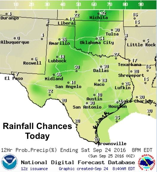
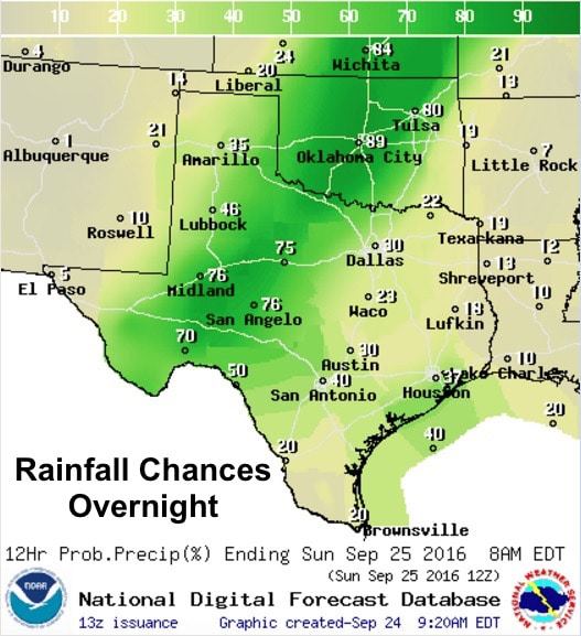
For today…not expecting much in the way of widespread rainfall until early to mid-afternoon. As we reach peak heating this afternoon, storms will begin to develop across parts of the eastern panhandle and southern panhandle and rolling plains. By late afternoon, we’ll see storm coverage expand into a pseudo-squall line which will stretch from western north Texas down into the Big Bend region. Again, heavy bands of training storms will accompany this squall line which will make a little bit of progress eastward during the overnight hours. Rainfall amounts today across these regions look to average around 1 to 2 inches with some pockets of higher amounts possible wherever the heaviest bands of rain set up. Severe weather is not much of a threat today, but a few of the storms that develop…especially near or ahead of the squall line this afternoon…could become strong and carry a lightning and gusty wind threat.
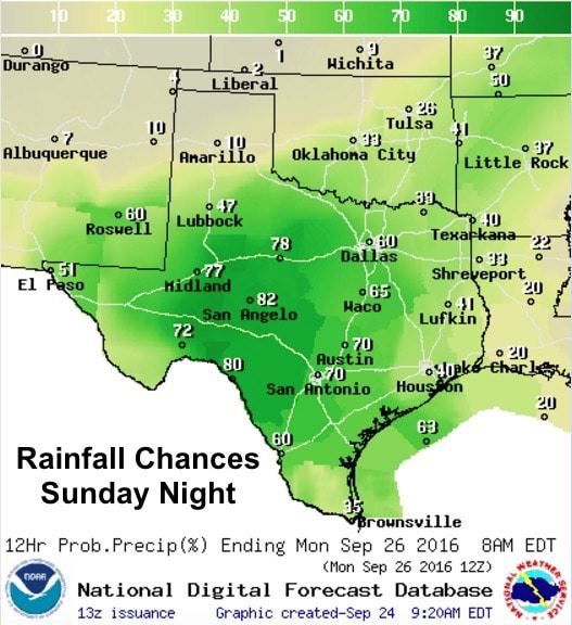
For Sunday…heavy rainfall will continue as the front begins to drop south/southeast across the state. This will help to expand rain chances further east into north central Texas and further southeast into central Texas during this time period, however the areas with the heaviest rainfall will continue to be parked across west and west central Texas where an additional 1 to 3+ inches will be likely Sunday through Monday. The cold front itself will finally move through late Sunday into Monday and we’ll begin to dry out from north to south with much cooler temps in its wake. High pressure will build in next week, but we will stay much cooler than we were this past week. We’ll have more on the cold front’s after effects and next week’s outlook in our Sunday blog.


0 Comments