
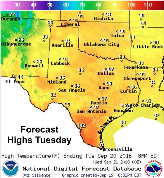
A late summer heatwave was flexing its muscles across the state today with highs well above normal for this time of the year. Tomorrow won’t be much different with highs in the mid to upper 90s expected once again. The one difference will be lower dewpoint values which will drop the Heat Index values down a few degrees. The good news is that we’ll continue to see drier air move in which will continue to keep the “feels like” temp closer to the actual temperature each day through Thursday. By Friday, as our resident dome of high pressure begins to shift east, we’ll see moisture and that lovely muggy feeling return.

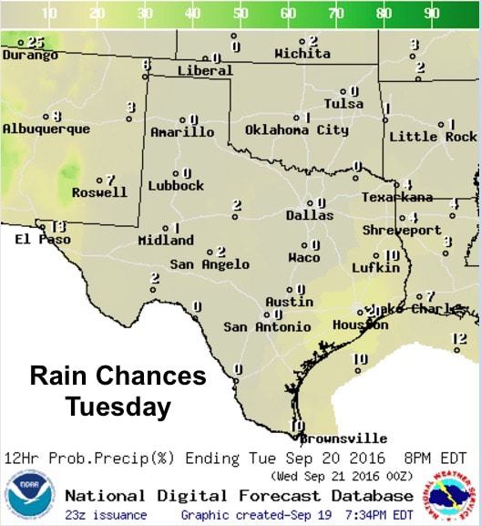
Rain chances will be minimal at best. Southeast Texas will have the best hope of seeing scattered afternoon showers. Widely scattered pop-up showers are also possible along the coastal bend tomorrow afternoon. Elsewhere, little hope of seeing any showers develop with high pressure sitting on top of our state through tomorrow. Patchy to dense fog is also possible again tomorrow morning across the coastal plains, but that should all burn off within a few hours of sunrise tomorrow.
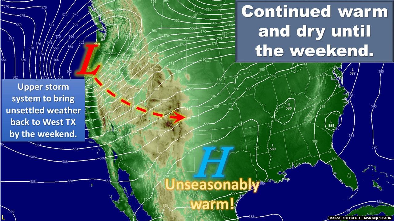
This weekend – The long range forecast models remain in disagreement with rain and cooler weather chances this coming weekend. High pressure over us currently is expected to shift east as a low pressure trough develops to our west. As this trough swings into the desert southwest, it’s expected to pinch off and become separated from the main jet stream and wobble around the southwestern states for a few days. How close to us this cutoff low meanders remains in question at this time. Some models are shifting that cutoff low further to the west which would allow high pressure to regain a foothold over at least the central and eastern portions of the state which would result in less chances for rain and cooler weather. The western half of the state would be the most likely to see rain and storm chances with either solution with the help of a cold front expected to arrive sometime late Saturday or early Sunday, but the eastern half, which has missed out on much of the recent precipitation, would once again be faced with scant rainfall chances if this next system stays further to the west. As always, we will continue to hope for the return of rain chances and cooler weather!


0 Comments