
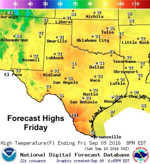
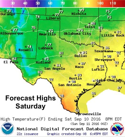
Rain chances will be on the uptick this weekend along with the arrival of a cold front to help knock temps down a good 10 degrees or so behind it. Unfortunately, this front will not be all that strong and will not make it too far into southern Texas before it stalls and dissipates, but it will bring a good coverage of rain and showers across much of the state through Saturday. That said, we’ll have one more day of hot and muggy temperatures before the front begins to push through the panhandle Friday afternoon. Highs tomorrow will range from the low to mid 90s across the northern half of the state, with highs in the upper 90s to just over 100 degrees across parts of south Texas along the Rio Grande. With lots of humidity still in place, we’ll see Heat Index values in the upper 90’s across the northern half of the state, and for south central and deep south Texas, we’ll see Heat Index values tomorrow afternoon climb between 100 and 105.
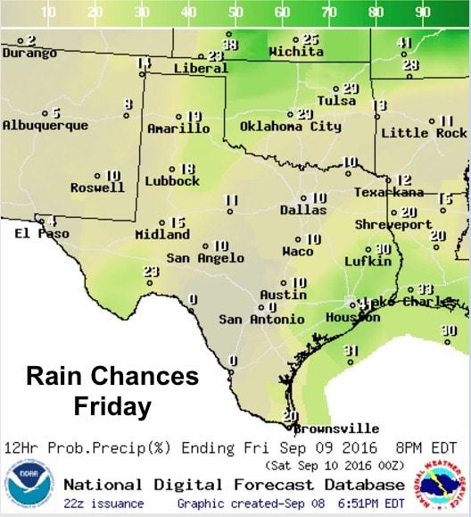
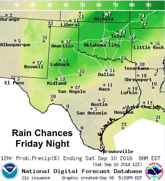
As the front begins to push south through the panhandle tomorrow afternoon, we’ll begin to see scattered shower and thunderstorm development by mid-afternoon. Instability and wind shear will be ample for a few strong storms in the central to southeastern panhandle and down into west central Texas. While the overall threat for widespread severe weather tomorrow is low, a few of the storms across this region could become strong to severe with gusty winds, lightning and small hail as the main threats. Further south along the coast, pop up showers will once again be possible along the daily seabreeze front mid-morning to late afternoon. Those will carry the typical threats of gusty downburst winds and lightning. Rain chances will carry on through Friday night as the front continues to slowly make its way south into west central and north central Texas by early morning on Saturday. With the loss of daytime heating, all storms should remain below severe limits with periods of heavy rainfall as the main concern during the overnight hours.
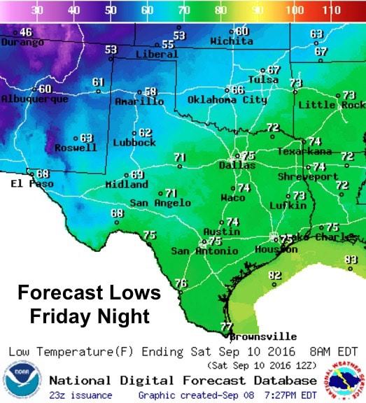
Lows Friday night will become quite pleasant behind the front where we’ll see temps dip down into the mid to upper 50s across the panhandle. Ahead of the front, folks will still have to contend with another warm and humid night in the mid to upper 70s, possibly close to 80 for urban areas…perfect for breeding mosquitoes.
In contrast to Friday’s forecast highs, Saturday looks pretty darn good. By late afternoon, the front will have pushed into south central Texas where it will stall and dissipate by early Sunday morning. Looks like we’ll have a real nice taste of fall across the panhandle, northwest and west Texas with highs only in the mid-70s. Of course, the further south/southeast you go, the warmer the temps; however, they will be…with the exception of deep south Texas…a few degrees below average for this time of the year.
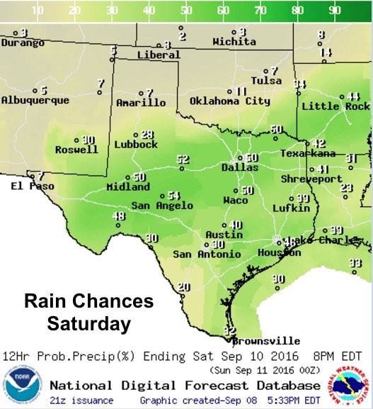
Rain chances stick with us on Saturday as well with widespread scattered showers continuing along and ahead of the front. Not everyone will see rain on Saturday, but those that do could pick up a decent 1/2 inch or more depending on where the heaviest showers set up. We will of course be watching the evolution of rain and storms tomorrow and through the weekend, so be sure to check back!


0 Comments