
Light rain is moving west across Southeast Texas this morning. The rain shield is associated with moisture from a weak tropical low in the Gulf of Mexico – not to be confused with Invest 99L. As temperatures continue their daily climb toward afternoon highs we should see an uptick in coverage by the early afternoon hours. The best chance for scattered showers will be along and east of Interstate 35 in North, Central, Northeast, East, Southeast Texas into the Brazos Valley.
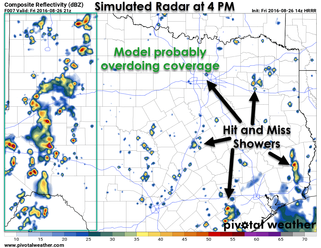
This activity will be moving west – the opposite of what you typically see activity move in our state. Each individual shower should only last 30-60 minutes before raining itself out, but the outflow from the dissipating showers will help spark off new activity. This process will continue through the late afternoon before coverage starts to decrease. As the title of this posts suggests these will be hit or miss. Most folks will likely be dry today. The stronger pulse storms may produce localized wind gusts over 40 MPH and brief heavy rain. Severe weather is not expected.
Afternoon thunderstorms will also increase in coverage across the Permian Basin later today. This activity may become strong with localized gusty winds and brief heavy rain. Movement will be to the northeast, albit slowly. Activity should decrease by the early evening as we start to lose some of the daytime heating. We’ll have to watch for minor flooding where we see a quick inch or two of rain. Otherwise widespread flash flooding and severe weather don’t look to be in the cards today.
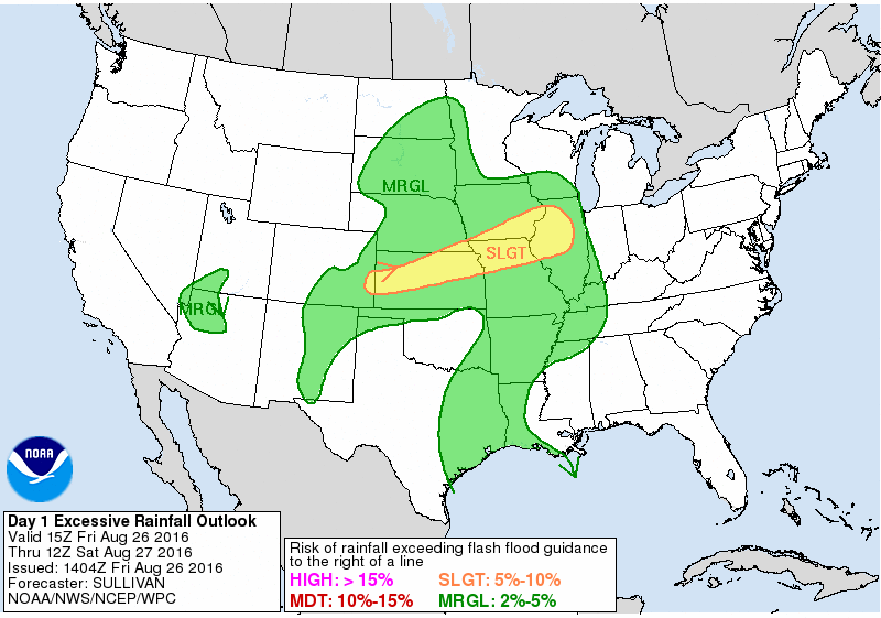
Flash Flood Outlook Today


0 Comments