
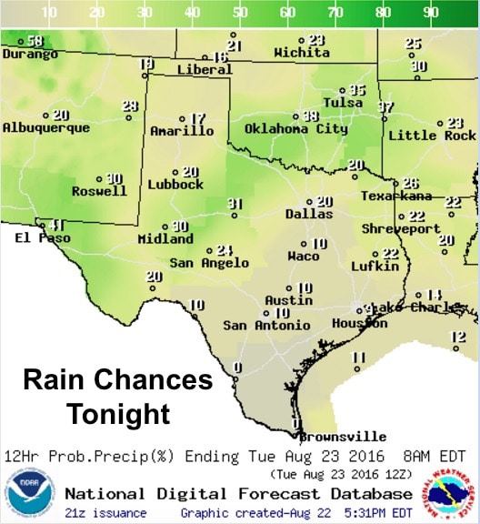
Scattered showers and a few stronger storms will continue across the northern half of the state for a few more hours before most of the activity eventually dies out after the sun sets. Best chances for overnight rain will be northwest of the DFW metro area across western north Texas and the eastern rolling plains. Elsewhere, the radar is expected to remain mostly quiet with no hazards expected.
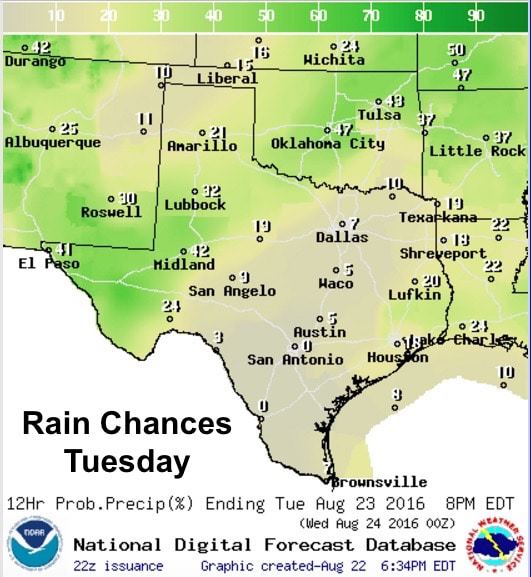
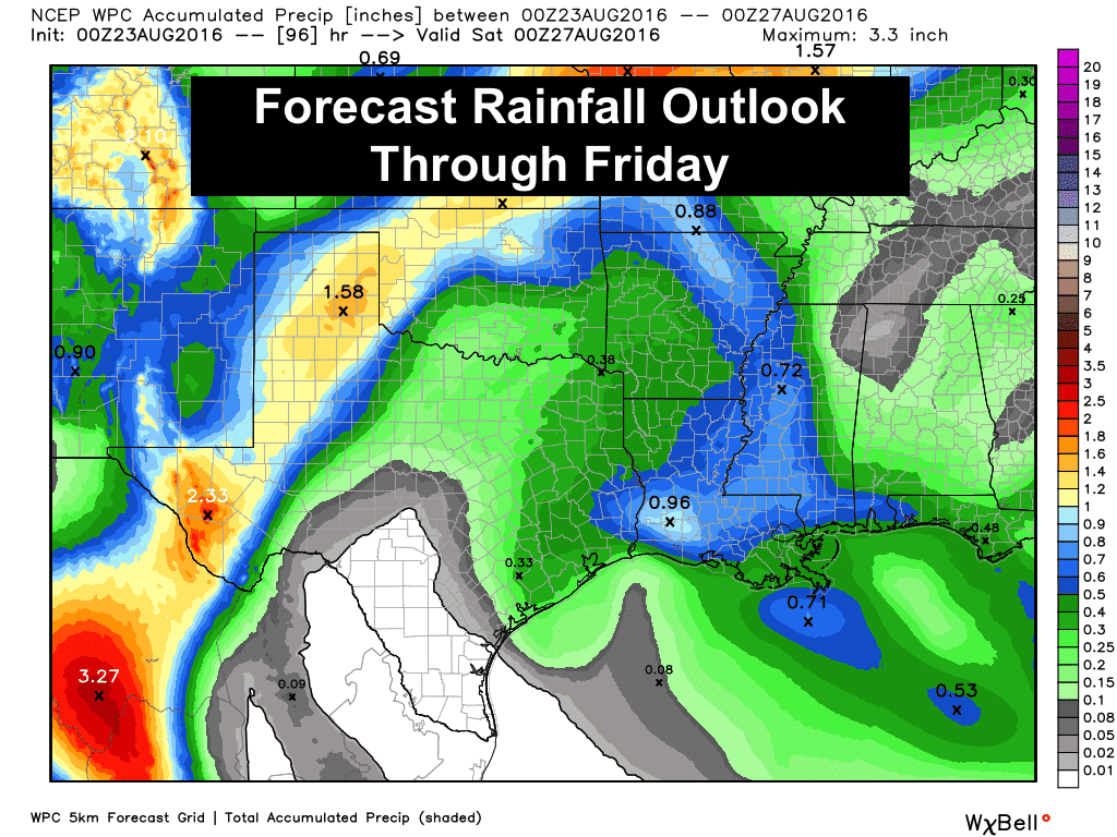
For Tuesday, high pressure currently over northern Florida will begin to expand and shift westward with the western periphery of the ridge settling in over the eastern half of the Texas. This will limit rainfall potential for central and eastern Texas over the next several days. The western half of the state…particularly across far west Texas, the Trans Pecos, Permian Basin, Big Country, Rolling Plains and portions of the Texas Panhandle…will see an uptick in rainfall chances Tuesday through Wednesday as moisture flows northward into the region while it’s sandwiched between the high pressure ridge to the east and a low pressure trough to the west. A couple of disturbances will also ride along the western periphery of the ridge which will likely result in multiple rounds of heavy rainfall across the area over the next few days. Exactly where the bands of heaviest rainfall will occur cannot be predicted at this time, but local forecasters are monitoring the potential for flooding concerns. That said, we may begin to see Flash Flood Watches issued for counties across this region by tomorrow after review of the next set of model data which rolls in late this evening.
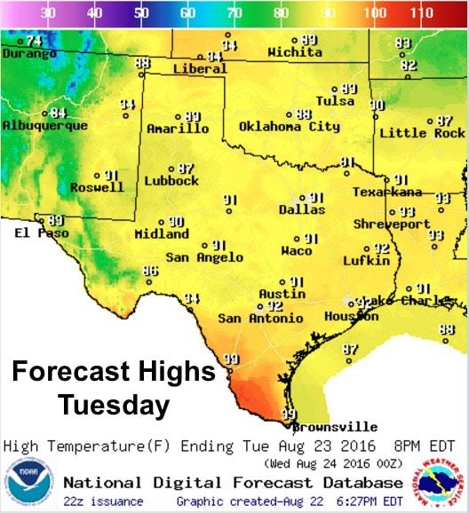
Forecast highs tomorrow will also be creeping back up into the low 90s across much of the state. That is still a few degrees below what we typically see in late August but that trend is likely to continue for the remainder of the work week.


0 Comments