
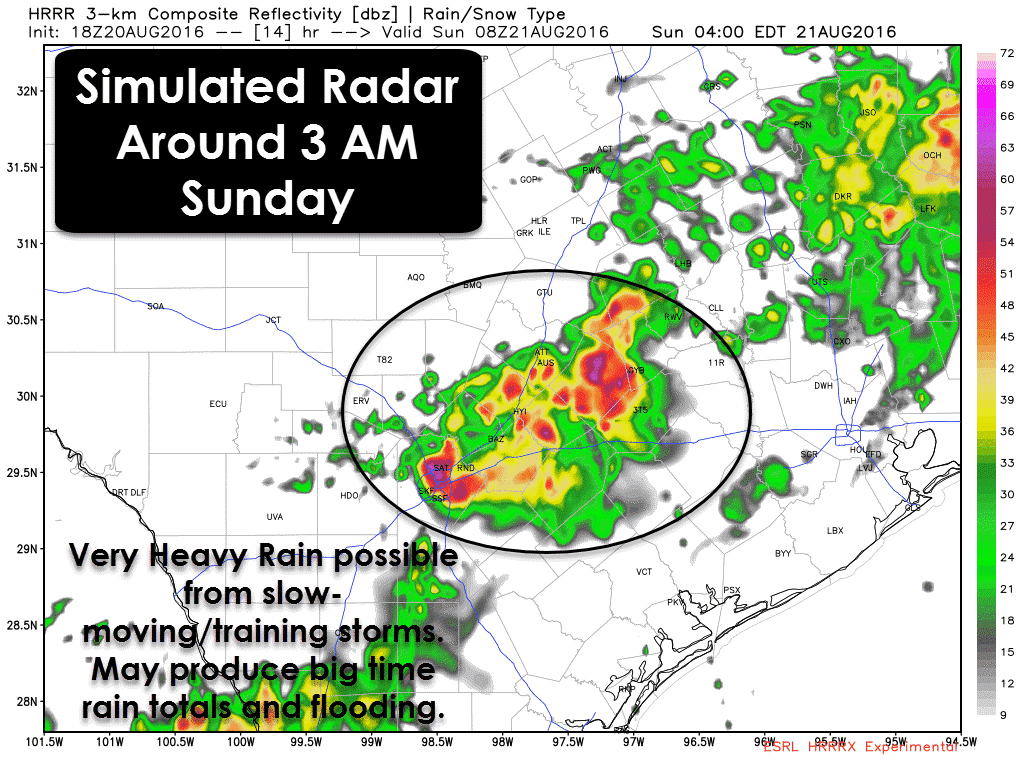
 A classic overnight rain event seems to be setting up in Central/South-Central Texas. A slow moving cool front will make its way south of Interstate 20 by late this evening. Copious amounts of moisture from the Gulf of Mexico and from the Pacific will converge south of the front. The front will help provide lift which will make thunderstorm development more likely. Since steering currents aloft are weak the storms aren’t forecast to be in much of a hurry. Short-term high resolution weather models are showing storms that do form tonight will likely back build and train over the same areas. Training is when storms simply keep redeveloping and move over the same locations. Essentially it looks like the storms are just stalled out and sitting. When you have copious amounts of moisture available that can quickly become a big problem with excessive rains.
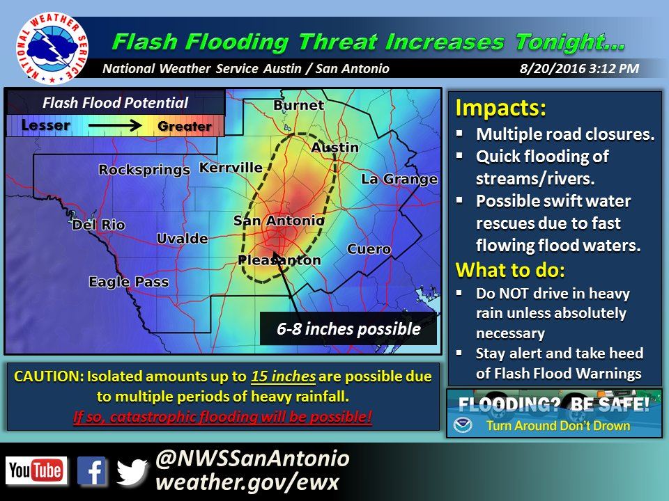
The stage seems to be setting up for a localized, but significant rainfall event in Central and South-Central Texas tonight. I can’t say with complete certainty where storms are going to fire up and sit tonight. The more probable solution is for the eastern Hill Country into Central Texas – including Austin south through San Antonio – and locations just east. With the lift tonight we could see rain rates approach 3 inches per hour. With several hours of rain it is not out of the question that we see new rain totals exceed 10 inches in localized areas tonight. In fact, the National Weather Service in San Antonio is saying isolated totals up to 15 inches will be possible. I want to emphasis those kinds of rain totals would be extremely localized. Yet with the potential for another 5-10+ inches of rain over a localized area tonight we need to be very aware of the flood potential. Regardless of where, if we see 7-12+ inches of rainfall tonight it will cause major flash flooding. If we see that kind of rain fall in more of an urbanized enviornment the results could be very serious – and potentially with catastrophic flash flooding. The good news is those excessive rains shouldn’t fall on more than a few counties tonight, but it won’t be good news for those who end up dealing with it. Please keep an eye to the sky and have a plan if you live in a typical flooding location.’
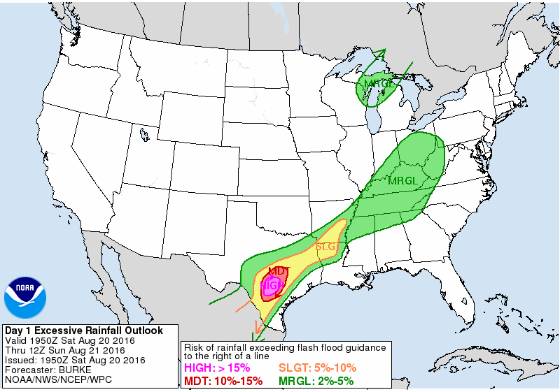
The Weather Prediction Center – in consultation with local weather service offices – has upgraded portions of Central Texas, South-Central Texas, and the Hill Country to a HIGH RISK of Flash Flooding Tonight. Previous setups like the one tonight have produced significant flooding. Its not a guarantee but confidence is increasing we’re going to have real serious issues later tonight.


0 Comments