
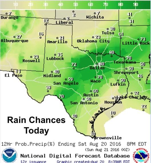
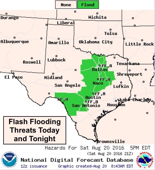
Chances for heavy rainfall from northern texas down through central and southwest Texas will continue today as our this unusual weather pattern continues to hang around this weekend and into next week. Localized flash flooding will be the main concern today as pockets of very heavy rainfall continue throughout the day and possibly into the overnight hours. The front appears to have slowed somewhat but is still expected to make it into the Red River Valley area by this afternoon. This will likely result in a regeneration of rain and storms again this afternoon across northern Texas as it interacts with a very moist and tropical-like atmosphere across the area. Further south, areas along and west of the I-35 corridor…western Hill Country and southwest Texas…will also see heavy rainfall continue with an additional 4 to 6+ inches likely with isolated higher amounts in excess of 10 inches possible.
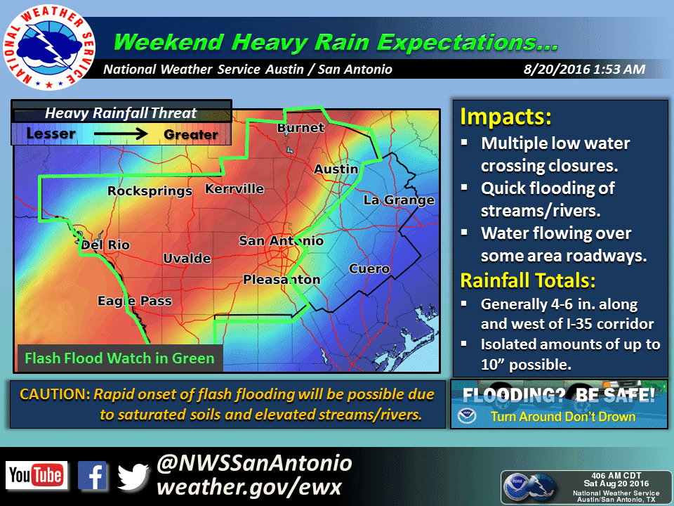
Flash Flood Watches remain in effect across much of north, central and southwest Texas through Sunday. Residents in flood prone areas, especially along local creeks and rivers, will need to keep an eye on local conditions and be prepared to take action.
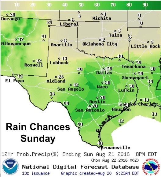
Where the front eventually stalls will have an impact on where the best rainfall chances set up again on Sunday. Yesterday, it looked like the front would stall somewhere south of I-20 across central Texas. Today, it appears the front has slowed and will stall out somewhere across north central Texas and the DFW metro area. If so, the best chances of rain tomorrow will nudge a little further north. That being the case, we’ll have to play the wait and see game and re-evaluate tomorrow’s chances later this evening.


0 Comments