
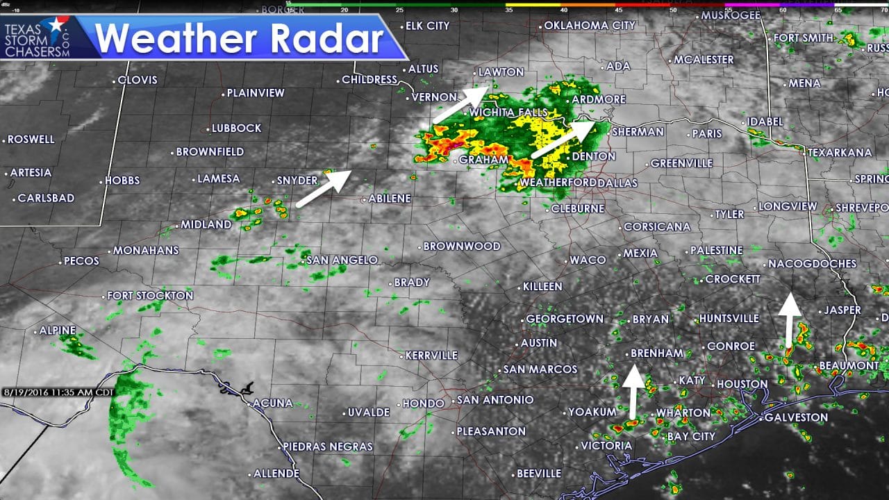
Moderate to heavy rain is moving northeast across western North Texas. Light to moderate rain is now falling in Tarrant, Denton, and Cooke counties. The heavier rains are falling from Olney to Archer City, east to Jacksboro to Weatherford. All of this convective activity is moving northeast around 30 MPH. We’ve seen it build south over the last few hours so those in D/FW shouldn’t be surprised if it starts raining soon. All that rain is thanks in part to a weak disturbance overhead. We should see the rain continue through the middle afternoon hours before coverage starts to decrease. Some locations may receive one to two inches of rain through the afternoon hours. Widespread flash flooding and severe weather is not anticipated.
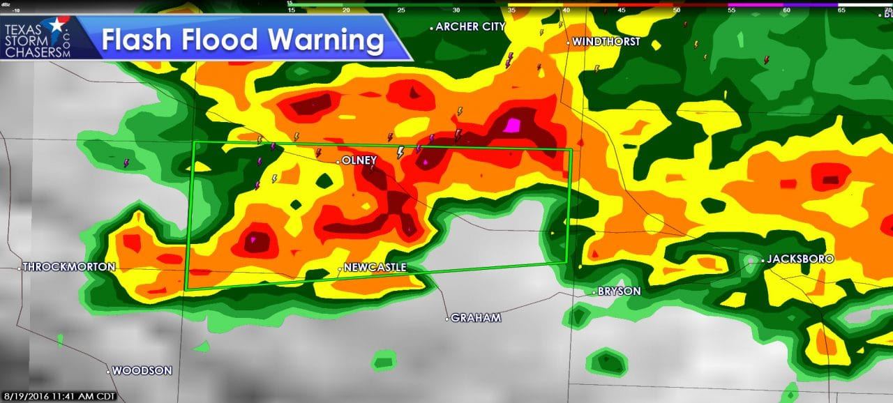
A flash flood warning has just been issued for northern Young county in North Texas. Olney, Newcastle, and locations just northwest of Graham on Highway 380 and 114 are included.
FLASH FLOOD WARNING
NATIONAL WEATHER SERVICE FORT WORTH TX
1139 AM CDT FRI AUG 19 2016
THE NATIONAL WEATHER SERVICE IN FORT WORTH HAS ISSUED A
* FLASH FLOOD WARNING FOR…
NORTHERN YOUNG COUNTY IN NORTH CENTRAL TEXAS…
* UNTIL 245 PM CDT
* AT 1137 AM CDT…THE PUBLIC REPORTED THUNDERSTORMS PRODUCING HEAVY
RAIN ACROSS NORTHERN YOUNG COUNTY. MORE THAN 4.5 INCHES OF RAIN
HAS FALLEN OVER THE LAST COUPLE OF HOURS. THIS RAINFALL WILL LEAD
TO EXCESSIVE WATER RUNOFF AND CAUSE FLASH FLOODING. LOW-LYING
AREAS ARE MOST VULNERABLE TO RAPIDLY RISING WATER. SOME LOW-WATER
CROSSINGS MAY FLOOD AND BECOME IMPASSABLE.
* SOME LOCATIONS THAT WILL EXPERIENCE FLOODING INCLUDE…
OLNEY AND NEWCASTLE…
HIGHWAY 79 NEAR OLNEY…
HIGHWAY 114 IN NORTHERN YOUNG COUNTY.
PRECAUTIONARY/PREPAREDNESS ACTIONS…
TURN AROUND…DON’T DROWN WHEN ENCOUNTERING FLOODED ROADS. MOST FLOOD
DEATHS OCCUR IN VEHICLES.
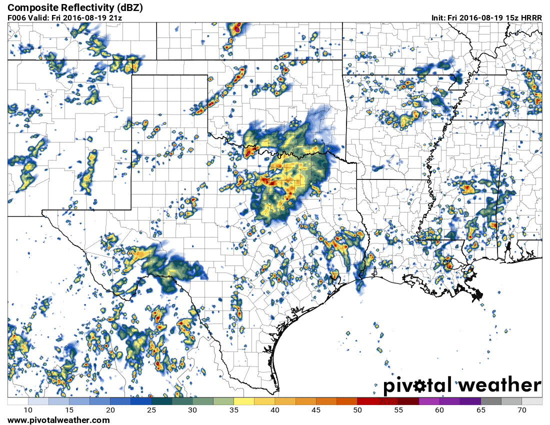
Simulated model radar this afternoon
Isolated to scattered storms should increase this afternoon from the Concho Valley east into Central Texas, Southeast Texas, and East Texas. This activity will be driven by the diurnal temperature peak and tropical moisture. Like most summer days we may see a few stronger storms with gusty winds and heavy rain. Compared to the larger area of rain in North Texas activity should remain less organized/less widespread. Those who end up under a popup storm could pick up a quick half inch to one inch of rain. Widespread flash flooding and severe weather is not anticipated.
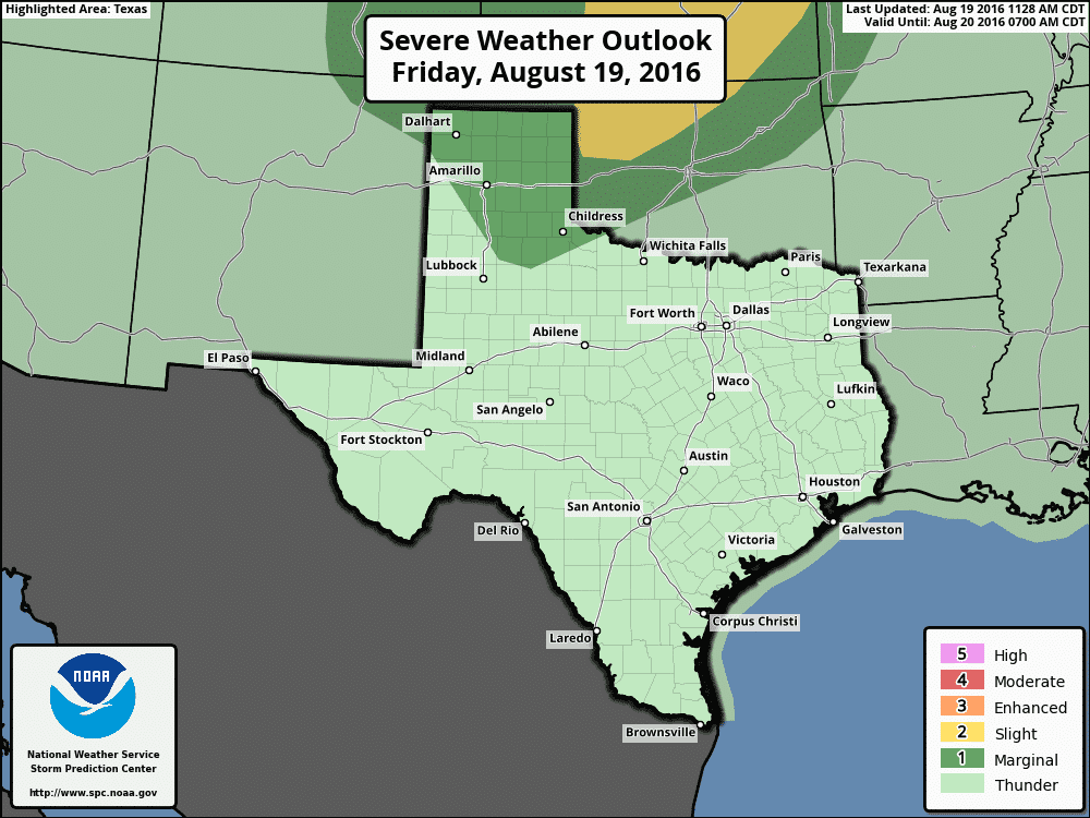
Today’s Severe Weather Outlook
Comparatively more organized thunderstorms are expected to develop later today in the Texas Panhandle. These storms will be associated with a weak upper level wave and approaching cool front. With weak wind shear and moderate instablity the more organized storms may be severe. The strongest storms may produce quarter size hail and damaging wind gusts up to 70 MPH. The Storm Prediction Center has placed much of the Texas Panhandle south to the Caprock in a category 1 severe weather risk. Storms should move east once they develop.


0 Comments