
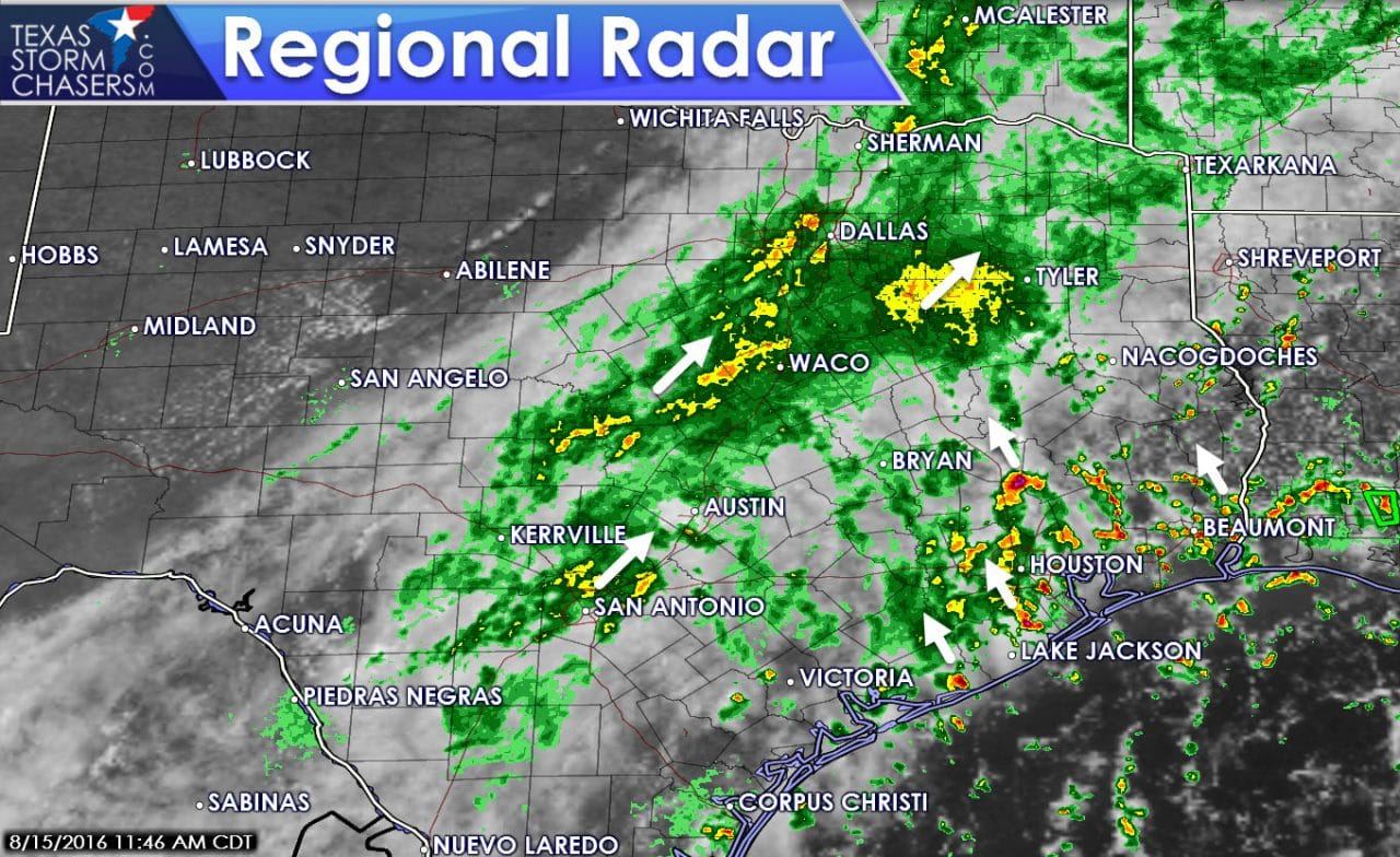
Widespread light to moderate rain is moving northeast across North Texas, Central Texas, and South-Central Texas. This precipitation is occuring in an axis of higher moisture and slight lift. Smaller cells in this larger area of rain are capable of producing heavy rain. While radar returns may not look impressive the tropical nature of the activity suggests rain rates may be higher.
More scattered activity is developing across Southeast Texas. This activity is not as widespread as precipitation further north and west, but is much heavier. These scattered heavy showers and storms are moving northwest around 25 MPH. Very heavy rainfall rates up to 2-3 inches per hour are occuring under these cells. As long as we keep the cells moving most locations won’t experience too many problems.
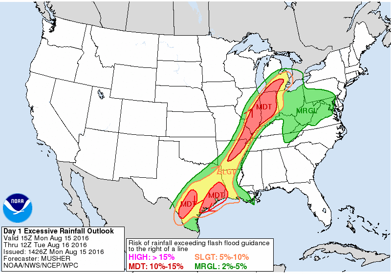
Flash Flood Outlook for Today/Tonight
What we will be looking for is storms that start training – as in moving over the same areas. Should we see training activity occur the potential for flash flooding would rapidly increase along with rainfall accumulations. That’s why a flash flood watch is in effect for all of Southeast and South-Central Texas this afternoon.The High Resolution Rapid Refresh (HRRR) weather model keeps the rain going for much of the afternoon. As described above we’ll be on the watch for training activity along with heavy rains over previously saturated locations. We may see a lull in rain across Central and South-Central Texas during the late afternoon. Additional rain showers may form tonight.


0 Comments