
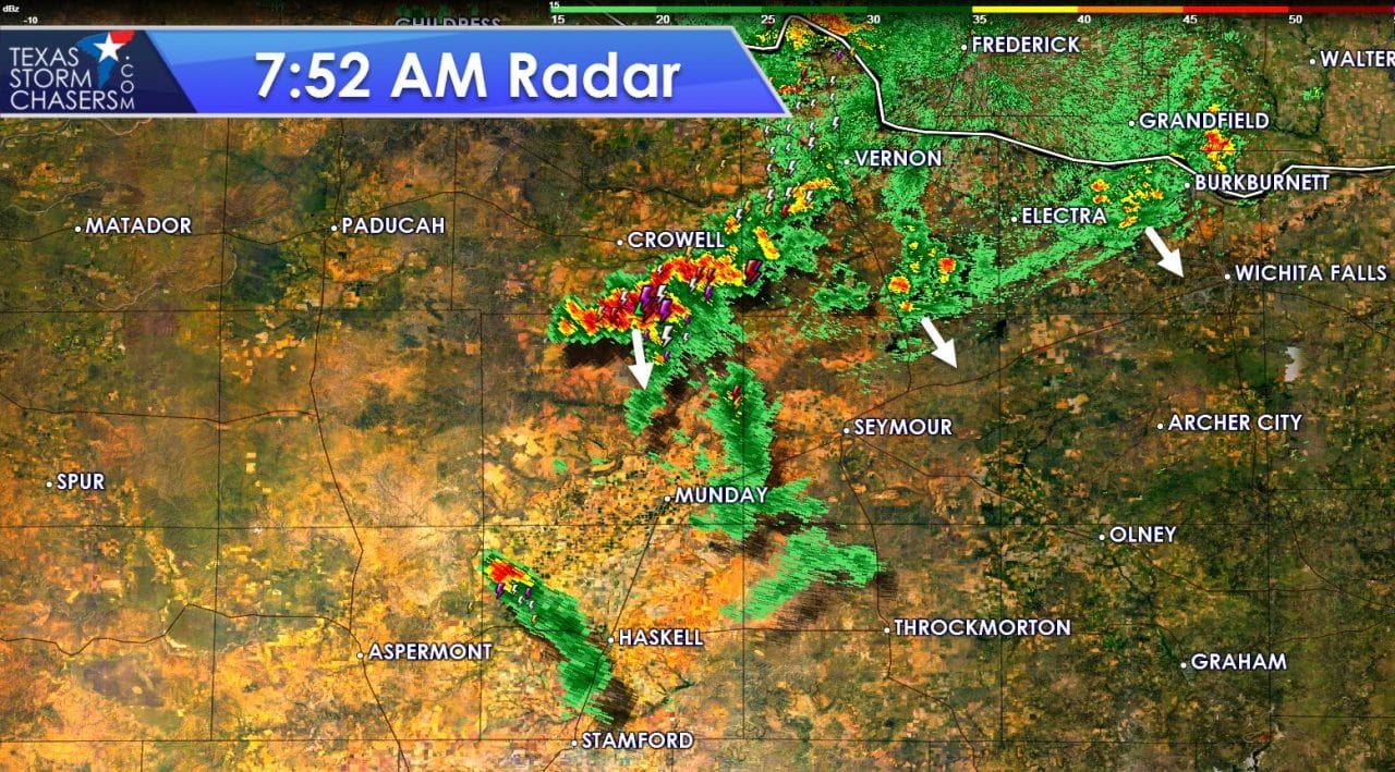
A few lucky folks got rained on overnight in Northwest Texas. All that is left of that activity shortly before 8 AM are a couple of thunderstorms from northwest of Haskell north to Crowell and Vernon. This activity is slowly pushing south but will likely continue to weaken through late morning. The storm a couple miles south of Crowell is the strongest with frequent cloud to ground lightning and gusty winds. No severe weather is expected with the morning activity.
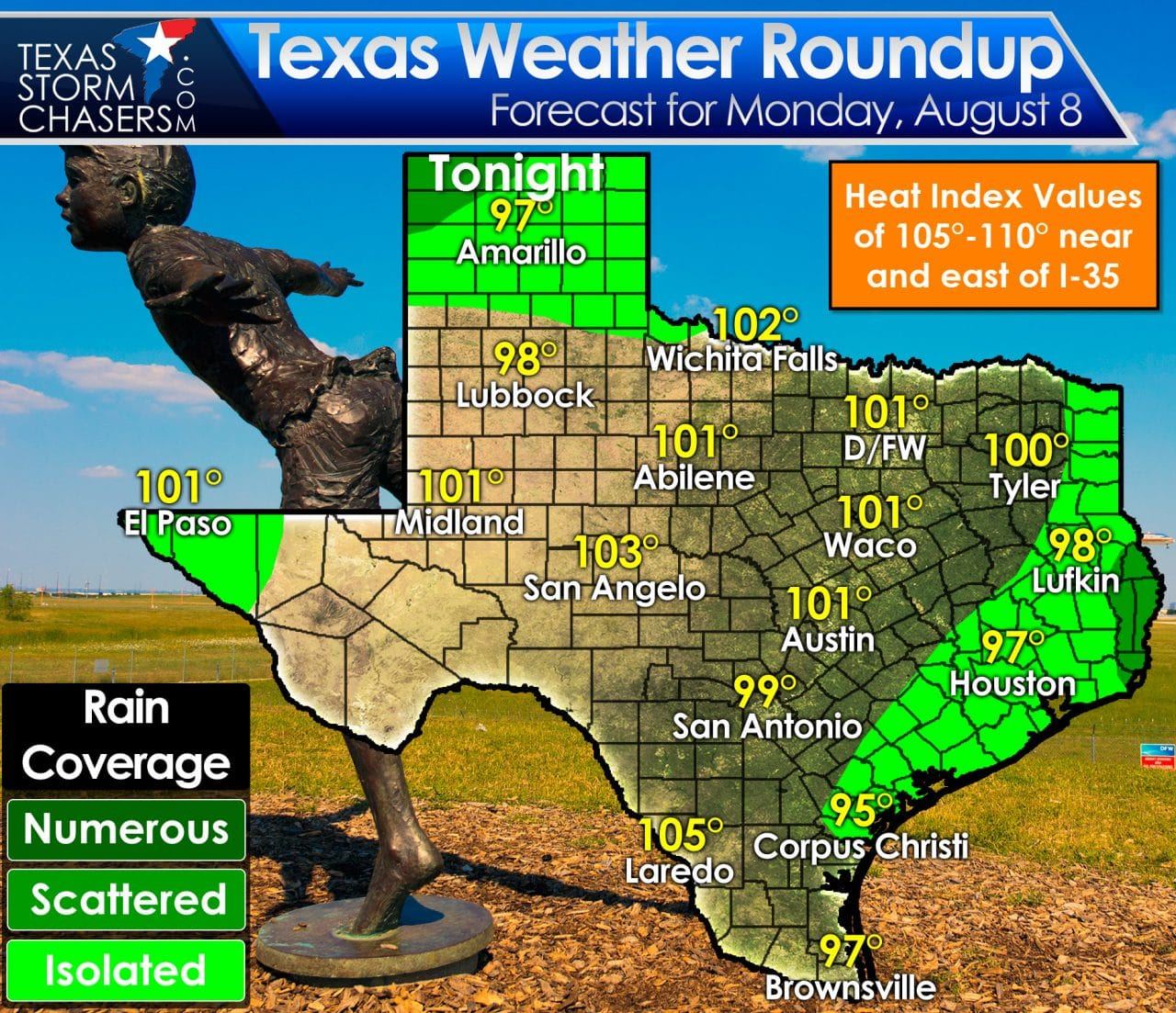
Outside of this morning’s precipitation in Northwest Texas we will see a few regions with afternoon popup storm chances later on. Southeast Texas, with its neverending summer humidity, will likely reach convective temperature by early afternoon. Once temperatures reach that magical point we should see widely scattered thunderstorms begin sprouting up. Organized thunderstorms are not expected, but those that end up under one of the afternoon popups will get a drenching. Brief heavy rain and frequent lightning can be expected with the more potent cells this afternoon. A second area of potential evening and overnight activity will be in the Texas Panhandle. Like last night we could very well see storms move in during the evening hours. Severe weather is unlikely but a few lucky souls could get a soaking. An isolated storm or two can’t be ruled out in far West Texas as the monsoon continues in the Southwest United States. Temperatures will be up there this afternoon with a heat advisory in place along and east of Interstate 35 in North and East Texas. High temperatures across the state should range from the middle 90s near the coast into the lower 100s. Heat index values will top out between 105 and 110 degrees where humidity values are highest east of Interstate 35. If working outdoors today please ensure you remain hydrated and don’t overdo it. I often jest at the summer heat safety tips that get plastered by the media, but heat stroke is a real danger.

A rare summer cool front is expected to roll south into parts of Texas by Friday and Saturday. Combined with moisture from Tropical Storm Javier near Baja California we should see increased chances for rain. At this time we’re not calling for widespread heavy rains, but some folks could get a soaking this weekend. The increased chances of rain and clouds also mean high temperatures will drop off into the upper 80s to lower 90s for some. It certainly won’t feel like fall but any relief is welcome in August. Refinements to the forecast can be expected as we get through the work week.


0 Comments