
August is typically our hottest month here in Texas and the first week of the month will live up to that this year. The upper level high pressure responsible for the current heat will continue through next week. The high itself will shift around the southern United States for the first half of August. That means we’ll likely remain hot and mostly dry. There will be chances for isolated thunderstorms in the forecast timeframe but no widespread or heavy activity is expected. The only way we typically see widespread rains in August and September is from a landfalling tropical storm or hurricane. Far West Texas (El Paso) will be an exception as they have now entered the typical monsoon pattern. They’ll be one of the only spots to get decent rains over the coming weeks, at least that is the hope.
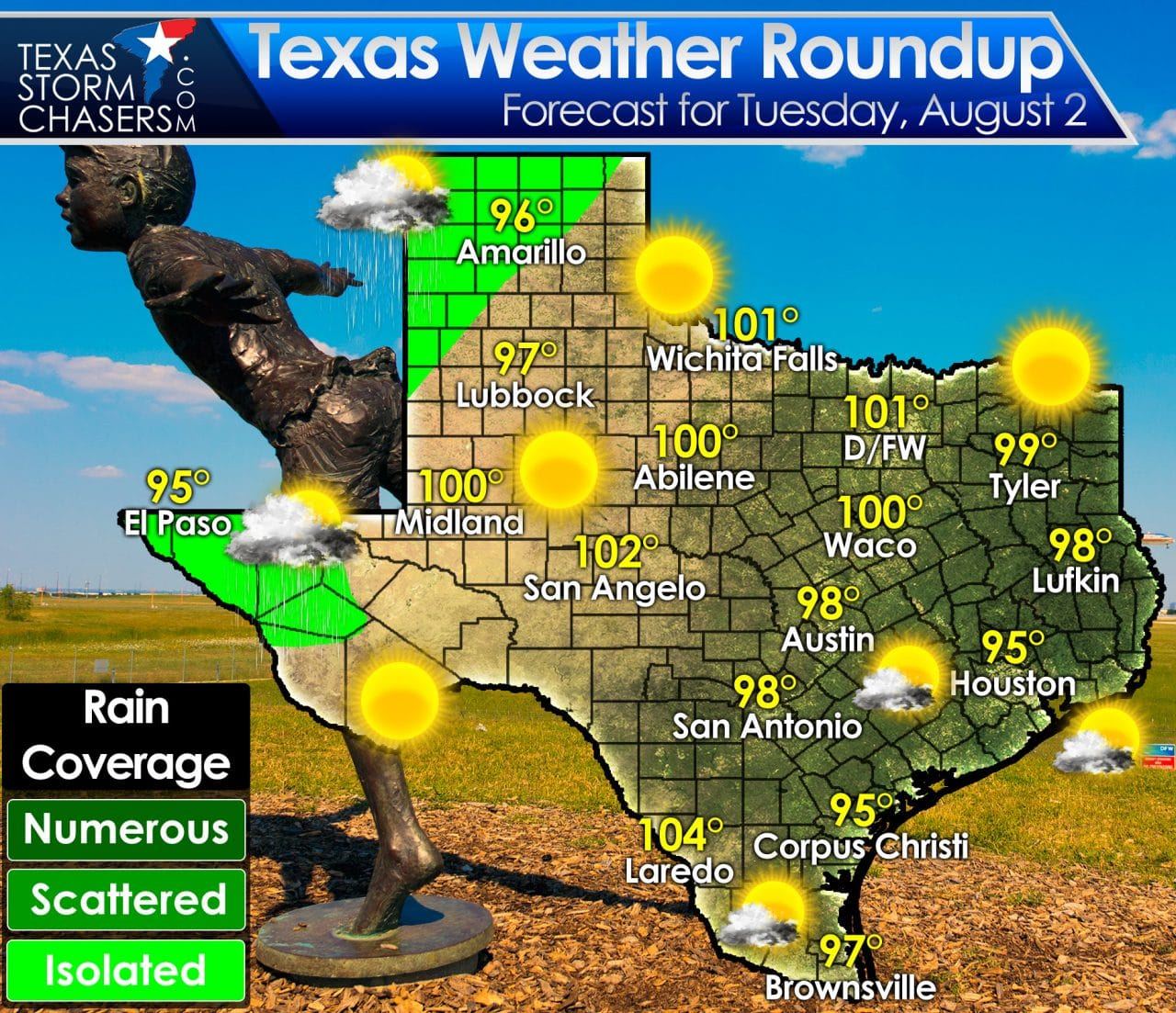
High temperatures today will be a few degrees higher than what we experienced yesterday. That means more triple digit temperatures will popup across the state this afternoon. Those who don’t make it up into the triple digits will still get to enjoy the heat with temperatures climbing into the middle and upper 90s. One cavet to the ‘lower’ temperatures is that humidity values are usually higher in those locations. That means even though temperatures may only be in the 90s the heat index values will be above 100 degrees. Who says we don’t equally share heat here in Texas. 😉
Isolated storms will be possible this afternoon in Far West Texas into the western Texas Panhandle. We may actually see scattered activity this evening with any activity that approaches from New Mexico. Otherwise the state will be mostly sunny and dry today.
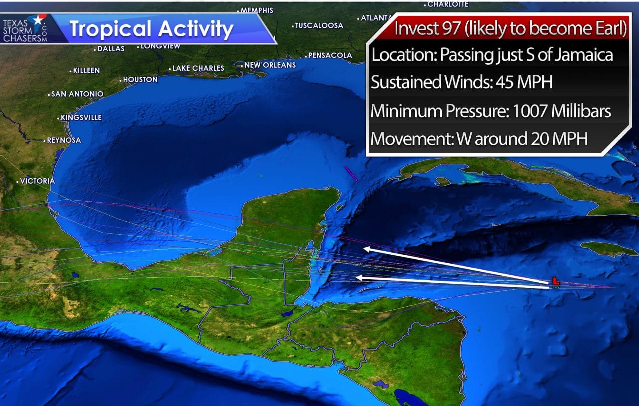
We finally do have something to discuss in the tropics. Invest 97 is a strong tropical wave that is quickly booking it west in the Caribbean. Passing just south of Jamaica this morning this system will likely become Tropical Storm Earl later today. It is already producing winds of tropical storm force, but lacks a defined low-level circulation. In order to be classified a tropical cyclone a distinct, organized low-level circulation is required. A hurricane hunter aircraft is enroute to investigate this system and it wouldn’t surprise me if they initiate advisories a bit later this morning on what would be Earl. The high pressure aloft over Texas will keep Earl moving west and this system poses no threat to Texas. No weather impacts are anticipated in the United States. Surf along the coast may pick up a bit later this week if 97L/Earl moves over the Bay of Campeche.


0 Comments