
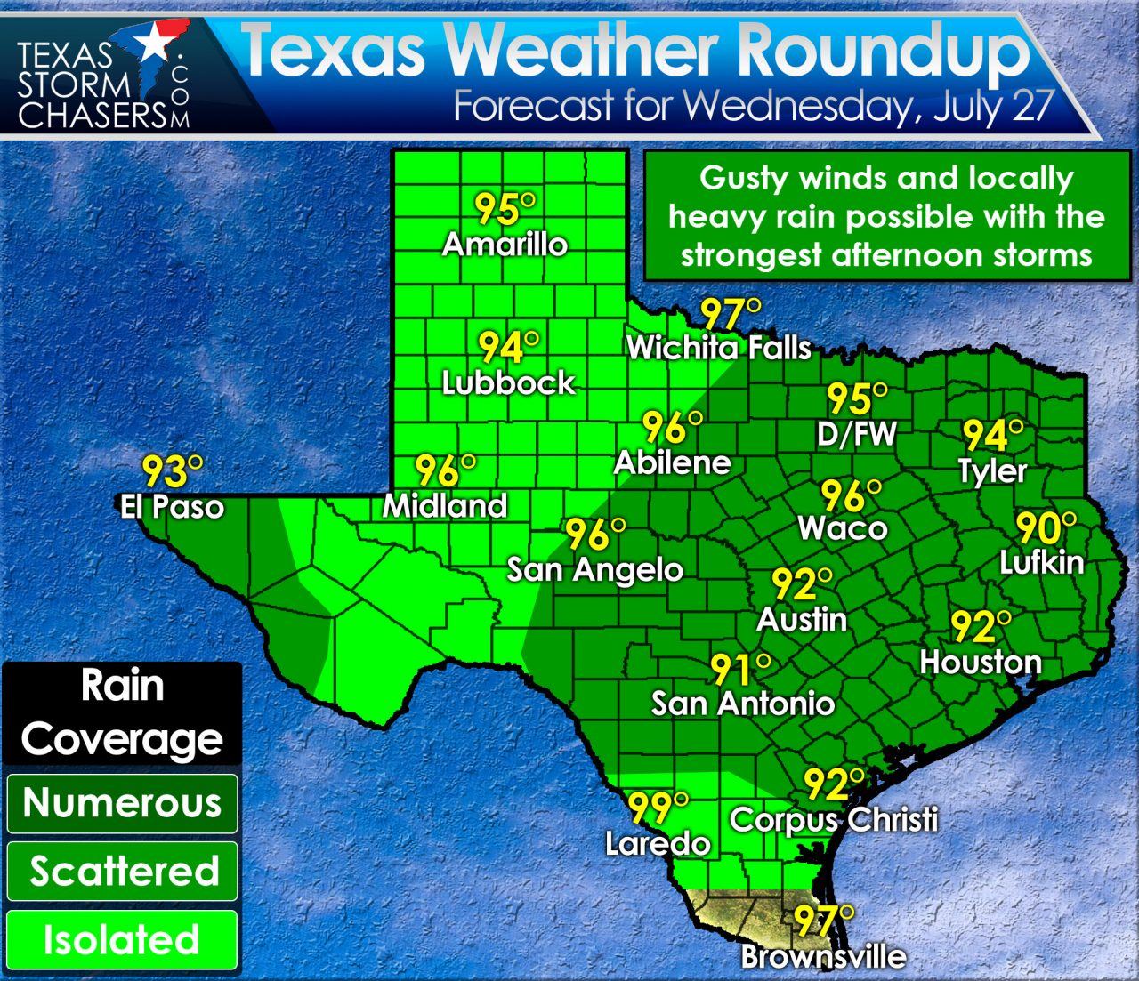
Unsettled summer weather continues today with more afternoon thunderstorm chances. Temperatures will top out near normal with highs in the middle to upper 90s. Portions of East Texas may actually only top out in the upper 80s depending on how quickly storms start to fire up today. Just like the past two days temperatures may peak in the early afternoon before cooling as storms increase this afternoon. Compared to our usual dry and hot summer weather I Think we’ll take it!
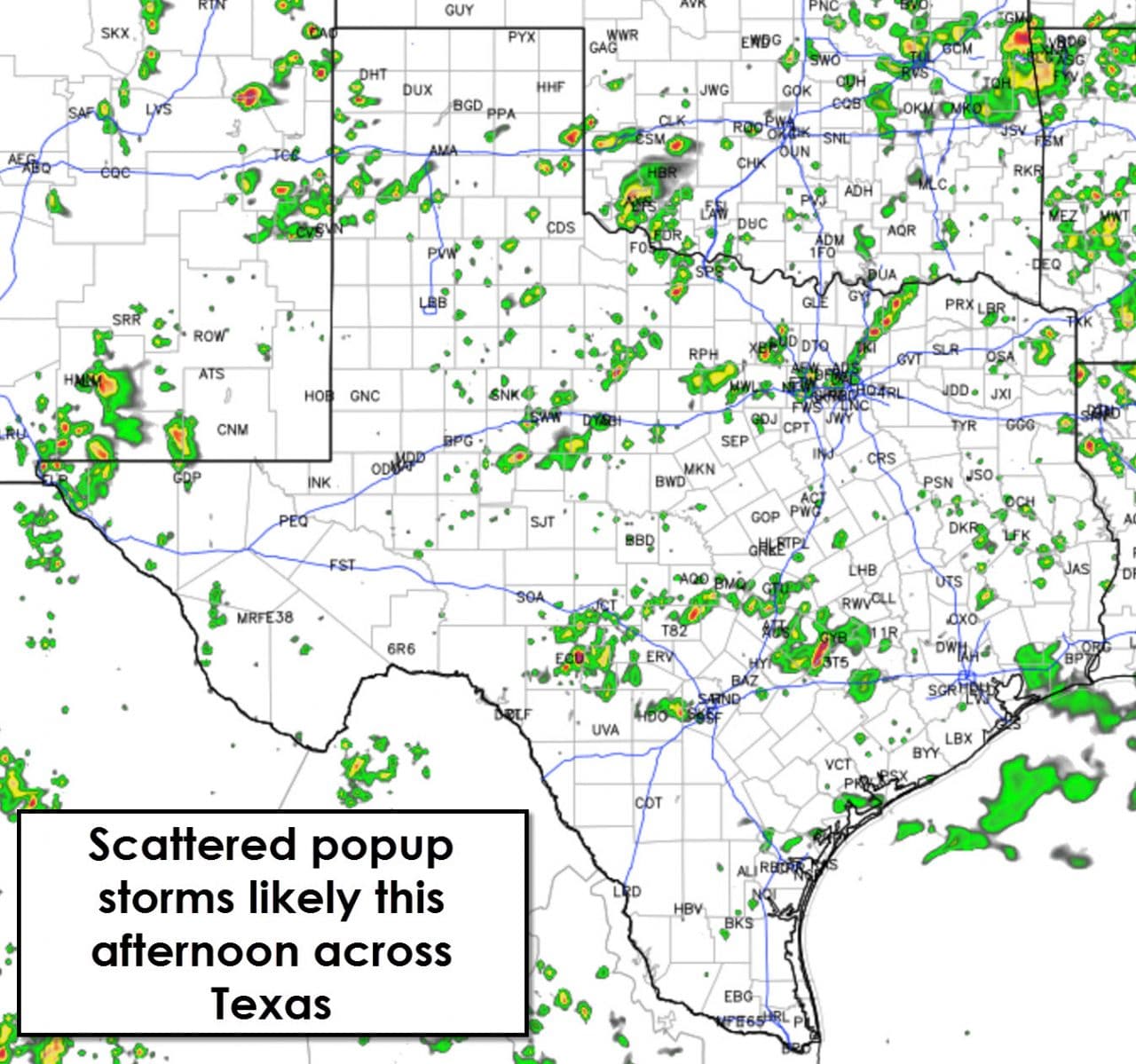
Scatterded thunderstorms are expected to develop once again this afternoon across the state. The best chance for a popup storm will be in North Texas, Central Texas, East Texas, Southeast Texas, and Far West Texas. Isolated storms will be possible pretty much anywhere today. The first storms that develop will produce outflow boundaries which will then help additional storms develop. That process will continue through the mid-afternoon hours before we see storm coverage start to decrease. A couple storms will remain possible into the evening hours.
Strong storms will be possible this afternoon with an unstable airmass in place. The strongest storms could produce microburst winds, very localized damaging winds, over 60 MPH. Locally heavy rain and frequent cloud to ground lightning is a good bet with storms today. Widespread severe weather and flash flooding is not expected. Besides needed rains those who end up under or near a storm will likely drop into the upper 70s to lower 80s for a nice cool off.


0 Comments