
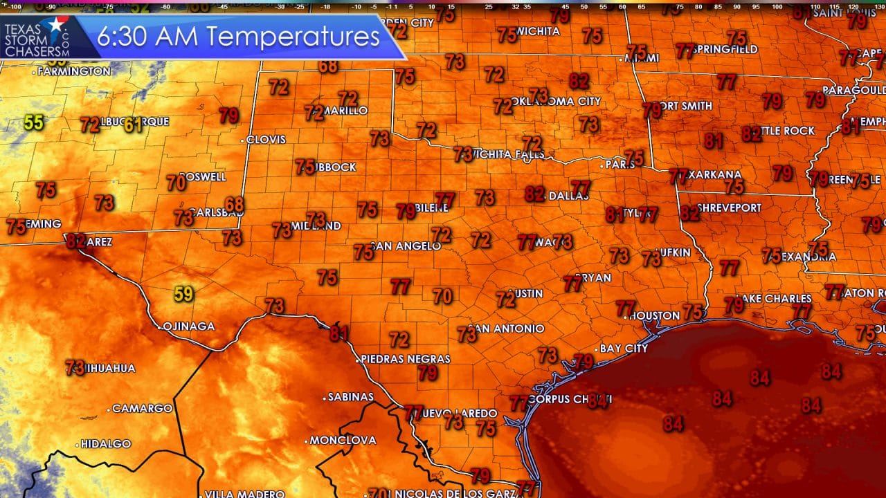
El Paso, Del Rio, and D/FW International Airport all have not dropped below 81 degrees overnight. It’s possible that temperatures could still fall below 80 degrees but that makes little difference. It has been a classic summer night in Texas with lows in the 70s statewide. Alpine, which gets to enjoy the benefit of a higher elevation, made it into the upper 50s. With sunrise occuring at the time of this writing temperatures should be about as low as they’ll go this morning. It won’t take long for them to pick right back up into the 80s with 90s likely by 11 AM.
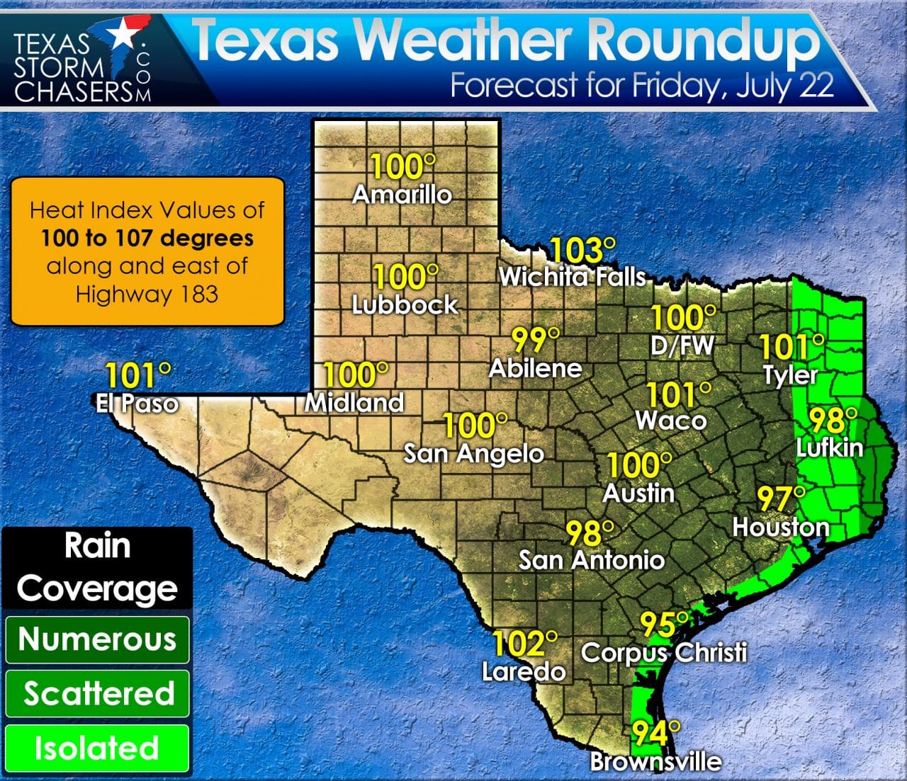
High temperatures will top out in the upper 90s to lower 100s this afternoon across much of Texas. Higher humidity values along and east of Highway 183 will allow heat index values to top out around 105 degrees. Temperatures will rise up into the 90s by late morning with triple digit readings by mid-afternoon. We won’t see any records broken today as we would need to be closer to 107-112 degrees for previous records to be in danger. What we will see today is the chance for popup afternoon thunderstorms in East and Southeast Texas. The best chance for scattered storms will be in far Southeast Texas into Louisiana. We can’t rule out a rouge shower or storm anywhere along the coast today. Any activity that does develop will start diminishing by late afternoon and should be out of the picture by sunset.
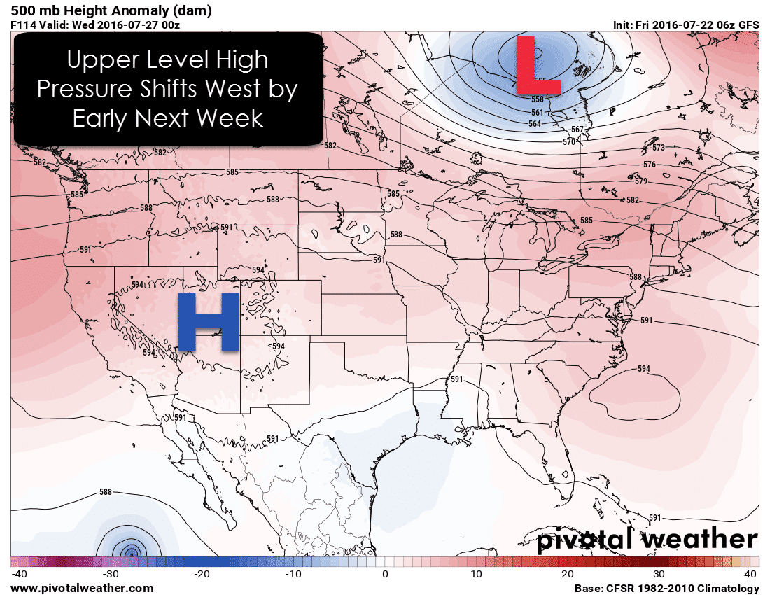
The upper level high pressure over us this week will move into the southwest United States by early next week. The result will be slightly less hot conditions in the state with increased chances of precipitation, especially east of Interstate 35. It will still be warm and humid, but at least we may have afternoon showers/storms to provide some a cool off.


0 Comments