
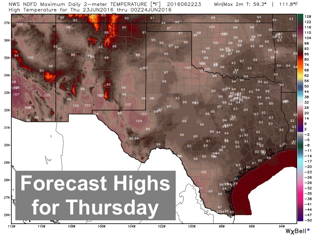
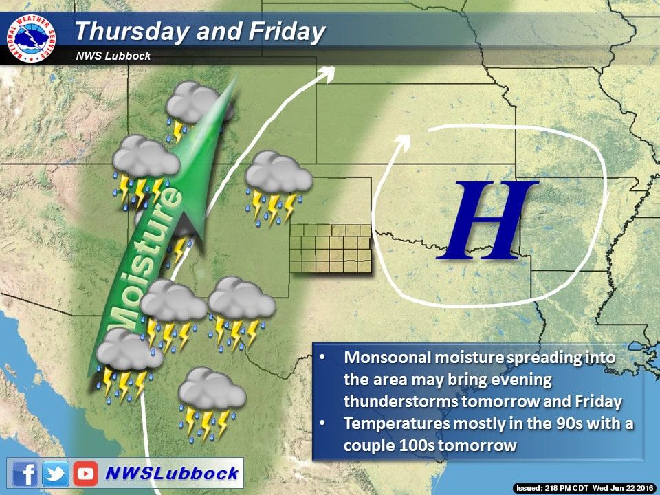
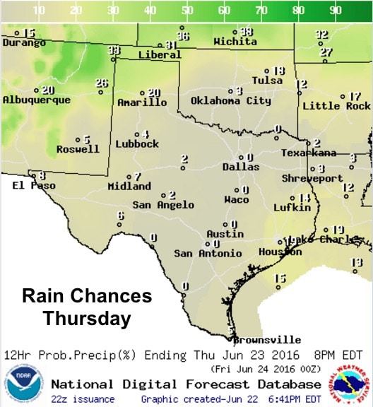
Pretty much a copy and paste forecast for the next several days…hot with just scattered chances for rain. The upper level ridge will stay centered over the southern plains with south winds and highs in the upper 90s across most of the state. Moisture has dropped off just a smidge which will leave heat index values just below advisory criteria for most areas. Monsoonal moisture streaming up into New Mexico will lead to the development of scattered showers and storms Thursday afternoon. Some of these could make a run for the TX/NM border and into the western panhandle tomorrow. Another round of widely scattered showers is possible across southeast Texas tomorrow…probably less than what we saw today, but still a possibility. Other than that, really not much else to highlight for our state! Looking way ahead…the upper level ridge looks to back off to the west by the middle of the week. This could lead to an increase in scattered storm activity, though exactly where is hard to pinpoint right now. What will be more likely is a return to near normal temps, though we’ll still be hot which is typical for this time of the year.


0 Comments