
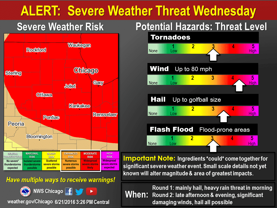
Our neighbors in the Midwest into the Ohio Valley will be dealing with significant severe weather threat tomorrow. Widespread damaging wind gusts, tornadoes, and very large hail are all likely. Rockford, Chicago, Lafayette, and Ann Arbor are a few cities included in the risk.
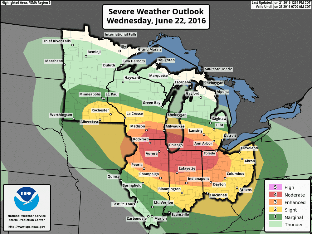
The Storm Prediction Center has issued a category 4 severe weather risk for the regions listed above. Severe storms may develop as soon as 2 PM Central in western areas of the risk areas. Those initial storms may be supercellular with a risk of tornadoes, very large hail, and damaging wind gusts. Depending on mesoscale factors there is the potential for a significant tornado risk. in northern Illinois tomorrow afternoon. Strong and long-track tornadoes may occur but ingredients would need to come together just right. I do expect several tornadoes tomorrow afternoon.
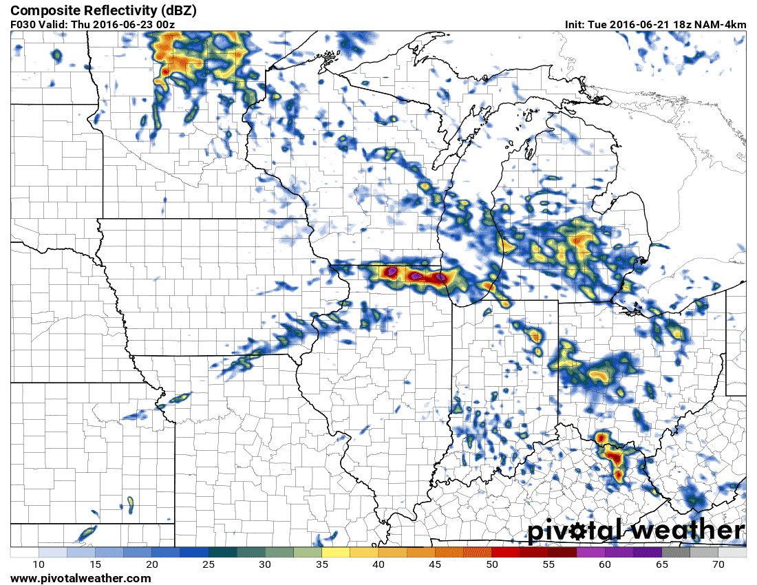
Simulated model radar late tomorrow afternoon
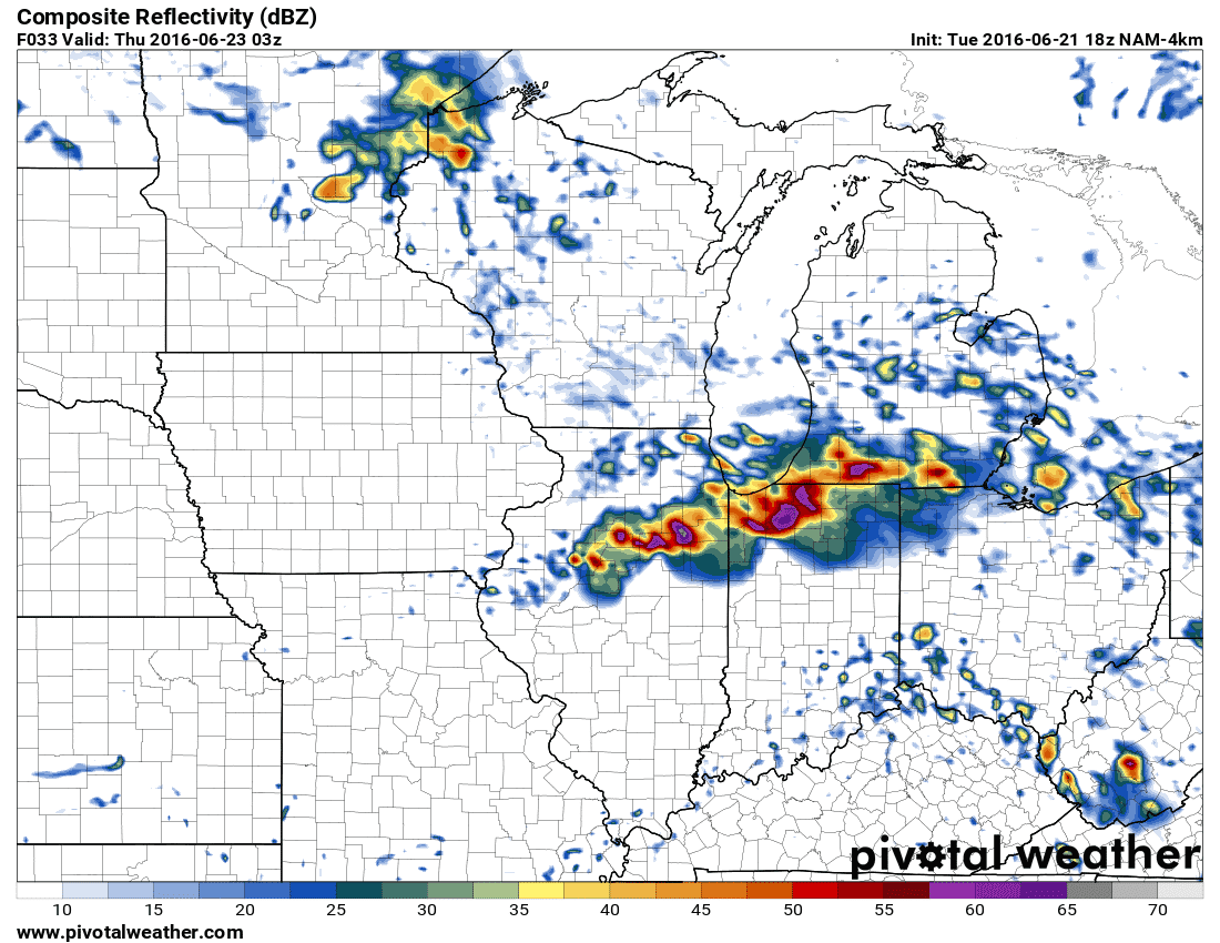
Simulated model radar tomorrow evening
As storms move towards Chicagoland early tomorrow evening I expect they’ll be growing upscale into a complex. Once storms form into a line or complex the threat for widespread, high-end damaging wind gusts will substantially increase. There is the potential for a widespread damaging wind event from northern Illinois tomorrow afternoon east into Michigan, Indiana, and Ohio tomorrow night. The complex of storms may continue into the Ohio Valley and Mid-Atlantic late tomorrow night into Thursday. Once all is said and done we may have a derecho on our hands. A derecho is a long-lived and widespread damaging wind event – which tomorrow could easily end up being. There is strong weather model indication that someone is going to be dealing with a lot of wind damage tomorrow evening.


0 Comments