
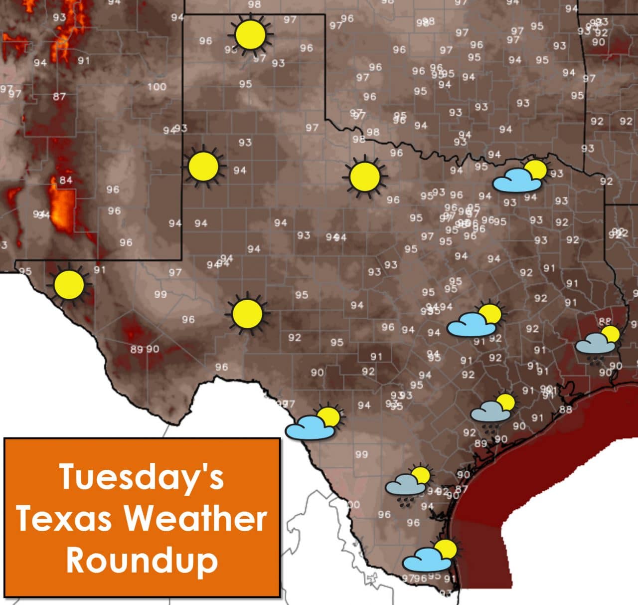
The headline for Texas weather continues to be typical summer weather. We’ll be a degree or two warmer than Monday. High temperatures today will top out in the upper 80s to right at 100 degrees. The upper 80s are expected across Southeast Texas and along the coast where we’ll have scattered showers and storms this afternoon. Partly cloudy skies are expected across South Texas north through North Texas and Northeast Texas. By the time you get into and west of the Concho Valley, Big Country, and Northwest Texas the clouds will be few and far between under sunny skies. High temperatures will be going back up over the next few days – although not near the levels of last week. The best chance for a storm this afternoon will be in Southeast Texas southwest through the Coastal Plains and Middle-Texas coast. Any activity that does develop should taper off by early evening. Tonight will be warm and humid – just like most nights for the next three months.
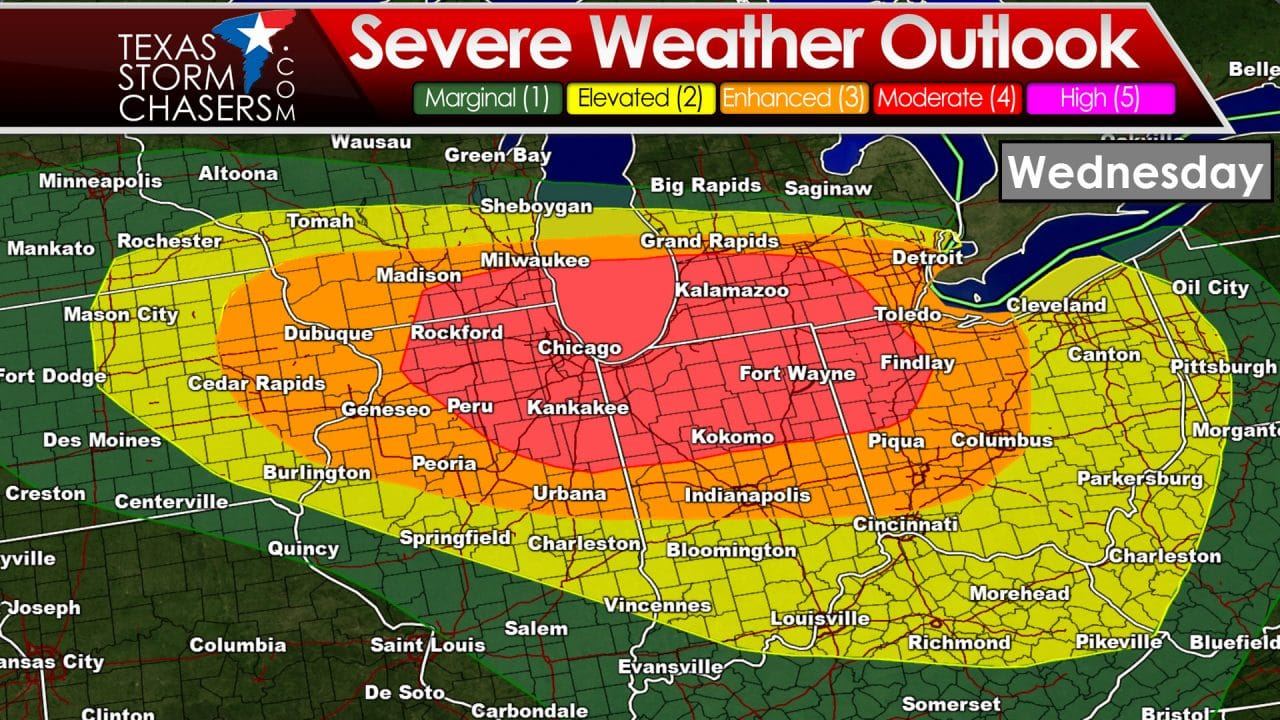
While our severe weather season has ended in Texas our neighbors to the north aren’t so lucky. Wednesday and Wednesday Night is setting up to be quite busy in the severe weather department in the Midwest and Great Lakes. The Storm Prediction Center has already placed a category 4 severe weather risk across southern Wisconson, northern Illinois, northern Indaiana, southern Michigan, and northwest Ohio. Supercells will develop qucikly tomorrow afternoon across the western section of the risk area – where all modes of severe weather will be possible. By tomorrow evening a rapidly moving complex of thunderstorms will fly east/southeast towards the Ohio Valley with widespread damaging winds. Our good old friend the derecho could be paying a visit to the Great Lakes and Ohio Valley tomorrow night. Storms could be continuing into the Mid-Atlantic on Thursday with a threat of damaging wind gusts.


0 Comments