
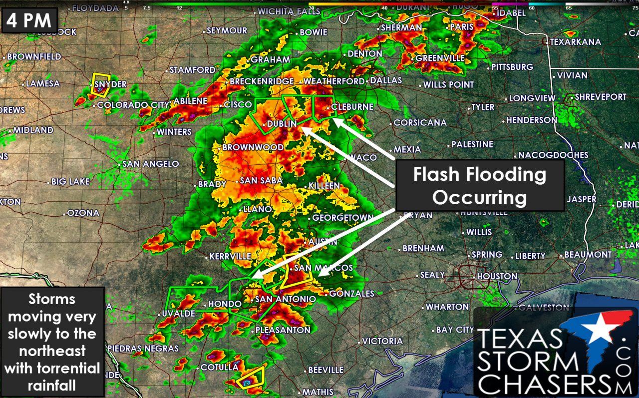
Flash flooding is underway in Hood County into Erath County and in the San Antonio metro. Widespread showers and thunderstorms are underway across Northeast Texas, North Texas, and Central Texas. The heaviest activity is producing torrential hourly rainfall rates up to three inches per hour. Storms themselves are moving northeast slowly but backbuilding is causing heavy rain to fall over the same locations. Significant flooding with numerous high water rescues is underway in Erath County and Hood County in North Texas. Several inches of rain fell in a 60 to 90 minute period. Additional storms are moving into Eastland county which has numerous roads underwater. Flash flooding is underway around the New Braunfels, San Antonio, and Hondo areas as well. Rivers remain in flood, lakes are full, and the ground is saturated. It won’t take much rain to cause issues so if you end up under a heavy storm you can expect nearby low-water crossings to quickly go underwater. Be mindful of nearby creeks and streams that may also rise quickly. In terms of river and lakes rises we’ll have to be on the watch tonight when runoff from today’s activities starts to influence flood forecasts. For the detailed week rain forecasts please see our post from this morning talking about upcoming flood potential.
Ongoing rain along the Interstate 35 corridor from the Red River into South-Central Texas should start to weaken after 6-7 PM. Its possible we see a lull in storms across these regions tonight. Meanwhile new storms should fire up in the Texas Panhandle to Big Country tonight. These storms may form into a storm cluster that moves southeast tonight and potentially move into North Texas, the Big Country, Hill Country, Concho Valley, and Central Texas overnight into the morning hours Wednesday. Additional flash flooding is likely.


0 Comments