
The next few days will be busy across Texas as a wet pattern continues. We’ll deal with rain chances today and Wednesday with the potential for a more organized rain event on Thursday, Friday, and Saturday. The forecast will undoubtedly change as new information becomes available. The good news is we’re not looking at much in the way of a severe weather event over the coming days. As usual in the late spring/summer months some of the afternoon storms could contain gusty winds and some hail. At the time of this posting we already have several heavy showers and thunderstorms underway across Northwest Texas, western North Texas, and the Hill Country. These storms are not severe but are producing excessive cloud to ground lightning and very heavy rains. They’re moving at about 20 MPH but we keep seeing new activity develop right behind. We do have a weak shortwave entering the state which is helping to provide ‘lift’ and thus the rain. We expect some storms today but the weak shortwave is a bit of a surprise. It won’t change the forecast too much except for raising rain chances today.
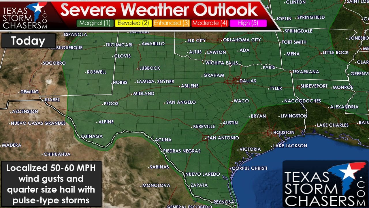
The Storm Prediction Center has placed a category 1 – marginal severe weather risk for a large chunk of Texas today. As previously described we’re in a pattern more reminiscent of the summer months. The stronger storms today could pulse up and produce quarter size hail and downburst winds over 55 MPH. If we see any storm clusters develop they would have a slightly higher chance of producing damaging wind gusts and multiple reports of quarter size hail. I wouldn’t be surprised to see a category 2 risk added later to account for that possibility. The tornado risk is very low today. Undoubtedly the threat for heavy rain and flash flooding will be the highest threat today and for the remainder of the week.
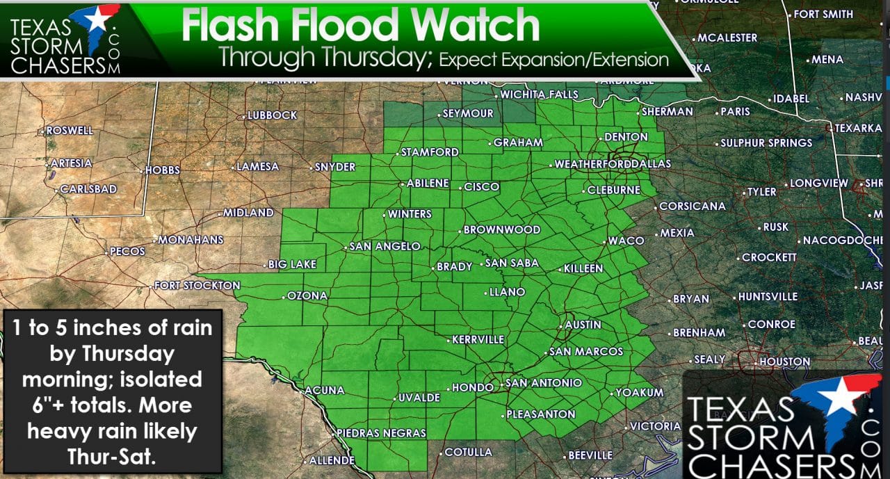
Just in time for this post we now have flash flood watches in effect for the Concho Valley, Big Country, North Texas, Central Texas, South-Central Texas, and the Hill Country through Thursday Morning. These are the first of what I expect will be many expansions and extensions over the coming days. We’ll likely see the flash flood watches expanded into all of Northeast Texas, East Texas, and Southeast Texas later today. While current watches expire Thursday morning I have no doubt they will likely be extended through Saturday as we get closer. Widespread rain totals of 1 to 5 inches can be expected in the watch areas by Thursday morning. Some locations could pick up 6+ inches of rain by Thursday morning – although those amounts will be localized to where we see training thunderstorms (storms moving over the same areas). With rivers in flood and many locations completely saturated we could see flash flooding develop easily. A more organized system is possible Thursday-Saturday which could produce widespread heavy rains. Time will tell where the highest flooding risk develops but I wouldn’t be surprised to see some folks in Central and South Texas pick up 8-10+ inches of rain by Saturday. We’ll have a detailed rain total update later today – but understand its going to be a wet week.


0 Comments