
There will be two systems to impact Texas this week worth watching. The first could occur on Tuesday and Wednesday with a risk of afternoon severe storms in the Panhandle and West Texas. Storms may try and form into clusters both nights and move southeast into Northwest Texas, the Big Country, and North Texas. No storm clusters are expected to impact North Texas tonight – although we have a few severe storms ongoing in the Permian Basin and Southwest Texas. Those storms could produce large hail and localized gusty winds for the next few hours. I can’t rule out localized flooding – especially in urban locations where storms sit or slowly move. The primary concern for more widespread heavy rain and flooding will be Wednesday Night, Thursday, and Friday.
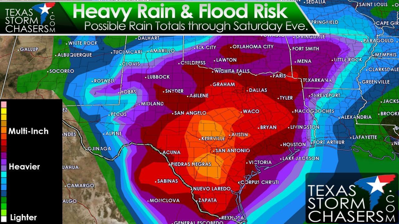
The forecast for Wednesday Night through Friday is a difficult one. We’re still a few days out which inherently increases forecast uncertainty. The upcoming setup may transition from a typical spring-time pattern with severe storm and rain chances to one we see in the summer months – a warm-core low. These warm-core lows historically have produced heavy rains and flooding across parts of Texas in the past. We usually see a few of these every summer. Over the past few years these events have produced heavy rain which has helped temporarily alleviate drought concerns. We don’t have any ongoing drought issues and most lakes are full in the area of concern. There is a concern that we may have another flood event setting up later this week. The area of heaviest rains and timing will change between now and later this week. At this point I believe it is safe to say that widespread 1 to 3 inches of rain will occur between now and Saturday from the Permian Basin, West-Central Texas, and Northwest Texas and everyone east. Heavier rain totals exceeding 6 inches may fall in locations in North Texas, Central Texas, the Brazos Valley, South-Central Texas, the Hill Country, and Deep South Texas. Those kind of rain totals could cause major flooding if it falls over areas that are already still having issues after last week’s rain event. No doubt another round of river rises will occur late this week into next week. Timing aspects, rain totals, and any possible severe weather threats will be determined as we get closer to the event. I will say the threat for severe storms (hail/wind/tornadoes) should be secondary compared to flooding potential.
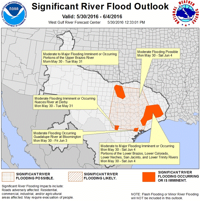
I’ll leave you with the significant river flood outlook from the Weather Prediction Center. They do note that another round of moderate to major flooding could occur later this week.


0 Comments