
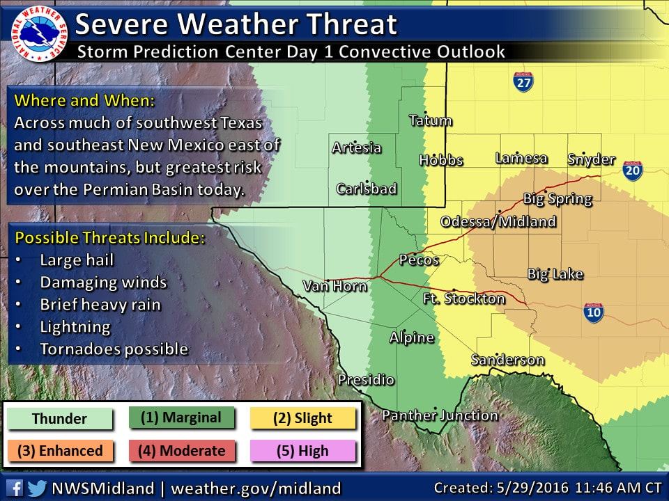
Storms overnight and early this morning have left much of the atmosphere across the panhandle, central and northern Texas overturned and rather stable for now and have made for a very complex and uncertain forecast for storms this afternoon and through the evening hours. At this time, we expect the best chances for severe weather across parts of west and southwest Texas this afternoon and evening. The atmosphere across western Texas has not been as affected by last night’s rain and storms. With sufficient moisture across the region and the surface heating expected by later this afternoon, moderate to strong instability will be in place for the development of scattered strong to severe storms across the Trans Pecos, Permian Basin and western Edwards Plateau region by late afternoon. The Storm Prediction Center has placed an Enhanced Risk Outlook across this region within a broader Slight Risk which covers much of the panhandle down through west central Texas. Large to very large hail and damaging downburst winds will be the primary threats within the Enhanced Risk Region. The tornado threat is low, but not out of the question. Brief period of torrential rain under the more robust storms that form is also a distinct possibility which could lead to localized flooding issues. 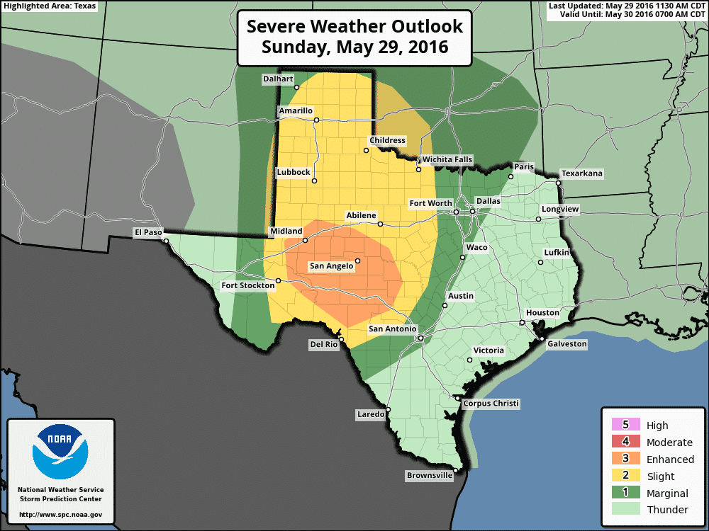
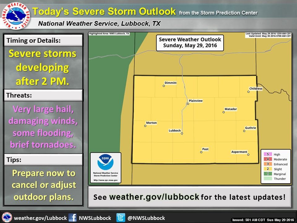
For areas within the Slight Risk, multicell clusters of storms are expected to develop with time and daytime heating by early afternoon across the northern and central panhandle which will possibly congeal into a mesoscale convective system (squall line) that moves southeast and into western north Texas during the early overnight hours. The forecast for that development is still a bit sketchy as this time, so it will be a situation we’ll have to monitor throughout the evening hours as this could bring a localized threat of damaging winds.


0 Comments