
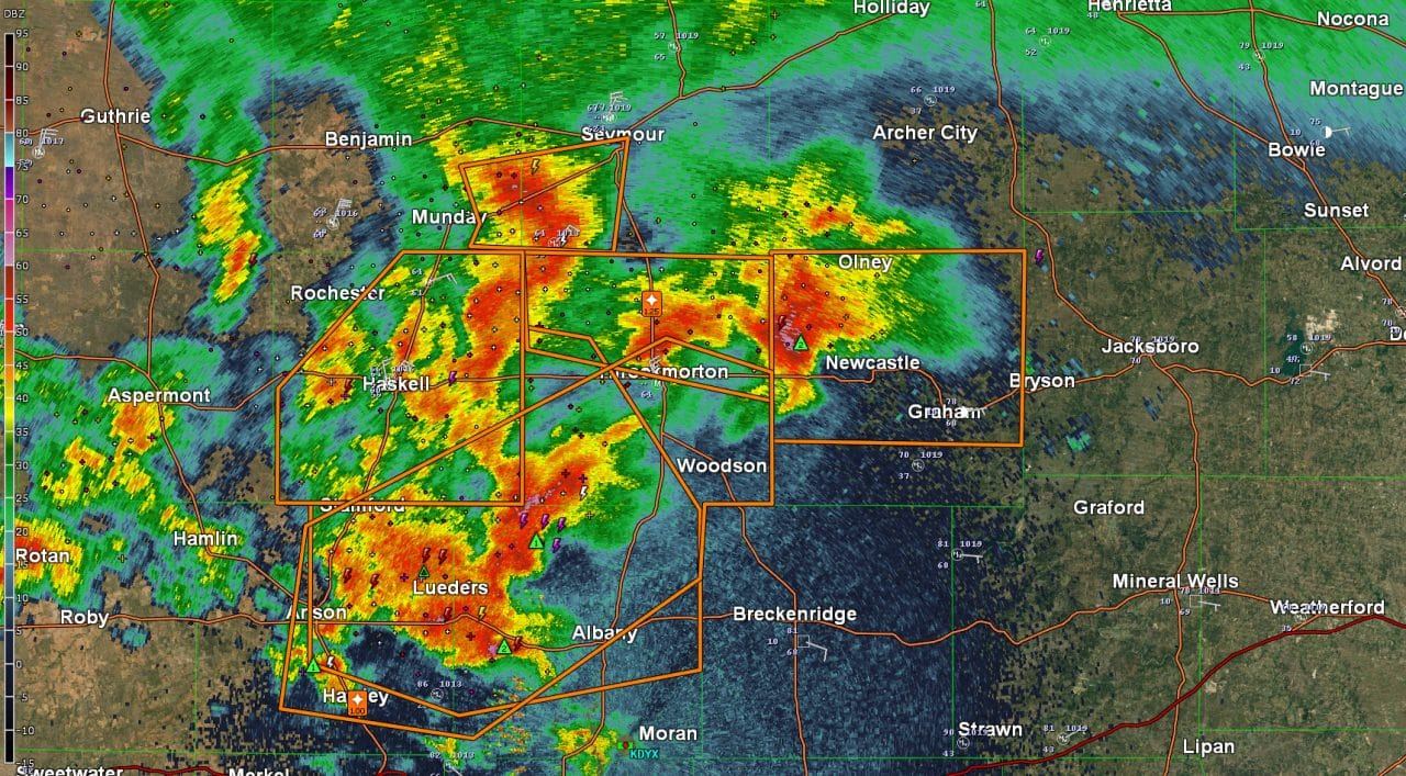
- A complex of severe thunderstorms is impacting northern section of the Big Country and western North Texas. One severe storm is near Olney and Newcastle. A second severe storm is near Lueders to just west of Albany. Additional storms continue across West-Central and Northwest Texas. Most activity is slowly moving east/southeast. The strongest storms through 11 PM may produce hail larger than the size of a golfball, localized damaging wind gusts over 60 MPH, flooding, and a low tornado threat.
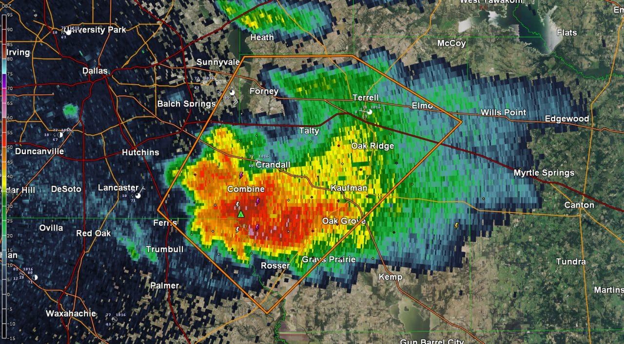
- Isolated thunderstorms continue across North Texas – including in the D/FW Metroplex. Storms have been more pulsy compared to the sustained severe weather out west. The stronger storms may produce hail up to the size of hen-eggs (2″) and localized damaging wind gusts. Very heavy rain and continuous lightning is occuring with these storms. Don’t be outdoors if lightning is close by. If thunder roars – go indoors!
- The Permian Basin and Southwest Texas remained capped and little thunderstorm development occurred. Good news for those folks today as we could have had some mighty big hailers!
- Additional thunderstorms are expected to develop in the Big Country and western North Texas later this evening. These storms may help storms out in the Big Country continue or we may just see new development all together. Regardless storms will likely congeal into a cluster and move east/southeast into North Texas by late tonight. Some of these storms could be severe with large hail and damaging wind gusts. This threat does include all of the D/FW Metroplex for late tonight – well after midnight most likely. These storms will be in addition to what is ongoing now.


0 Comments