
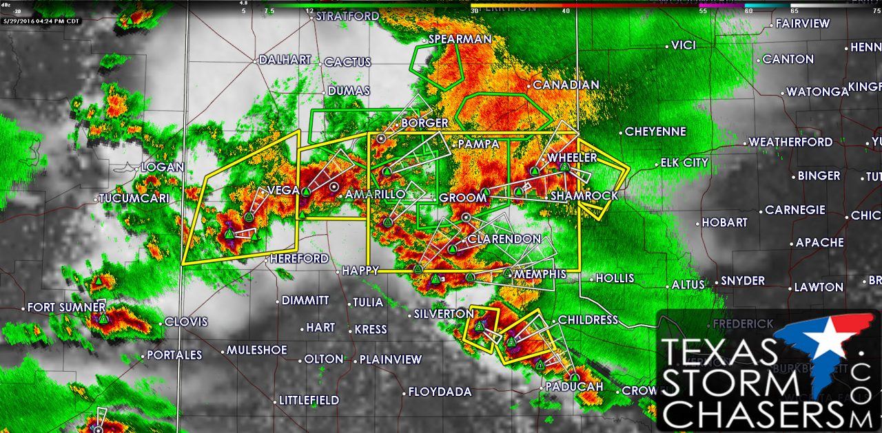
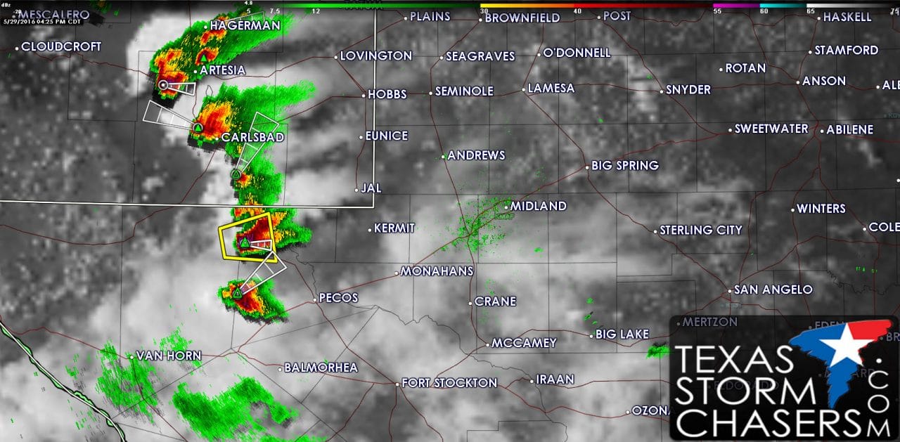
The Texas Panhandle has lit up like a Christmas tree this afternoon. Severe Thunderstorm Warnings are currently in effect for storms on Interstate 40 from near New Mexico all the way east to the Oklahoma border. The primary severe weather hazards so far have been hail sizes up to the size of golfballs and localized damaging wind gusts up to 55-60 MPH. Flash flooding is ongoing from between Amarillo and Dumas east through Borger, Pampa, to McLean. Storms as a whole have been making slow progress to the south. New storms are forming from Turkey southeast to Paducah in a more unstable enviornment. The higher threat of severe thunderstorms will start to shift south into West Texas and the Permian Basin over the next hour or two. Additional storms should form in those regions by 6 PM. Unlike the Texas Panhandle the atmosphere further south is more unstable along with slightly more impressive wind shear values. The result will be more potent storms capable of producing hail larger than the size of baseballs, damaging wind gusts over 70-75 MPH, and even the threat of an isolated tornado. Localized flooding will also be possible. By the early/middle evening hours we should see storms start to form into one or more clusters. As storm clusters develop they’ll make more noticeable progress to the east/southeast. Damaging straight-line wind gusts of 70-80 MPH will be possible with the strongest storm clusters along with golf ball sized hail and very heavy rain.


0 Comments