
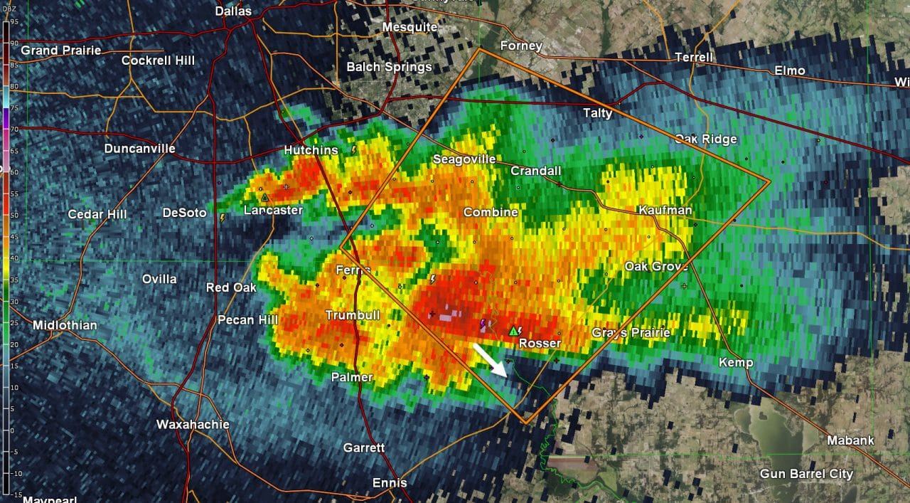
- A severe storm is sitting about 8 miles south of Combine, east of Ferris, and just west of Rosser. This storm is nearly stationary and has dropped three to four inches of rain in the past hour over the Trinity River. Large hail continues to be a good bet as is flash flooding. Storms have back built into Lancaster where frequent cloud to ground lightning is occuring. Get indoors as the lightning is quite dangerous this evening. A second storm continues to pulse up and down in Denton with occasional lightning.
- Additional storm development is expected through the evening and overnight hours across the Big Country and North Texas. In addition the cluster of storms near Abilene to Throckmorton may impact North Texas through the overnight hours as it slowly moves east/southeast.
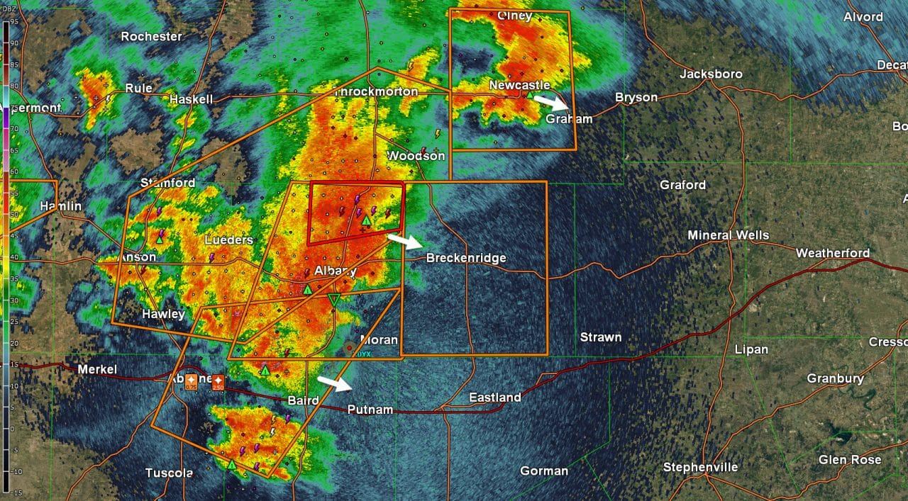
- A cluster of intense thunderstorms extends from Olney southwest through Albany to Baird. These storms are slowly progressing east around 20-25 MPH. The strongest storms may produce hail larger than the size of golfballs, destructive straightline wind gusts over 75 MPH, and brief tornadoes. This cluster of storms is making progress towards Stephens and Eastland counties – including Breckenridge, Cisco, Putnam, and Ranger over the next 60-90 minutes. The threat for flash flooding is moderate to high with these slow-moving storms.
- Multiple showers and thunderstorms continue across West Texas and Northwest Texas. Severe weather is unlikely with these storms but cloud to ground lightning and gusty winds are occuring.
- A haboob is moving south into the Permian Basin from the South/Rolling Plains. This wall of dust was generated by an outflow boundary with gusty north winds up to 50 MPH. Rapid visibility reduction is expected as this outflow boundary and dust move south.
- Track the storms using our free interactive weather radar here.


0 Comments