
The Storm Prediction Center has indicated a severe thunderstorm watch may be issued for the Concho Valley and Hill Country soon. With warming surface temperatures the cap (convective inhibition) is weakening. It’s possible that we will see isolated thunderstorm development occur soon. Storms this afternoon will occur in an enviornment moderately unstable with marginal wind shear values. The strongest storms this afternoon will be capable of producing large hail and localized damaging wind gusts. Storms will slowly progress east with some southeastward component of motion in more intense storms. Wind shear values will increase slightly towards sunset which may support a more organized threat for one or two supercells. Should that occur the threat for very large hail and an isolated tornado will be possible.
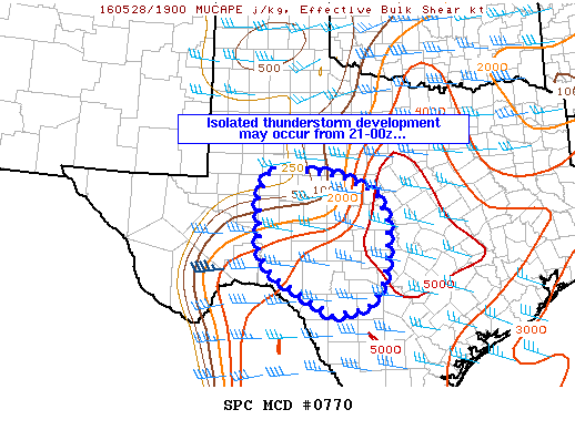
 MESOSCALE DISCUSSION 0770
   NWS STORM PREDICTION CENTER NORMAN OK
   0258 PM CDT SAT MAY 28 2016

   AREAS AFFECTED...PARTS OF CENTRAL/WEST-CENTRAL TEXAS AND THE BIG
   BEND AREA

   CONCERNING...SEVERE POTENTIAL...WATCH POSSIBLE

   VALID 281958Z - 282200Z

   PROBABILITY OF WATCH ISSUANCE...40 PERCENT

   SUMMARY...ISOLATED CONVECTIVE DEVELOPMENT IS POSSIBLE IN THE
   DISCUSSION AREA OVER THE NEXT FEW HOURS...WITH SEVERE WIND AND HAIL
   POSSIBLE BENEATH ANY SUSTAINED STORM.  A WW ISSUANCE IS POSSIBLE
   WITH THIS ACTIVITY.


0 Comments