
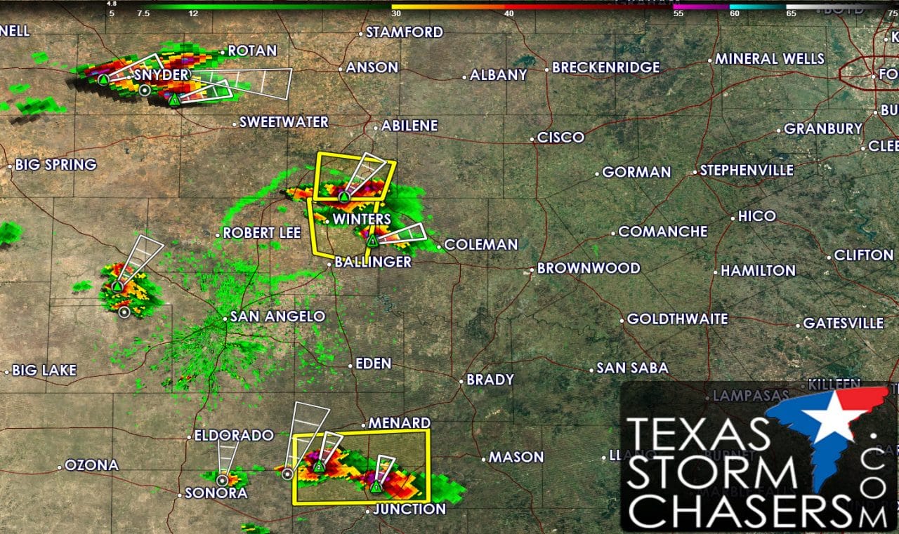
Isolated severe thunderstorms have erupted across West-Central Texas, the Big Country, and the Concho Valley. A few storms are around Snyder, Winters, and just north of Junction and Sonora. Some of these storms have a history of producing hail just under the size of a ping-pong ball. If we see one or two cells become supercellular over the next few hours then the hail size could increase to tennis-balls. Warm surface temperatures are also promoting a risk of damaging winds in a localized area called a downburst). Some downburst winds may be up to 70 MPH over a localized area. A brief tornado is not out of the question towards sunset. The overall tornado risk is very low. As storms continue to organize over the next few hours we may see one or two clusters form. Should a cluster of storms form it would likely move southeast into the Hill Country and Southwest Texas by late evening. Storms may make a run at the San Antonio area by midnight but will run into a stronger cap and be on a weakening trend. Any storm cluster that forms this evening could have an enhanced risk of damaging wind gusts up to 75 MPH, golfball size hail, and brief tornadoes. The most likely area to have a cluster form currently is from the storms around Junction and WInters. You can track the ongoing storms using our free interactive weather by clicking on the ‘weather radar’ button in the menu.


0 Comments