
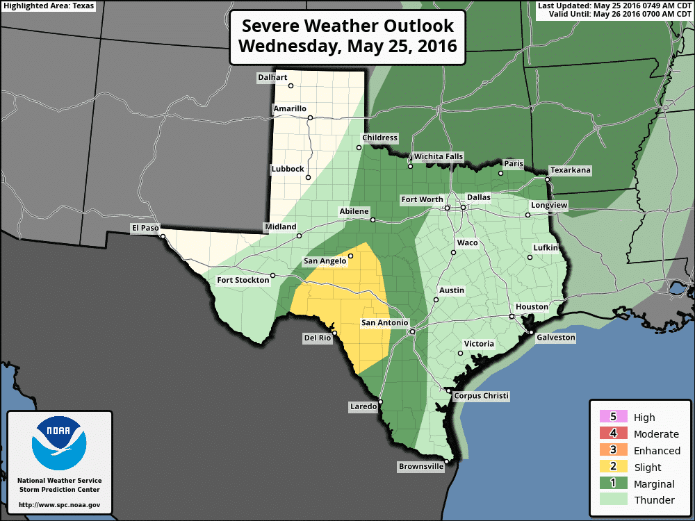
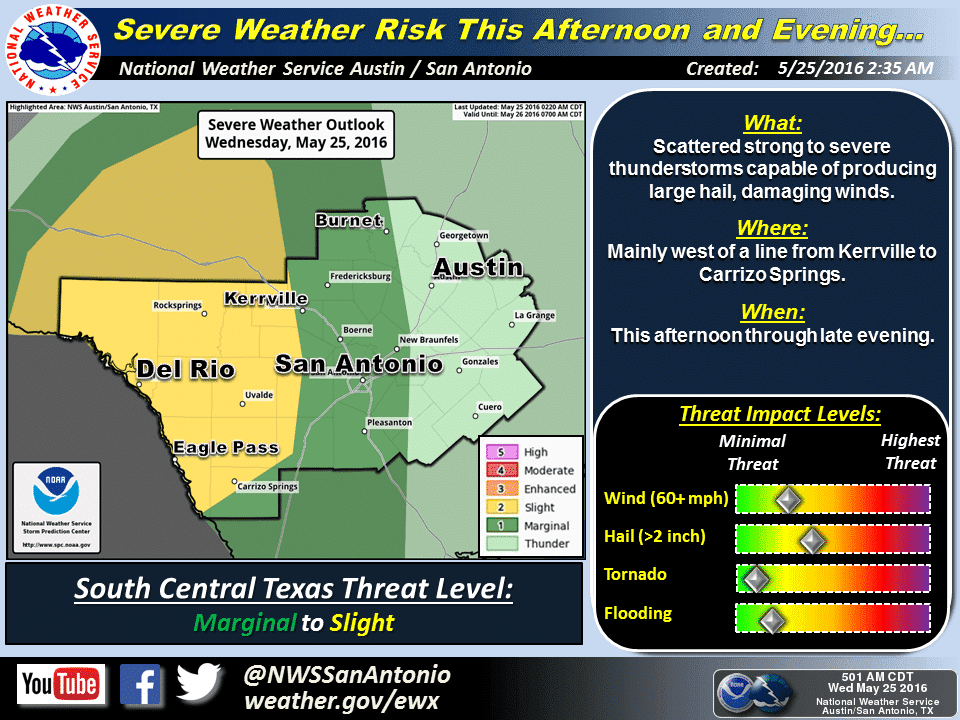
For most of the state, today will be a “down day” in terms of severe weather with a brief period of high pressure ridging across the eastern half of the state, and being rather “in between” systems across the western half of the state. The only area of concern will be across southwest Texas this afternoon as storms develop across northern Mexico and cross the Rio Grande. The capping inversion is expected to remain strong across most of the state this afternoon east of the dryline, but short-range models are indicating it will be weakest across this region of the state. Some of these storms approaching this area later today could be severe with large hail and damaging downburst winds possible. This area remains under a Slight Risk for this afternoon. Outside of the Slight Risk area, scattered rain and showers are possible, but with a formidable cap in place, severe weather is highly unlikely. The only caveat to that is a small area west/southwest of the DFW metroplex down around Cisco which short range models have been showing some potential for isolated development this afternoon. While not highly likely, if we do see some breaks in the clouds and additional surface heating over this area later today, we could see some isolated development with a large hail, lightning and downburst wind threat. We’ll keep our eyes on it!
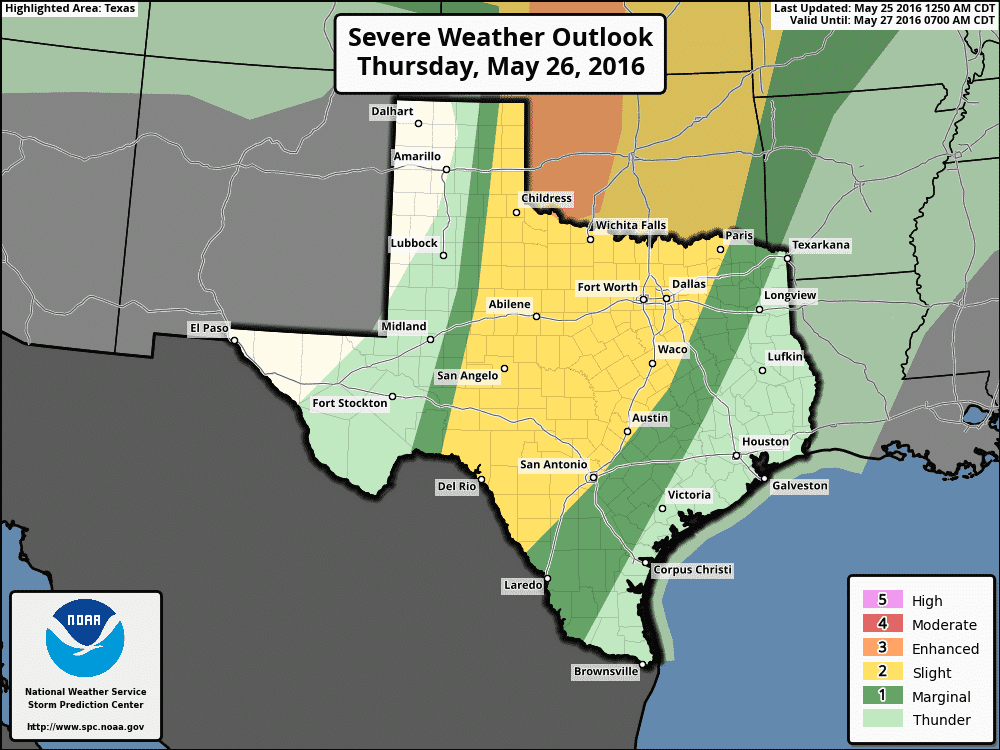
For Thursday, the latest Storm Prediction Center update has removed the area of Enhanced Risk from the state and pulled it further north into Western OK. The dryline across western Texas is expected to become active again tomorrow afternoon with the risk of scattered severe storm development into the early evening hours. East of the dryline, increasing tropical moisture overhead will likely lead to the increase in scattered rain during the early part of the day, which ultimately may have some impact on the severe weather chances later in the afternoon. Those details won’t become apparent until we see how widespread the rainfall is early Thursday and how long it sticks around. Development along the dryline Thursday afternoon and evening has the potential to develop into a squall line which will move east across the state during the night into early Friday. If that materializes, we would likely see a threat of damaging winds, so that’s another thing we’ll be keeping an eye on for late Thursday into early Friday.


0 Comments