
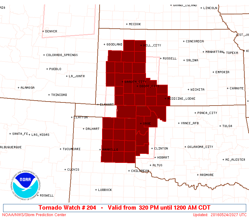
A Tornado Watch was issued earlier for the eastern Texas Panhandle. Amarillo, Shamrock, and Canadian are all included in this watch through midnight. We’re now starting to see isolated storm development occur just east of the dryline in the eastern Panhandle. Thunderstorms may tend to organize quickly once they get going. I don’t think we’ll see more than a couple of storms for the next few hours. THose storms that do develop could become supercellular with a risk of very large to giant hail, damaging wind gusts over 70 MPH, and tornadoes. The tornado threat will increase after 6 PM with any sustained supercell and could continue after dark – like the previous two nights. We’re also watching for isolated storm development further southeast off the Caprock and in Northwest Texas. An outflow boundary may spark off one or two storms near the Red River. If storms develop they could quickly become severe with a risk of very large hail and isolated tornadoes. The threat for severe storms will be highest through the eastern Texas Panhandle from 5 PM through midnight. The threat for tornadoes could continue into the late evening. We’re chasing in the Oklahoma Panhandle today where we expect the highest threat for tornadoes – along with southwest Kansas.
You can keep up with storms this evening using our free interactive weather radar at texasstomrchasers.com/live. Live streaming operations are not planned today due to the rural area we’re chasing in as data will be limited.


0 Comments