
The complex of thunderstorms that moved across the Red River Valley and North Texas this morning have created a few forecast changes for today. The Storm Prediction Center has issued a category 3 enhanced severe weather risk for Northwest Texas, eastern Permian Basin, the Big Country, and the Concho Valley. A category 2 standard severe weather risk includes western North Texas, the eastern Texas Panhandle, and western sections of the Hill Country. The main change compared to the forecast posted earlier this morning is that some of the severe weather probabilities have been shifted east/south out of the Texas Panhandle. I want to emphasis that we are still dealing with a dynamic situation with outflow boundaries galore produced by yesterday’s storms. There will still likely be some adjustments to the overall severe weather risk zone for today. That said I think the current severe weather outlook is a good one and highlights where the highest concentration of severe thunderstorms will occur this afternoon and this evening. The strongest storms will be supercellular in nature with a risk of very large hail larger than the size of baseballs, damaging wind gusts over 70 MPH, and a couple tornadoes. The tornado threat will be highest with storms that are rooted on outflow boundaries and are intense supercells.
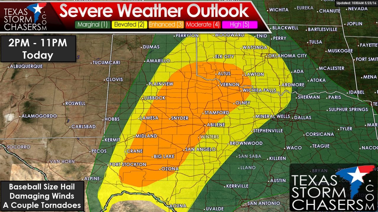
The first storms could start to pop up as soon as 2 PM – although I would say the more likely timeframe for scattered storm development will be in the 3-4PM timeframe. Storms could become severe quickly with the previously mentioned hazards. Storms will make progress to the east late this afternoon through the early evening hours. The highest number of severe storms (a couple – not many) will be in the category 3 risk zone. As storms move east early this evening we may see another complex of severe storms develop near the Red River into the Big Country. If this complex develops it would have the potential to produce significant straight-line winds of 70-80 MPH and move into Northwest Texas and the Big Country. Like this morning the storms may make it into North Texas late tonight but in a weakened state. We’ll have an updated severe weather outlook out in about an hour and we’ll post updates as necessary today.


0 Comments