
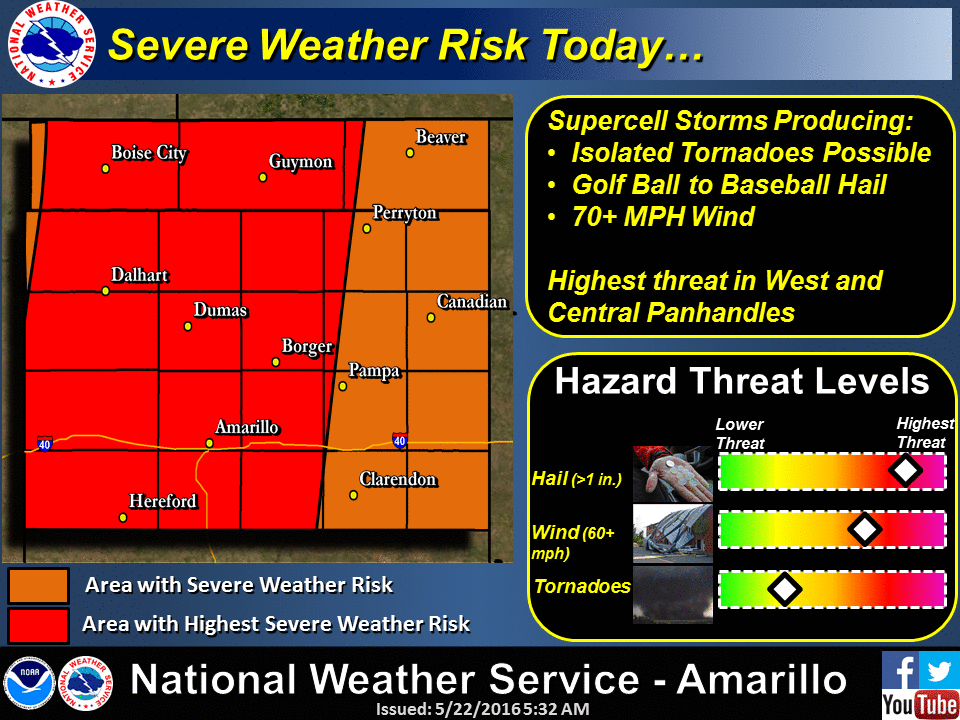
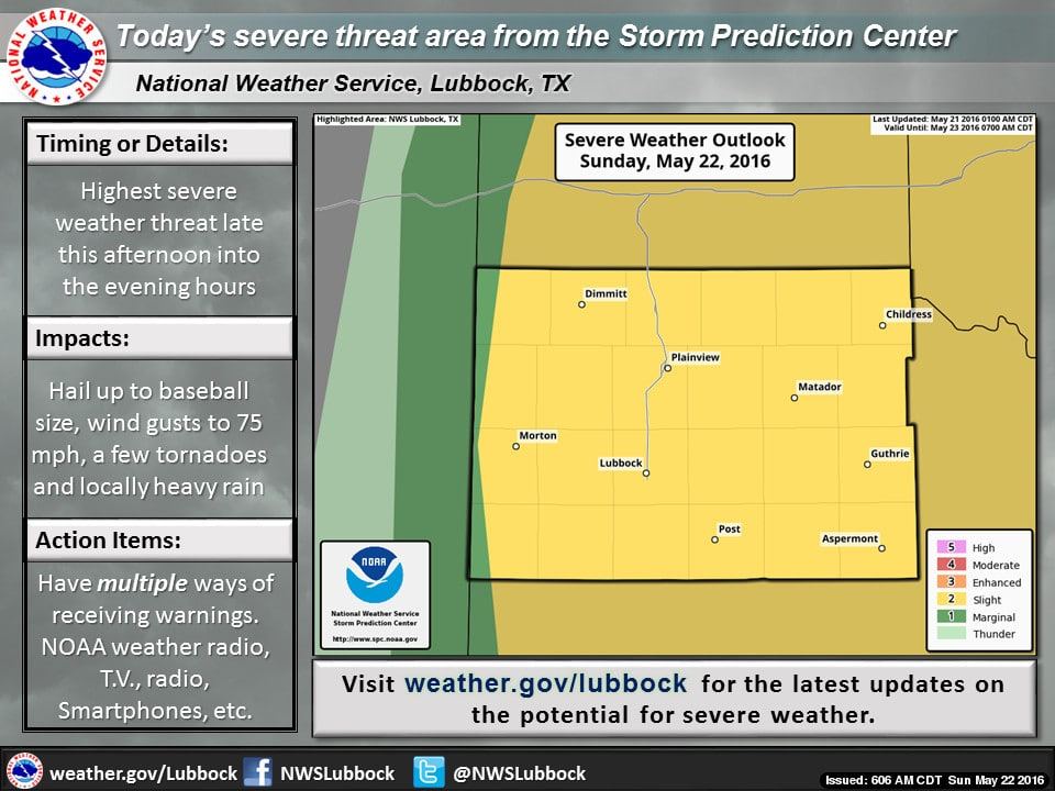
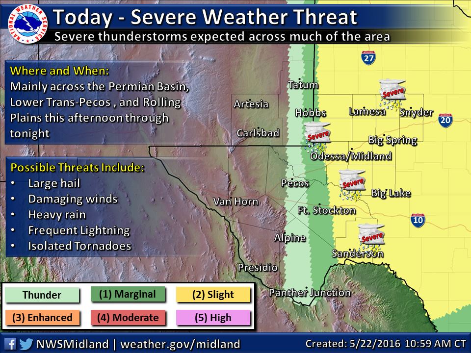
Round 2 of strong to severe storms will be possible once again this afternoon and evening across the Panhandle and parts of western Texas including the rolling plains, Permian Basin and lower Trans Pecos regions. Once again, the dryline is expected to set up close to the TX/NM border and stretch down into the Big Bend Region which will later become the initiation point for storm development this afternoon similar to what we saw yesterday. The difference between yesterday and today will be better wind shear and upper level support by late afternoon/early evening, and a better chance of seeing the formation of stronger and longer-lived supercell thunderstorms. Hail up to the size of baseballs, winds in excess of 75mph and tornadoes are all possible with this afternoon and evening’s storms as they kick east off the dryline. In addition to those threats, moisture levels across the panhandle region are unusually high with dewpoints averaging in the 60s across the region. Storm movement today is also expected to be slow, which combined with the high levels of moisture will produce heavy rainfall with any of these storms. Wherever these cells end up forming this evening, flash flooding will likely be an issue for at least a couple of hours. The window of opportunity for the development of tornadoes is rather small…just a few hours during the late afternoon and early evening hours before we begin to lose surface heating, and will likely not carry on too long after sunset…unless we get an overachiever storm that manages to stay surface-based well after sunset. Any severe weather or tornado watches covering the Slight Risk area shown on the graphic below will likely not be issued until we get closer to 3-4pm, so we’ll have those posted once they become available.
UPDATE: New severe weathergraphic
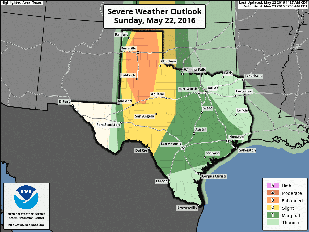
Across western north Texas and central Texas on the eastern fringes of the Slight Risk…these area will need to be monitored this afternoon for the development of widespread rain and embedded storms. If this happens…some short-range models are showing this potential, some are not…one or two storms could become surface-based and pose the same threats as mentioned above. Coverage of severe weather across western north Texas down into central TX west of I-35 is less, but all it takes is one or two mischievous storms to ruin someone’s day. All folks within the Slight Risk outlined above will need to stay weather aware this afternoon, but again, areas closest to the dryline in west TX and the western and central panhandle region will likely be the most impacted by severe weather development today.


0 Comments