
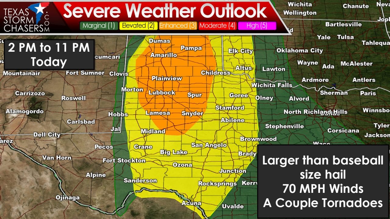
The Storm Prediction Center has upgraded much of the Texas Panhandle, South Plains, and Rolling Plains to an enhanced risk of severe weather today. That is a category 3 on the 5-level system. Dumas, Amarillo, Pampa, Shamrock, Plainview, Lubbock, Lamesa, Snyder, and Spur are all included in this severe weather risk. The category 2 – standard severe weather risk has not changed much from our update an hour ago and includes the Big Country, Concho Valley, and Permian Basin. Thunderstorm initiation is possible after 2 PM and likely after 4 PM across the western sections of the risk areas. The initial storms this afternoon and evening will likely be supercells with a risk of very large to giant hail. Some parameters are suggesting the strongest storms may produce hail up to the size of softballs. The threat for a couple tornadoes will also exist with the more dominant supercells – especially in the enhanced risk zone. I also cannot rule out isolated storm development further east in the Big Country and Northwest Texas this afternoon – also with a risk of large hail. sTorms will make slow but steady progress to the east this afternoon. If we have any storms form into a cluster or squall line the threat for widespread damaging winds of 60 to 75 MPH would increase. Storms should slowly weaken as they move east this evening into Northwest Texas, the Big Country, and the Concho Valley. Otherwise the previous forecast issued an hour ago remains valid. You can read it here.


0 Comments