
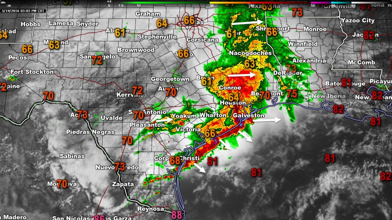
The threat for severe thunderstorms continues to diminish this afternoon. With the exception of the severe storm near Galveston and a limited risk in the RGV we’re now done with severe thunderstorms today. I can’t rule out an isolated severe storm in the Rio Grande Valley for the next few hours but otherwise the remainder of the state has stabilized north of a stationary front. A large area of moderate to heavy precipitation is moving across East Texas and Southeast Texas. The rain shield is making good progress east and should be out of Houston in the next hour. It should exit Southeast Texas as a whole by the early evening hours. A few showers have redeveloped southeast of San Antonio and those are moving east. A line of strong to severe thunderstorms near extends from Galveston southwest into the Gulf. This line is robbing moisture inland preventing additional rain/storms. We’ll have to keep an eye on the Rio Grande Valley for a few more hours where temperatures are in the 80s and the atmosphere is unstable. Otherwise the threat for severe weather and heavy rain/flooding will end once the rain shield in E/SE TX moves away. In its wake temperatures across most of Texas are quite comfortable for mid-May with temperatures only in the 60s and 70s. Enjoy the cooler weather because next week brings a return of the heat, humidity, and multiple days of spring severe weather potential.


0 Comments