
Severe Weather Outlook
The Storm Prediction Center is indicating the potential for severe thunderstorms this afternoon and evening across parts of Texas. The primary severe weather hazards today will be large hail, damaging wind gusts, and localized flooding. The threat for one or two tornadoes – while not zero – is low.
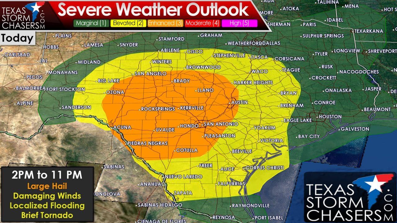
Category 3 – Enhanced Risk: Concho Valley, Hill Country, South-Central Texas including Brady, Rock Springs, Del Rio, Uvalde, San Antonio, Austin, and Llano. The enhanced risk is where the coverage of severe thunderstorms is expected to be highest today. The strongest storms may produce large hail up to the size of tennis-balls, localized damaging wind gusts up to 70 MPH, localized flash flooding, and perhaps a brief tornado.
Category 2 – Elevated/Standard Risk: Central Texas, Brazos Valley, Coastal Plains, South Texas including Big Lake, San Angelo, Brownwood, Stephenville, Hillsboro, Waco, B/CS, Yoakum, Victoria, Corpus Christi, Freer, Falfurrias, Laredo, and Zapata. A couple severe thunderstorms are possible today with large hail up to the size of golfballs, localized damaging wind gusts up to 65 MPH, and localized flooding in the strongest storms.
Category 1 – Marginal Risk: Portions of the Permian Basin, Big Country, North Texas, Northeast Texas, East Texas, Southeast Texas, and the Rio Grande Valley. Isolated strong to marginally severe thunderstorms will be possible this afternoon and evening. Hail up to the size of quarters, localized wind gusts of 50 to 60 MPH, and localized flooding could occur in the heaviest storms.
Timing Projections
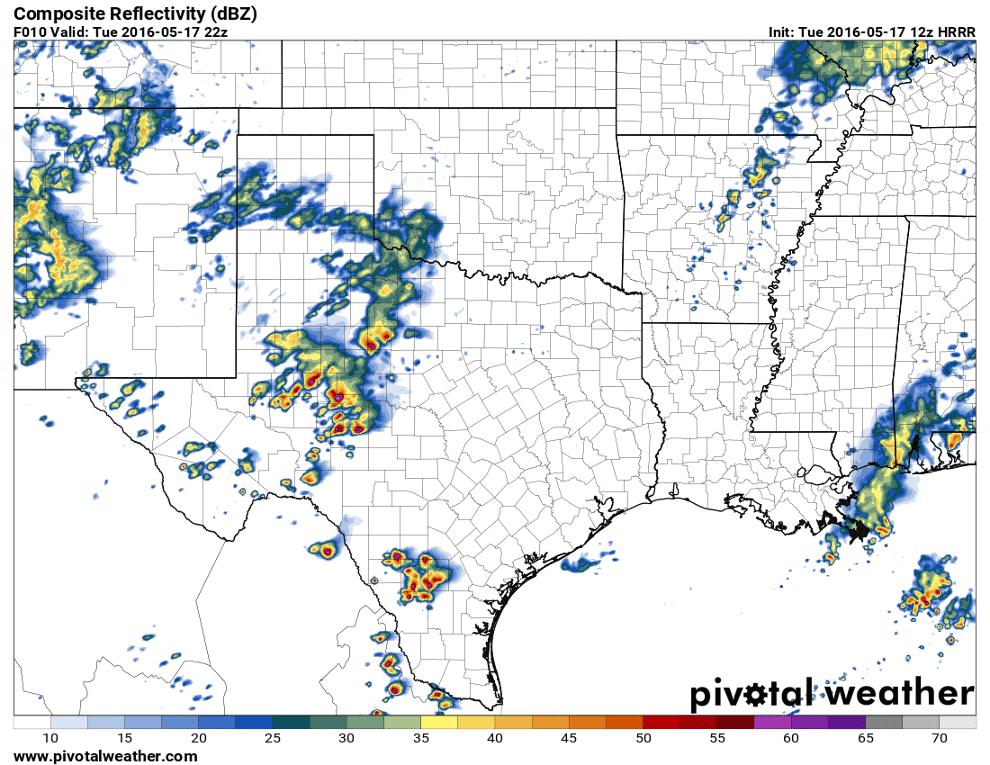
One model’s radar output at 5 PM this afternoon. Don’t put too much faith in it since today’s forecast is a difficult one.
Showers and a few thunderstorms are in progress across North Texas this morning. An outflow boundary is slowly progressing south of Interstate 20. This outflow boundary may play a role in new thunderstorm development this afternoon wherever it sets up – likely in Central Texas. Likewise if cloud cover holds tough the atmosphere will be more stable and may alter the forecast. The most likely outcome at this time seems to be thunderstorm initiation in the eastern Permian Basin into the Concho Valley after 2 PM. These initial storms may be supercellular with a threat of very large hail. We may also see storms fire up by early afternoon in South Texas with a threat of large hail. Storms in the Concho Valley may develop into a cluster or squall line by the early evening hours as it moves east/southeast. If we have storms develop in the Hill Country those storms may also become a ‘cluster’ and move towards the Interstate 35 corridor in Central/South-Central Texas. The squall line or cluster would have a threat of widespread damaging wind gusts and large hail. We’ll also be on the look out for localized flooding due to heavy rain rates anticipated with the strongest storms. The widespread cloud cover across North/Central Texas this morning and the southward sagging outflow boundary leads uncertainty to the convective forecast across Central Texas this afternoon. Trends should become more clear by lunch time at which point I can provide a more accurate/confident forecast.


0 Comments