
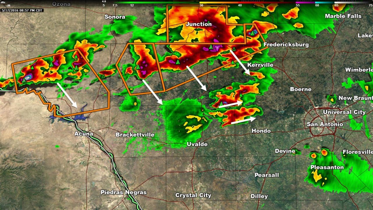
A line of severe storms extends from Mountain Home to Rocksprings in Southwest Texas/Hill Country. These storms have organized into a squall line type event with an increasing potential for damaging straight-line winds in addition to a continued threat of large hail. This line as a whole is moving southeast at 25 MPH but we could start to see it pick up a little speed if the damaging wind threat becomes more sustained. Additional cells have formed ahead of the squall line from west of Fredericksburg to near Kerrville to southeast of Leakey. These storms are moving more easterly at 15 MPH. If they don’t get going soon they may be absorbed by the line of storms to the northwest – which may also help the line of storms become more sustained. Should this trend continue the line of storms ma in a couple of hours. If those storms southeast of Leakey become more organized and start to move more quickly than the storm threat may begin for areas northwest of San Antonio more quickly.
Supercell thunderstorms are in progress across South Texas from Randado to 20 miles southwest of Falfurrias. These storms have a history of producing baseball to softball size hail earlier in the evening. The storm from Hebbronville to Randado is capable of producing baseball size hail and 70 MPH winds as it slowly moves southeast. A supercell about 15 miles west of Laredo may impact the city after 9:30 PM with large hail.


0 Comments