
Today will feature some of the warmest temperatures so far this year across Texas with highs peaking in the upper 80s to upper 90s in some locations. I honestly wouldn’t be too surprised to see one or two folks hit the century mark this afternoon. Just another sign we’re starting to edge closer to summer in the south. Our focus with this forecast will not be on the heat but rather the chance for more thunderstorms over the next few days. Lets dive into it! The Storm Prediction Center has placed a category 2 severe weather risk – the standard risk level – across the eastern Concho Valley, the Hill Country, western sections of Central Texas, and a narrow corridor of North Texas which includes the D/FW Metroplex. Isolated thunderstorm development will become more likely after 2-3 PM across the southern Concho Valley and Hill Country as temperatures soar into the 90s and the cap weakens. As the afternoon progresses we could also see isolated thunderstorm development occur across Central Texas and North Texas.
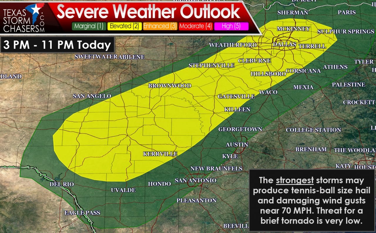
Today’s setup is referred to as a high instablity – low shear event. The atmosphere will be extremely unstable with summertime temperatures in the 90s. Meanwhile wind shear values will be lower than what we had on Monday. With some storms possibly becoming as tall as 55,000 feet this afternoon there will be just enough wind shear aloft to help a few storms organize into supercells. We could also see storms organize into small clusters which would help enhance their organization. We’re not talking about a tornado-risk day like Monday in Oklahoma and Northeast Texas. Low-level wind shear will be very weak although the tornado threat isn’t totally zero due to the extremely unstable airmass projected to be in place. The strongest storms this afternoon will likely be hailers with a threat of some hailstones as large as a tennis-ball. Not every storm will produce that kind of hail today and not all storms will become severe. Since temperatures will be in the 90s we may actually have more of a damaging wind threat as well today. Localized wind gusts up to 70 MPH will be possible with the strongest storms and those storms that start to weaken quickly. If we see storms organize into a cluster late this afternoon or this evening than the threat of damaging straight-line winds would increase across the Hill Country and Central Texas. I anticipate the strongest storms will be in a window from 3 PM to 10 PM today. After that storms should either be in a weakening state. The overall storm movement will be to the east around 20-30 MPH but left-splitting and right-splitting cells mean we could have varying degrees of storm direction.
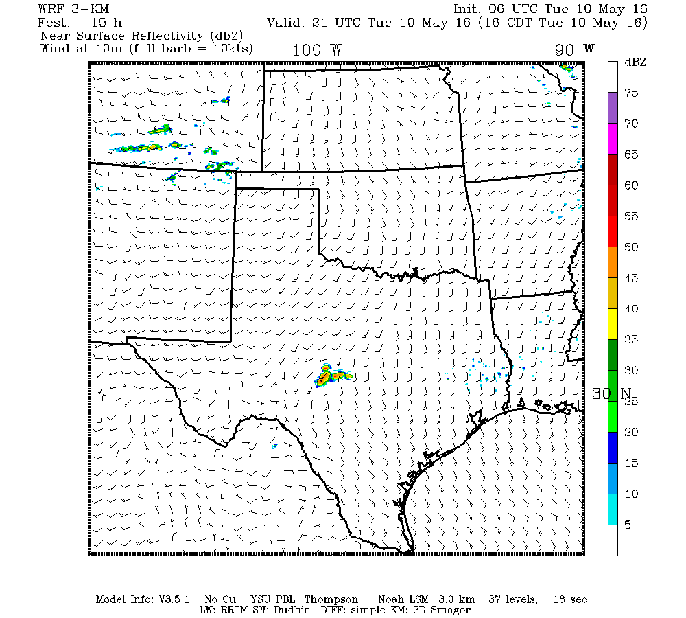
06Z TTU WRF – Simulated weather model radar at 4 PM today
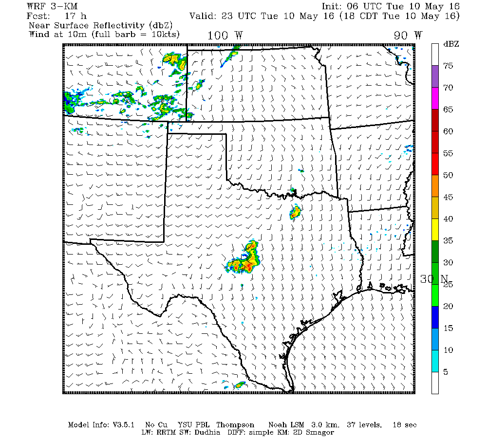
06Z TTU WRF – Simulated weather model radar at 6 PM today
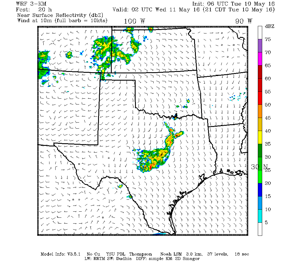
06Z TTU WRF – Simulated weather model radar at 9 PM today
A high resolution weather model run by Texas Tech seems to show a plausible convective evolution today. This weather model has our first isolated storms firing up in the southern Concho Valley and Hill Country by 3-4 PM as surface temperatures in the 90s help erode the cap. These initial storms will likely go up in a hurry with an extremely unstable airmass in place. We could see cell splitting which is where one cell ‘splits’ into two. Once cell would move northeast while the second cell would move more east/southeast. We could see several of those kind of splits today. By 6-7 PM we could have an isolated storm or two ongoing in North Texas with multiple storms ongoing in the Hill Country. Some of these storms could be severe with large hail and localized damaging wind gusts. Finally by 9-10 PM we should see a general downward trend in thunderstorm intensity. We may still have a couple severe storms ongoing but at this point the severe weather threat should have peaked.

With an active weather pattern continuing this week our focus on a few severe storms will shift into Northwest Texas and Texoma for Wednesday afternoon and evening. The Storm Prediction Center has plcaed a category 2 severe weather risk – the standard risk level – across those regions. The risk currently runs along/north of a Abilene-Mineral Wells-Sanger-Sherman line. It includes Vernon, Wichita Falls, Graham, and Decatur just to name a few towns. Now I do expect this outlook will change as we get new data in and can refine the threat areas. Like today we’ll see isolated thunderstorm development occur after 3 PM Wednesday to the east of a dryline. The strongest storms will likely be severe with a threat of very large hail up to the size of tennis-balls, localized wind gusts up to 70 MPH, and a low threat of a tornado. The category 2 risk zone does extend north into Southern, Central, and Eastern Oklahoma where storms with large hail and damaging wind gusts will also be possible.
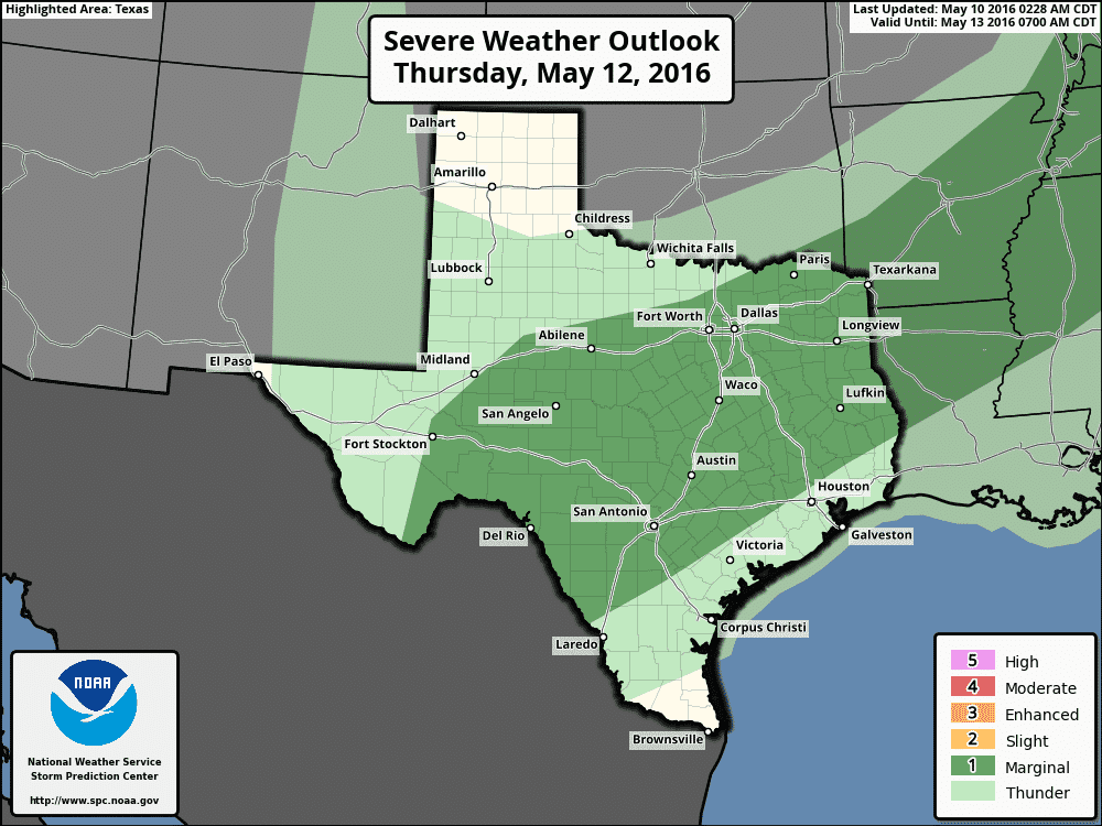
But wait there’s more! A large category 1 severe weather risk zone is in place for Thursday which includes the Concho Valley, Big Country, Hill Country, South-Central Texas, Central Texas, North Texas, Northeast Texas, East Texas, and the Brazos Valley. Once again storms are possible with the strongest possibly becoming severe with large hail and localized damaging wind gusts. We’ll also have to be on the watch for any localized flooding. You can expect changes with this severe weather outlook as details become more clear. The previous two days of storm potential will help dictate what happens on Thursday with potential outflow boundaries left over from previous storms. Wind shear values will be weak but the atmosphere will be unstable. This may be a day with pulse-like summer storms with spotty hail and wind issues.


0 Comments