
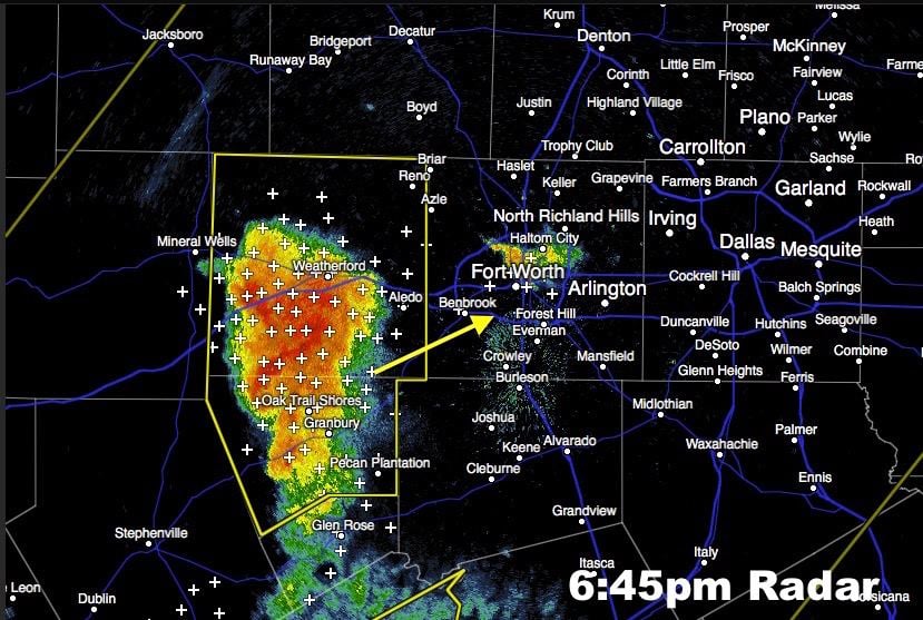
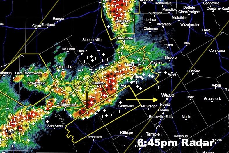
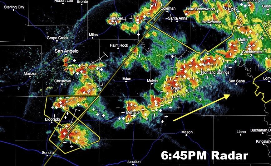
Strong to severe storms will continue to be a threat for several more hours across parts of west central, central and north central Texas this evening. Northward propagation of ongoing storms into the southern portions of Ft. Worth appears to be more likely this evening than previously thought. The current segment of storms southwest of Ft. Worth now approaching Weatherford, Granbury and Glen Rose have a chance of making it well into the Ft. Worth area within the next hour or so. Gusty winds and hail up to around 2 to 3 inches in diameter will be the greatest threat with this batch of storms. Heavy rain with a threat for some nuisance flooding is also possible. Further south along the line, gradual expansion eastward towards the I-35 corridor between Grandview and south towards Waco and Temple is expected later this evening. Squall line development with the threat of high winds west of the I-35 corridor as this line moves east will be the greatest threat along with large hail and some flooding issues. The tornado threat within this area of storms is low, but cannot be completely ruled out, especially for any storms managing to form along outflow boundaries pushed out ahead of the line of storms. The current Severe Thunderstorm Watch for the area will expire at 10pm; however, it may be continued for a few more hours after that depending on how quickly these storms begin to quiet down after sunset as the atmosphere begins to stabilize.
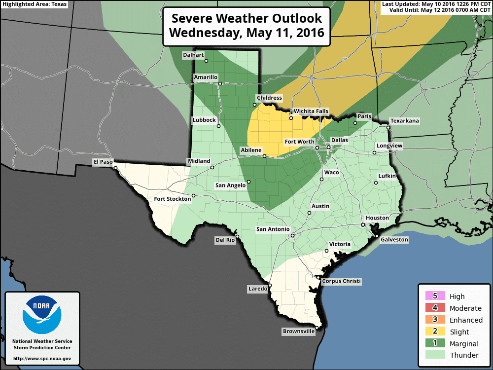
For tomorrow, a cold front will also be drop south through the panhandle tomorrow morning and stall out somewhere across the rolling plains/northwest Texas. By mid-afternoon, a dryline is expected to set up once again across western north Texas. Strong to severe storms are expected to develop along the dryline across northwest Texas down into the Big Country region by late afternoon into the early evening hours. Storms tomorrow will likely be much more isolated than today as the cap will be stronger, but with the atmosphere ahead of the dryline expected to be just as unstable as it was this afternoon, any storm that manages to break the cap could quickly become severe with a large hail and damaging wind threat. The area with the highest probability of seeing severe storm development will likely be north of I-20 tomorrow where the Storm Prediction Center has placed a Slight Risk, but development anywhere within the Marginal Risk area is also possible.


0 Comments