
- A small cluster of severe thunderstorms is currently located from Interstate 20 near Santo in Palo Pinto County south to just northeast of Stephenville. These two storms are moving northeast at 30-35 MPH towards western sections of the D/FW Metroplex. These storms are currently capable of producing ping-pong ball size hail and wind gusts over 60 MPH. The storms are crossing into a more unstable airmass and it will be interesting to see how they react. At present course these storms will move into the D/FW Metroplex in the next 60-80 minutes.
- A cluster of thunderstorms extends from 6 miles northwest of Cranfills Gap to Hamilton to 4 miles west of Evant to Goldthwaite. Some storms in this cluster are severe with large hail up to the size of golfballs and wind gusts over 65 MPH. At this time storms are nearly stationary with a slight movement to the southeast. Flash flooding is a threat from Mullin and Goldthwaite to north of Star at this time.
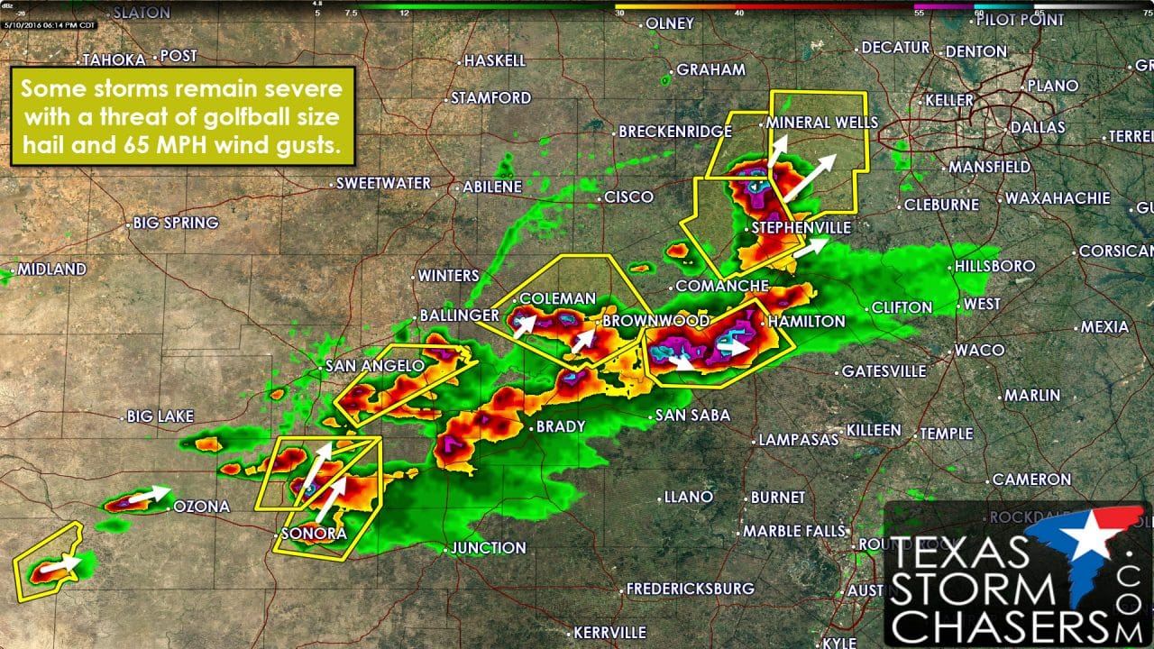
- Multiple severe thunderstorms with large hail up to the size of golfballs are in progress across the eastern Concho Valley. One severe storm with large hail is near Santa Anna to Brownwood. A second is near Vancourt east of San Angelo. A couple more are just east of El Dorado. One is just west of Ozona. These storms are generally moving northeast.
- The general expectation is for a cluster of storms to organize in Central Texas over the next few hours. It may be the one near Goldthwaite that is just sitting there. Eventually it should start to make progress to the east/southeast. Some storms in that cluster could contain damaging straight-line wind gusts and hail. Time will tell what becomes of that.


0 Comments