
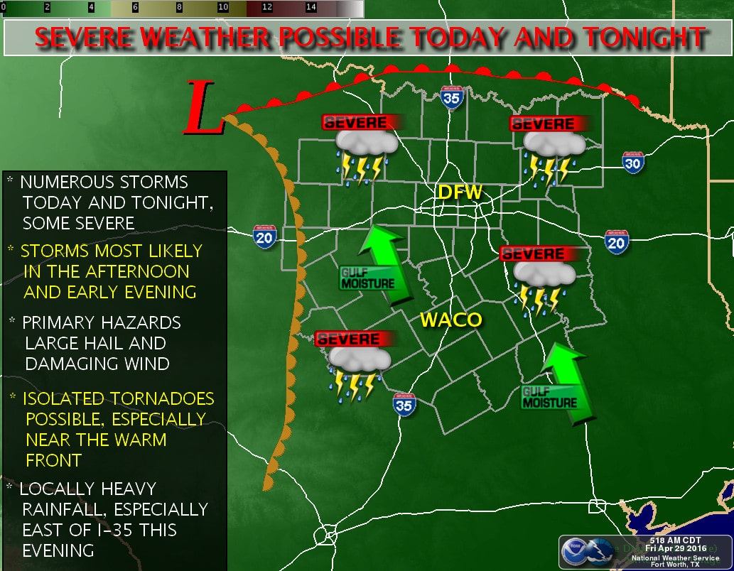
A very complex and messy convective evolution is anticipated today due to a weak cap. Shortly before 9 AM we already had strong thunderstorms moving east across the Texas Panhandle. Some of those storms could become severe with a hail risk through the morning hours. By the early to mid afternoon its anticipated that convective development will occur from Northeast Texas into Central Texas. With little to no cap in place these storms could form pretty much anywhere versus off the dryline. Storm coverage could become widespread which would work to keep one storm from becoming too intense. Nevertheless the strongest storms will likely pose a severe weather risk with the threat of large hail, damaging winds, and isolated tornadoes. At the same time a dryline will surge east into western North Texas into western Central Texas by the afternoon hours. With a weak cap its likely thunderstorms will fire up east of the dryline by late afternoon. The strongest storms could be severe with a risk of large hail, damaging winds, and isolated tornadoes. Low-level wind shear is actually pretty favorable for rotating storms today but the ‘messy’ storm evolution lowers my confidence in a more significant severe weather threat at this time. If we see any supercells become established that can dominate their local enviornment they could produce baseball size hail, damaging winds, and tornadoes. Storms will continue into Northeast Texas and East Texas overnight with the potential for one to four inches of rain through Saturday. That could cause some flooding issues since soils are saturated and rivers are still full.
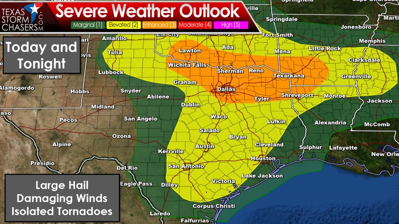
Above is the latest severe weather outlook from the Storm Prediction Center. They have an enhanced risk (category 3) placed across Texoma into North Texas and Northeast Texas. A category 2 severe weather risk includes the Texas Panhandle, North Texas, Central Texas, South-Central Texas, the Brazos Valley, East Texas, and portions of Southeast Texas. As stated above the forecast today is very complex – also known as uncertain. The enhanced risk has been placed where confidence is at least medium that there will be several severe weather reports today. That is also where the threat for isolated tornadoes is highest due to a warm front that will enhance low-level wind shear. Large hail is likely with the strongest storms today. If we see any dominant supercells take hold than the threat of very large hail up to the size of baseballs will increase. Localized damaging wind gusts are possible. Isolated tornadoes cannot be ruled out – but that threat could locally be enhanced where the warm front sets up along the Red River if we see supercells this afternoon.


0 Comments