
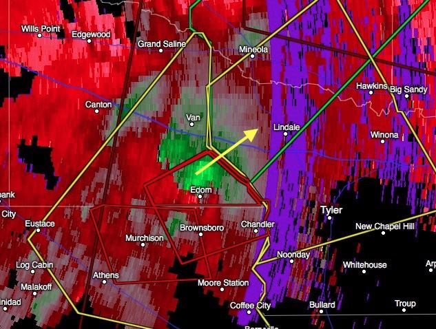
Multiple areas of storms have erupted across north central Texas over the past several hours. So far, conditions in the immediate Dallas/Ft. Worth metro area have remained under control with no significant reports of very large hail or other damage….yet. We still have a few more hours to go yet. East of the DFW metro area, the main concern at this time is a tornado warned cell between Murchison and Edom moving east at 20mph. I’ve not seen any confirmation of an actual tornado touch down, but whatever is, or was, there is likely rain-wrapped and will be impossible to see. Seek shelter now if you are in the path of this storm…don’t wait for visual confirmation because you probably won’t be able to see it at all.
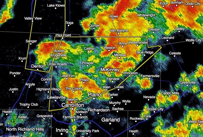
A large portion of Denton and Collin County remain under Severe Thunderstorm Warnings. Hail up to 1.5 inches is likely with these storms as the continue off to the northeast. The previous tornado warning for Grayson county has expired.
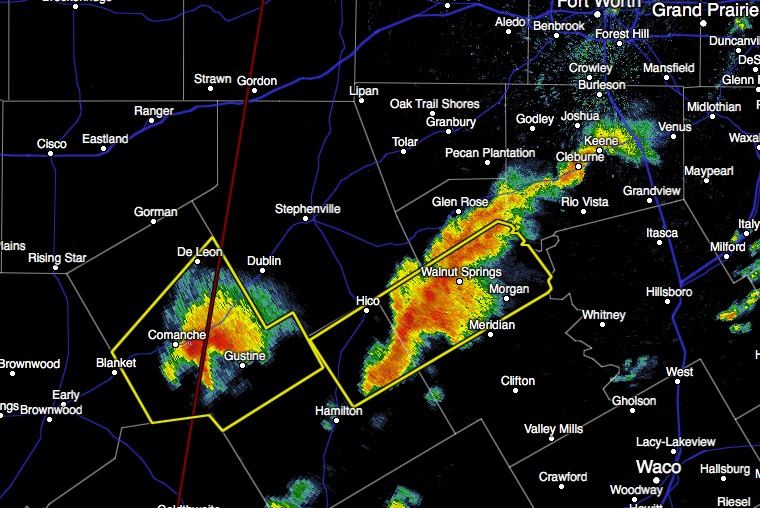
Southwest of the DFW Metro, additional Severe warned storms are moving northeast and may pose a threat to areas south and southwest of Ft. Worth within the next hour. Circulation has been noted with the storm currently over Comanche, but no confirmation of tornado touch down as of yet. Treat this storm like it has one anyway and get into shelter if you’re in its path. Hail up to 1.75 inches is also likely as this storm continues moving northeast at around 25.


0 Comments