
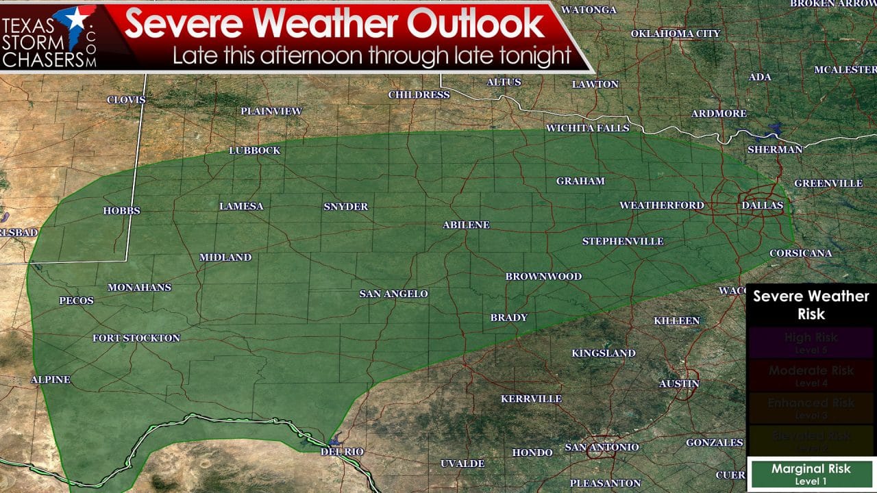
The Storm Prediction Center has issued a category 1 – marginal risk of severe thunderstorms for this afternoon and tonight. On a five-level risk scale a category one is the lowest. A marginal risk does not mean the threat of severe weather should be disregarded. We don’t expect a widespread severe weather threat today – but we could see some issues this afternoon and evening. The Permian Basin, Concho Valley, Big Country, West-Central Texas, Northwest Texas, and North Texas are included in this marginal risk. Parts of the marginal risk may be upgraded to the standard category two severe weather risk in later outlooks. The strongest storms could produce hail up to the size of ping-pong balls and localized wind gusts over 65 MPH. A tornado cannot be ruled out but the overall tornado risk is very low today and tonight. That said if the one tornado today comes down your street it won’t matter how low the overall risk is predicted to be.
As usual there remains a few uncertainties in the convective forecast for today. We’ll be using an experimental version of the HRRR (High Resolution Rapid Refresh) weather model for graphics in this forecast. The Texas Tech WRF weather model also shows a similiar solution so that leads to increased confidence. Don’t expect the radar to look exactly like what is presented below – but hopefully it’ll give a general idea of what to expect.
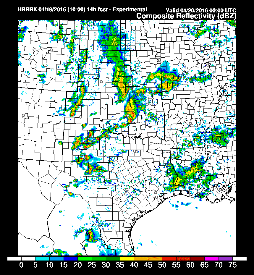
10Z HRRR: Simulated radar at 7 PM CT
Around 7 PM this evening the HRRR has a broken line of thunderstorms developing and moving east/southeast from Central Oklahoma extending into Northwest Texas and the western Big Country. Isolated activity may also be occuring in the Texas Panhandle and in Southeast Texas. Some of the storms in Northwest Texas and the Big Country could be severe with a threat of hail and localized damaging wind gusts.
10Z HRRR: Simulated radar at 10 PM CT
Fast forward a few hours and it appears possible a line of thunderstorms may be moving east/southeast into the Big Country from Northwest Texas. More isolated storms are possible with southward extend into the Concho Valley. Some of the storms may be severe with damaging wind gusts and spotty hail. I should point out I don’t anticipate hail sizes like we saw last week. Once storms are in a line – like what is predicted this evening – the most likely threat usually becomes strong winds.
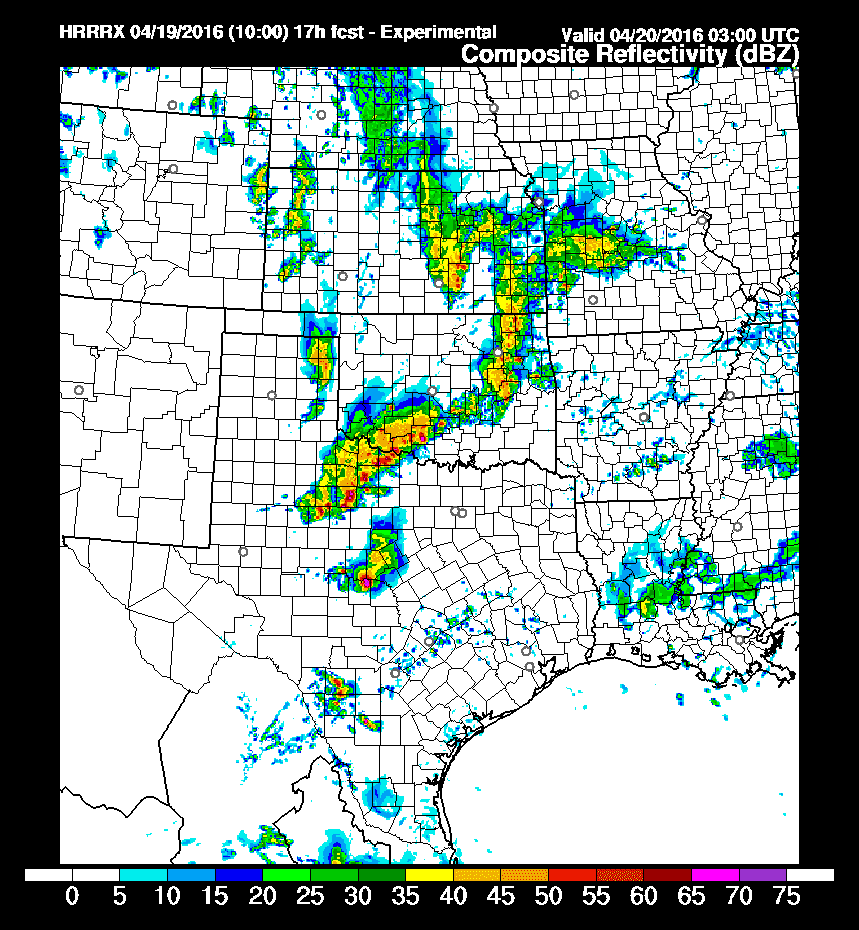
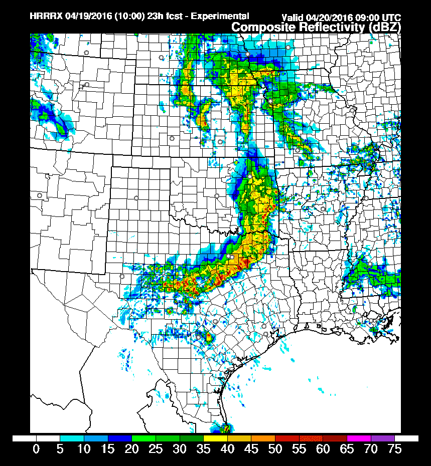
10Z HRRR: Simulated radar at 1 AM CT Wednesday
By midnight it’s plausible we have a line of strong to locally severe storms moving east/southeast into North Texas and northern sections of the Concho Valley. Timing may be off by a few hours but I do anticipate a squall line this evening moving into the I-35 corridor from the Red River south into North Texas – including D/FW. Some sections of the line may be severe during this timeframe with wind gusts over 60 MPH, quarter size hail, and brief tornadoes. At the same time spotty showers and a few storms will be possible across Central Texas and South Texas – though this activity is not expected to be severe.
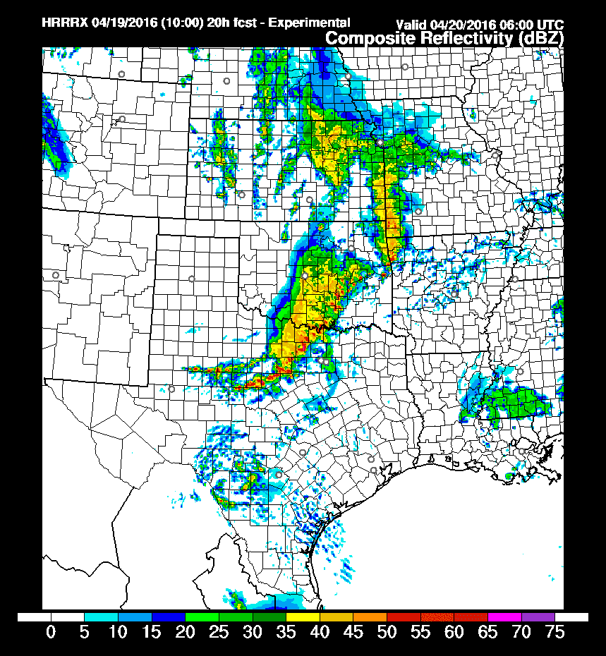
10Z HRRR: Simulated radar at 4 AM CT Wednesday
Additional rain may build into Central and Southeast Texas tonight into Wednesday morning. Additional rain totals of half an inch up to two inches may occur through Wednesday in parts of the state. Locations that are already inundated may not be able to handle that additional rain without causing more flooding. At the least the additional rain will prolong elevated stream and river flows. The threat of flash flooding is lower compared to the past few days but we will have to watch for issues that develop.


0 Comments