
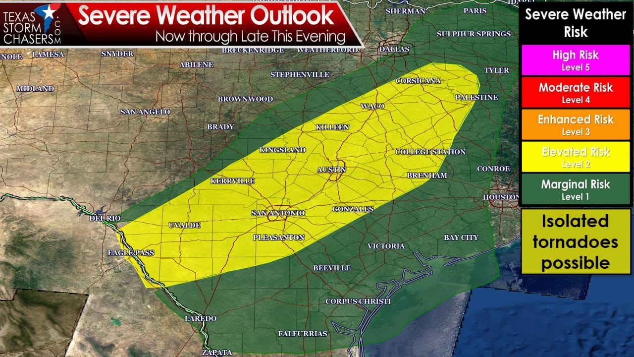
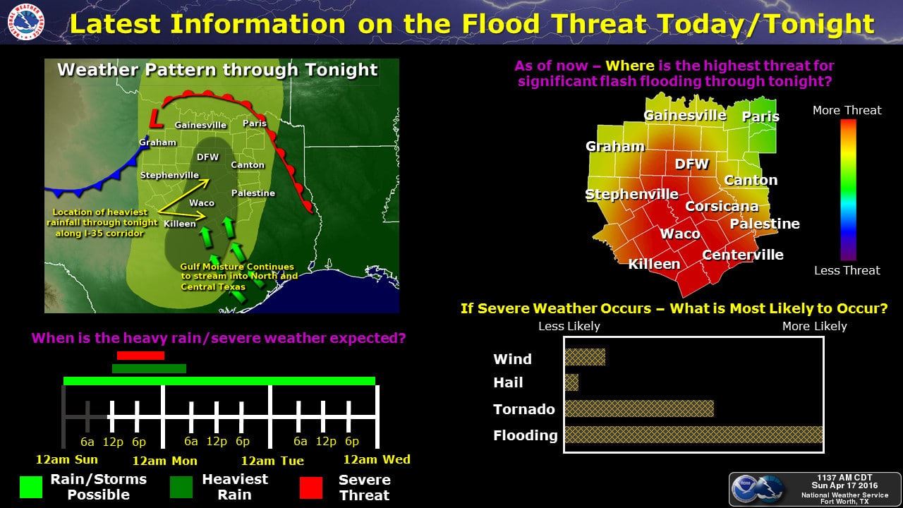
Conditions across central and south Texas this afternoon will be favorable for a few severe storms and possibly an isolated tornado or two as we reach peak heating this afternoon. Visible satellite at this time shows cloud cover beginning to thin across central Texas south of the Waco area. Temperatures are already in the low 70s with ample moisture continuing to stream north from the Gulf of Mexico. Instability values this afternoon across this area will be sufficient to produce strong to severe storms, most likely embedded with existing clusters of rain. A quick tornado spinup with any of the severe cells is not out of the question within the Slight Risk area; however, heavy rain with flash flooding, damaging winds and hail will continue to be the primary threats.
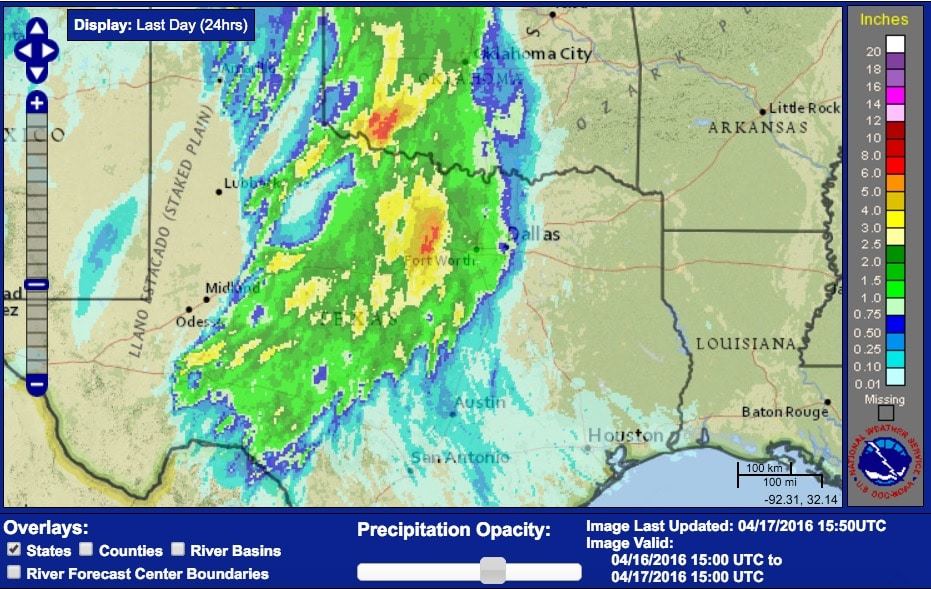
Rainfall over the past 24 hours have been heaviest just west of the Dallas/Ft. Worth metro area. Heavy rainfall will continue to develop across the region today mainly south of the Dallas/Ft. Worth metroplex down through the Hill Country region with widespread rainfall totals between 3 to 6 inches, with some isolated 8+ accumulations possible. For the latest on road conditions, be sure to check http://drivetexas.org/ for the latest if you’re heading out.


0 Comments