
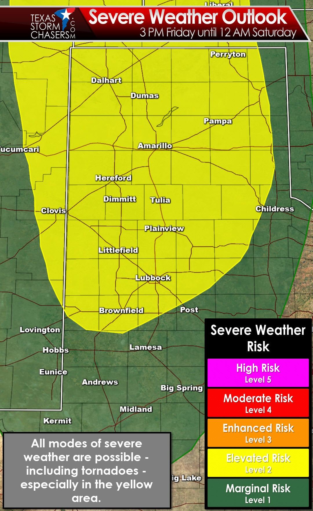
The Storm Prediction Center has placed the Texas Panhandle and South Plains in the standard ‘elevated’ risk of severe weather for Friday afternoon and Friday evening. The severe weather risk scale goes from one to five – one being the lowest and five being the highest. Tomorrow’s risk is currently at a two out of five. I would not be surprised to see a portion of the northern Texas Panhandle upgraded to a level 3 at some point tomorrow. A level 1 risk (marginal risk) extends south into the Permian Basin and east towards Childress and Sweetwater. That level 1 risk takes into account for the possibility of a couple strong storms late tomorrow night into the pre-dawn hours Saturday which may contain some hail. The primary focus for tomorrow’s severe weather threat will be in the Texas Panhandle.
The overall setup for severe weather tomorrow is a bit marginal but definitely worth watching. Low-level wind shear will be impressive thanks to a strengthening area of low pressure in southeast Colorado. Southeast winds will be absolutely blowing tomorrow across the Panhandle and West Texas. Sustained winds may approach 30-35 MPH by the early evening with higher gusts. At the same time moisture levels in the atmosphere will be slowly increasing. Dewpoint temperatures – a measure of moisture – should be in the low to middle 50s. That is on the lower side of the spectrum when looking for a tornado threat since the lower dewpoints would usually result in higher cloud bases. Since the Panhandle is at a higher elevation compared to further east in Texas things can get done with more modest moisture levels. High-resolution models are indicating the potential for a couple discrete supercell thunderstorms by late tomorrow afternoon. Depending on where the dryline sets up these storms may form in the western Panhandle and move northeast.

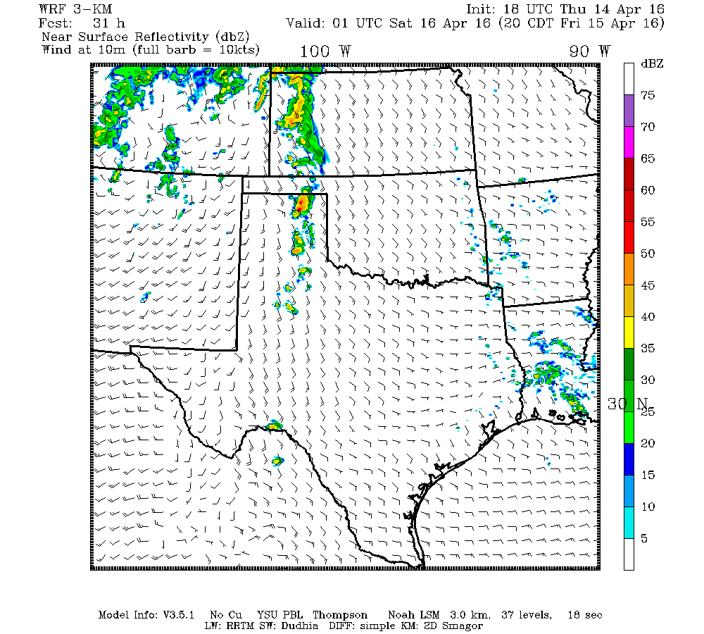
18Z Texas Tech High Resolution Weather Model. Simulated weather model radar at 6 PM CT Friday
18Z Texas Tech High Resolution Weather Model. Simulated weather model radar at 8 PM CT Friday
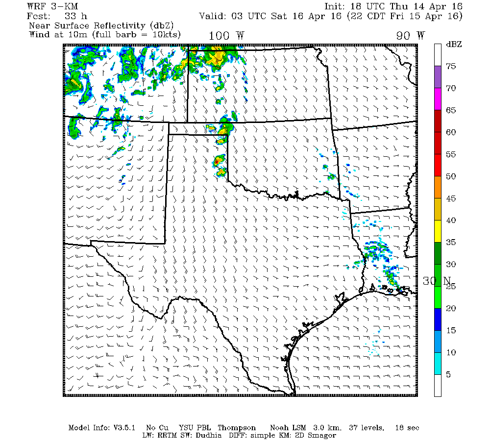
18Z Texas Tech High Resolution Weather Model. Simulated weather model radar at 10 PM CT Friday
Initially cloud bases should be fairly high keeping the severe weather threat limited to tennis-ball size hail and damaging wind gusts. After 7 PM as temperatures begin to cool cloud bases will start to lower and the threat for tornadoes may increase. The tornado threat for tomorrow is uncertain due to mitigating factors but if we can get conditions to come together there will certainly be a threat of tornadoes from 6 PM tomorrow through 11 PM in the Texas Panhandle. We’ll need to closely monitor conditions tomorrow to refine any potential tornado risk. I would certainly encourage folks in the Panhandle to keep an eye on the weather tomorrow and check local media or your local National Weather Service office for updates. If conditions come together just right we could be looking at a fairly busy severe weather event in the Panhandle. November 16 of last year was a stark reminder that tornadoes can – and do occur – when you might not expect them. Paige and I will be chasing tomorrow with Jenny hanging back to post updates as needed.


0 Comments