
Only minor forecast adjustements are required compared to our update earlier this morning. The highest risk of severe weather today continues to be in Northeast Texas and East Texas where an enhanced severe weather risk is in place. Isolated severe thunderstorms are also possible this afternoon further west in North Texas.
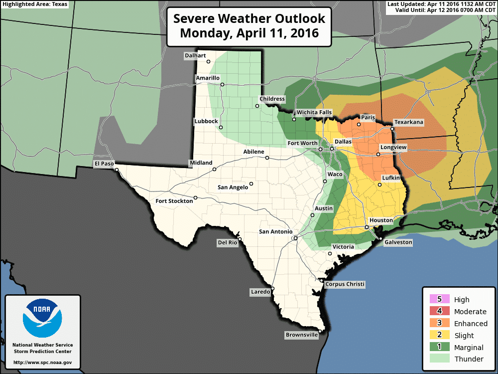
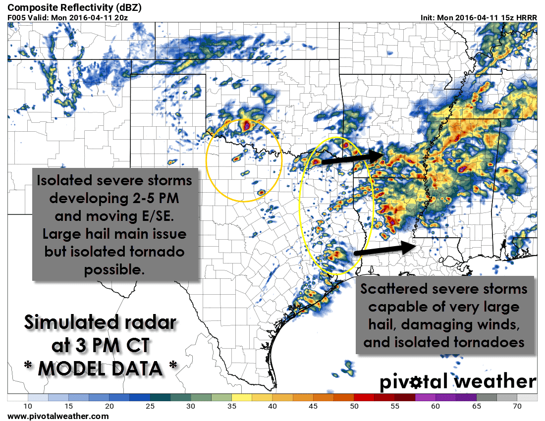
Scattered severe thunderstorms will be possible from 2 PM through 10 PM across Northeast Texas, East Texas, and Southeast Texas. Storms will move east/northeast. The strongest storms will likely be discrete supercells capable of producing hail up to the size of tennis balls, damaging wind gusts, and perhaps a couple tornadoes.

More isolated severe thunderstorm development is also expected on an outflow boundary this afternoon across North Texas. The best chance for a few discrete severe storms appears to be across Southern Oklahoma and the adjacent counties of North Texas. Storms that develop could be severe with very large hail up to the size of hen-eggs, localized damaging wind gusts, and a threat of a tornado. Storms – if they develop – could impact D/FW during the evening rush hour. These storms could then move into Northeast Texas this evening.
Today isn’t an overly impressive tornado setup and large hail should be the most frequent severe weather issue. As always I encourage you to keep up with the latest weather information and have multiple ways to receive severe weather warnings. Your local National Weather Service office is a great resource to follow for hyper-local weather updates. I am chasing this afternoon in North Texas and will post pictures/video as things develop today.


0 Comments